The Polygon in Southampton, England, United Kingdom — Northwestern Europe (the British Isles)
Blechynden Terrace Gardens
Photographed by Ray Gurganus, April 1, 2025
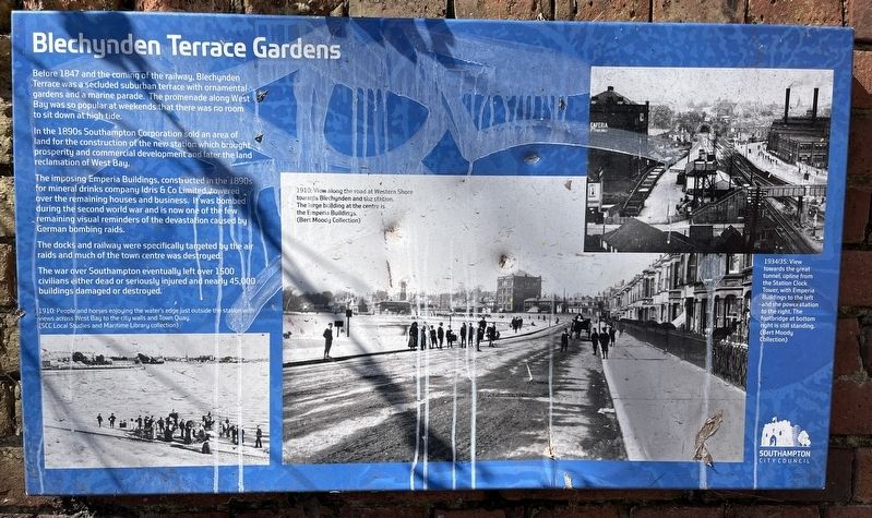
1. Blechynden Terrace Gardens Marker
In the 1890s Southampton Corporation sold an area of land for the construction of the new station which brought prosperity and commercial development and later the land reclamation of West Bay.
The imposing Emperia Buildings, constructed in the 1890 for mineral drinks company Idris & Co Limited towered over the remaining houses and business. It was bombed during the second world war and is now one of the few remaining visual reminders of the devastation caused by German bombing raids.
The docks and railway were specifically targeted by the air raids and much of the town centre was destroyed.
The war over Southampton eventually left over 1500 civilians either dead or seriously injured and nearly 45,000 buildings damaged or destroyed.
Erected by Southampton City Council.
Topics. This historical marker is listed in this topic list: Parks & Recreational Areas. A significant historical year for this entry is 1847.
Location. 50° 54.471′ N,
this page online

Regionally, this marker is in the Hampshire Ports. Globally, it is on the Atlantic Ocean, in the North Atlantic Region, in Europe, in Atlantic Europe, on one of the British Isles, in the Western World, and in the Anglosphere. Historically, it finds itself in what was once the Roman Empire.
Other nearby markers. At least 8 other markers are within walking distance of this marker: Time for Compassion (approx. half a kilometer away); Peaceful Parks (approx. half a kilometer away); Engineer Officers of the RMS Titanic (approx. 0.6 kilometers away); Richard Andrews 1798-1859 (approx. 0.6 kilometers away); Welcome to Central Parks - East Park (approx. 0.6 kilometers away); Arundel Tower (approx. 0.7 kilometers away); A Fashionable Resort (approx. 0.7 kilometers away); Town Walls (approx. 0.8 kilometers away). Touch for a list and map of all markers in Southampton.
Credits. This page was last revised on July 20, 2025. It was originally submitted on July 19, 2025, by Ray Gurganus of Washington, District of Columbia. This page has been viewed 134 times since then and 52 times this year. Photo 1. submitted on July 19, 2025, by Ray Gurganus of Washington, District of Columbia. • Andrew Ruppenstein was the editor who published this page.
Editor’s want-list for this marker. photo of the marker within its surroundings • Can you help?
