
Southampton City Centre , England, United Kingdom — Northwestern Europe (the British Isles)
Westgate
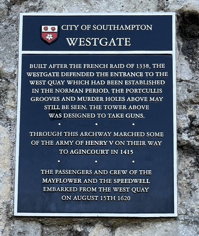
Photographed by Ray Gurganus, April 1, 2025
1. Westgate Marker
Through this archway marched some of the army of Henry V on their way to Agincourt in 1415.
The passengers and crew of the Mayflower and the Speedwell embarked from the west quay on August 15th 1620.
Topics. This historical marker is listed in these topic lists: Forts and Castles • Roads & Vehicles. A significant historical date for this entry is August 15, 1620.
Location. 50° 53.937′ N, 1° 24.427′ W. Marker is in Southampton, England. It is in Southampton City Centre. It is at the intersection of Western Esplanade and Westgate Street, on the right when traveling north on Western Esplanade. Touch for map. Marker is at or near this postal address: 8 Western Esplanade, Southampton, England SO14 2AZ, United Kingdom. Touch for directions.

Regionally, this marker is in England’s Hampshire Ports. Globally, it is on the Atlantic Ocean, in the North Atlantic Region, in Europe,
this page online
Other nearby markers. At least 8 other markers are within walking distance of this marker: Walter Taylor (a few steps from this marker); Southampton's Medieval West Quay c.1450 (a few steps from this marker); a different marker also named Westgate (within shouting distance of this marker); Replica of a 14th Century Cargo Ship (within shouting distance of this marker); Cuckoo Lane (within shouting distance of this marker); Blue Anchor Lane (within shouting distance of this marker); Mayflower Memorial (about 120 meters away, measured in a direct line); Mayflower Pilgrims Memorial (about 120 meters away). Touch for a list and map of all markers in Southampton.

Photographed by Ray Gurganus, April 1, 2025
2. Westgate

Photographed by Kingsway Real Photo Series, circa 1920
3. The Westgate
Credits. This page was last revised on July 20, 2025. It was originally submitted on July 19, 2025, by Ray Gurganus of Washington, District of Columbia. This page has been viewed 86 times since then and 18 times this year. Photos: 1, 2. submitted on July 19, 2025, by Ray Gurganus of Washington, District of Columbia. 3. submitted on July 20, 2025. • Andrew Ruppenstein was the editor who published this page.
