Southampton City Centre , England, United Kingdom — Northwestern Europe (the British Isles)
Watergate
Photographed by Ray Gurganus, April 1, 2025
1. Watergate Marker
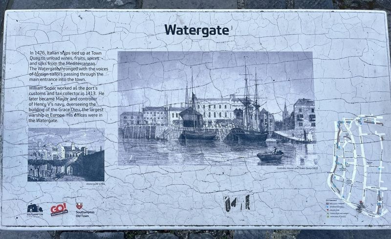
William Soper worked as the port's customs and tax collector in 1413. He later became Mayor and controller of Henry V's navy, overseeing the building of the Grace Dieu, the largest warship in Europe. His offices were in the Watergate.
Topics. This historical marker is listed in this topic list: Waterways & Vessels.
Location. 50° 53.814′ N, 1° 24.263′ W. Marker is in Southampton, England. It is in Southampton City Centre. It is at the intersection of Porters Lane and High Street, on the right when traveling west on Porters Lane. Touch for map. Marker is at or near this postal address: 2 Porters Lane, Southampton, England SO14 2AR, United Kingdom. Touch for directions.

Regionally, this marker is in the Hampshire Ports. Globally, it is on the Atlantic Ocean, in the North Atlantic Region, in Europe, in Atlantic Europe, on one of the British Isles,
this page online
Other nearby markers. At least 8 other markers are within walking distance of this marker: Jane Austen (a few steps from this marker); The Medieval Mayors' Wine Vaults (within shouting distance of this marker); Nos. 52-56 French Street (about 210 meters away, measured in a direct line); Migration in Southampton (about 210 meters away); Mayflower Pilgrims Memorial (about 210 meters away); Mayflower Memorial (about 210 meters away); Cuckoo Lane (approx. 0.2 kilometers away); Westgate (approx. 0.3 kilometers away). Touch for a list and map of all markers in Southampton.
Credits. This page was last revised on July 20, 2025. It was originally submitted on July 19, 2025, by Ray Gurganus of Washington, District of Columbia. This page has been viewed 58 times since then and 9 times this year. Photo 1. submitted on July 19, 2025, by Ray Gurganus of Washington, District of Columbia. • Andrew Ruppenstein was the editor who published this page.
