Niagara Falls in Niagara Region, Ontario — Central Canada (North America)
R. Nathaniel Dett Chapel, British Methodist Episcopal Church
Chappeller R. Nathaniel Dett, British Methodist Episcopal Church
Photographed by Kevin Westell, July 18, 2025
1. R. Nathaniel Deit Chapel, British Methodist Episcopla Church - Marker

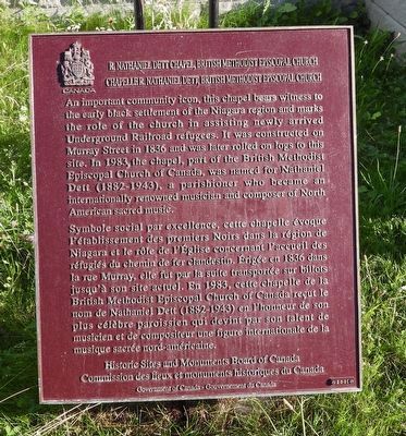
R. Nathaniel Dett Chapel, British Methodist Episcopal Church
An important community icon, this chapel bears witness to the early black settlement of the Niagara region and marks the role of the church in assisting newly arrived Underground Railroad refugees. It was constructed on Murray Street in 1836 and was later rolled on logs to this site. In 1983, the chapel, part of the British Methodist Episcopal Church of Canada, was named for Nathaniel Dett (1882-1943), a parishioner who became an internationally renowned musician and composer of North American sacred music.
happeller R. Nathaniel Dett, British Methodist Episcopal Church
Symbole social par excellence, cette chapelle évoque l'établissement des premiers Noirs dans la région de Niagara et le rôle de l'Eglise concernant l'accueil des réfugiés du chemin de fer clandestin. Érigée en 1836 dans la rue Murray, elle fut par la suite transportée sur billots jusqu'à son site actuel. En 1983, cette chapelle de la British Methodist Episcopal Church of Canada reçut le nom de Nathaniel Dett (1882-1943) en l'honneur de son plus célèbre
this page online
Erected 2001 by Historical Sites and Monuments Board of Canada.
Topics and series. This historical marker is listed in these topic lists: Abolition & Underground RR • African Americans • Religion & Religious Structures. In addition, it is included in the Canada, Historic Sites and Monuments Board series list. A significant historical year for this entry is 1836.
Location. 43° 5.263′ N, 79° 5.31′ W. Marker is in Niagara Falls, Ontario, in Niagara Region. It is at the intersection of Peer Street and Grey Avenue, on the right when traveling east on Peer Street. Touch for map. Marker is at or near this postal address: 5674 Peer Street, Niagara Falls ON L2G 1X1, Canada. Touch for directions.

Regionally, this marker is on the Golden Horseshoe and in Niagara Canada. It is also in Central Canada. Globally, it is in North America, on the Great Lakes, in the Western Hemisphere, in the Western World, and in the Anglosphere. Historically, it finds itself in what was once a British
Photographed by Kevin Westell, July 18, 2025
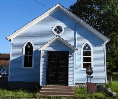
2. R. Nathaniel Dett Memorial Chapel
Other nearby markers. At least 8 other markers are within walking distance of this marker: The British Methodist Episcopal Church of Canada (here, next to this marker); Stamford Township Hall (approx. 0.3 kilometers away); Stamford Township Hall 1874 (approx. 0.3 kilometers away); Royal Canadian Legion Branch 479 War Memorial (approx. 0.3 kilometers away); The Americans Capture the British Guns (approx. half a kilometer away); The Americans Attack (approx. half a kilometer away); Facing the American Attack (approx. half a kilometer away); Burr Lockhart Plato (approx. half a kilometer away). Touch for a list and map of all markers in Niagara Falls.
Photographed by Kevin Westell, July 18, 2025
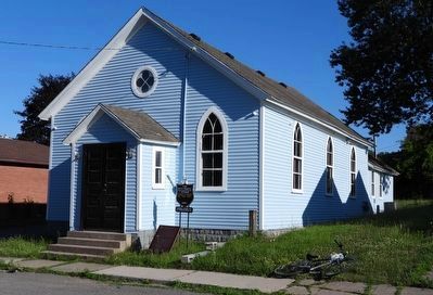
3. R. Nathaniel Dett Memorial Chapel
Credits. This page was last revised on July 20, 2025. It was originally submitted on July 19, 2025, by Kevin Westell of St. Catharines, Ontario. This page has been viewed 69 times since then and 15 times this year. Photos: 1, 2, 3. submitted on July 19, 2025, by Kevin Westell of St. Catharines, Ontario. • Andrew Ruppenstein was the editor who published this page.
