Richmond Hill in Bryan County, Georgia — The American South (South Atlantic)
Kilpatrick on Bryan Neck
Photographed by Jeff Leichsenring, July 6, 2025
1. Kilpatrick on Bryan Neck Marker (Re-erected)
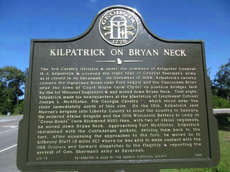
The 3rd Cavalry Division (US), Brigadier General H.J. Kilpatrick (US), covered the right rear of General Sherman's army as it closed in on Savannah. On December 12, 1864, Kilpatrick's army crossed the Ogeechee River near Fort Argyle and the Ogeechee River near the town of Court House (now Clyde) on pontoon bridges laid by the 1st Missouri Engineers (US) and moved down Bryan Neck. That night, Kilpatrick made his headquarters at the plantation home of Lieutenant Colonel Joseph L. McAllister, 7th Georgia Cavalry (CS), which stood near the river immediately north of this site. On the 13th, Kilpatrick sent Murray's brigade into Liberty County to scout the country to Sunbury. He ordered Atkins' brigade and the 10th Wisconsin Battery to camp at "Cross Roads" (now Richmond Hill) then, with two of Atkins' regiments, he moved down Bryan Neck. Approaching Fort McAllister, Kilpatrick skirmished with the Confederate pickets, driving them back to the fort. After examining the approaches to the fort, he moved on to Kilkenny Bluff (8 miles SE) where he was able to make contact with the USS Octorara and forward dispatches to the flagship
this page online
Erected 2022 by Georgia Historical Society. (Marker Number 015-13.)
Topics. This historical marker is listed in this topic list: War, US Civil. A significant historical date for this entry is December 12, 1864.
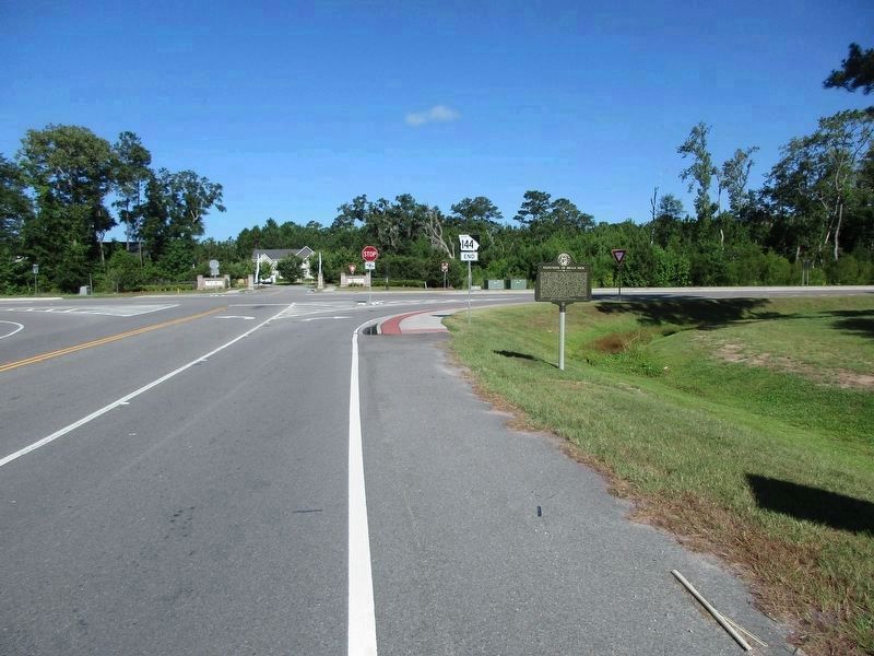
Location. 31° 53.405′ N, 81° 15.683′ W. Marker is in Richmond Hill, Georgia, in Bryan County. It is at the intersection of Fort McAllister Road (State Highway 144 Spur) and Bryan Neck Road (State Highway 144), on the left when traveling east on Fort McAllister Road. Touch for map. Marker is in this post office area: Richmond Hill GA 31324, United States of America. Touch for directions.

Regionally, this marker is on the Coastal Plain, on the Georgia Coast and the Golden Isles, and in Greater Savannah. It is also in the American South, specifically in the Deep South, and on the Eastern Seaboard. Globally, it is in the North Atlantic Region, North America, the Western Hemisphere, the Western World, and the Anglosphere. Historically, it finds itself in what was once New Spain, the territory of the Mississippian Culture, one of the original Thirteen Colonies, one
Photographed by Jeff Leichsenring, July 6, 2025
2. Kilpatrick on Bryan Neck Marker (Re-erected)
Other nearby markers. At least 8 other markers are within 2 miles of this marker, measured as the crow flies: A different marker also named Fort McAllister (within shouting distance of this marker); Richard James Arnold (approx. 0.6 miles away); Burnt Church Cemetery (approx. 0.8 miles away); George W. McAllister (approx. 0.8 miles away); The Clay Family of Bryan Neck (approx. 0.8 miles away); George Washington Carver School (approx. 1.3 miles away); Bryan Neck Missionary Baptist Church (approx. 1.3 miles away); Hardwicke (approx. 1.9 miles away). Touch for a list and map of all markers in Richmond Hill.
Other markers no longer nearby. Fort McAllister (was within shouting distance of this marker but has been replaced with another marker now near it); Kilpatrick On Bryan Neck (was within shouting distance of this marker but has been replaced with another marker now near it).
Related marker. Click here for another marker that is related to this marker. Old 1959 marker located nearby.
Credits. This page was last revised on July 25, 2025. It was originally submitted on April 4, 2010, by Mike Stroud of Bluffton, South Carolina. This page has been viewed 128 times since then and 42 times this year. Last updated on July 19, 2025, by Jeff Leichsenring of Garland, Texas. Photos: 1, 2. submitted on July 19, 2025, by Jeff Leichsenring of Garland, Texas. • Bernard Fisher was the editor who published this page.
