
Southampton City Centre , England, United Kingdom — Northwestern Europe (the British Isles)
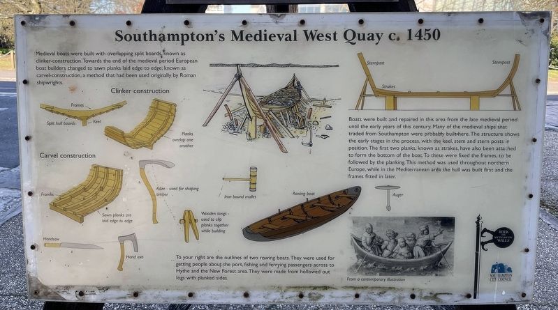
Southampton's Medieval West Quay c.1450
Photographed by Ray Gurganus, April 1, 2025
1. Southampton's Medieval West Quay c.1450 Marker
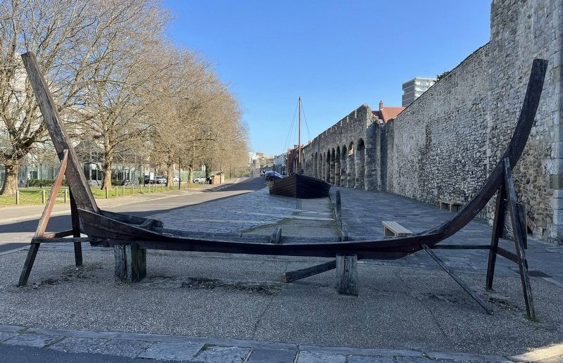
Boats were built and repaired in this area from the late medieval period until the early years of this century. Many of the medieval ships that traded from Southampton were probably built here. The structure shows the early stages in the process, with the keel, stem and stern posts in position. The first two planks, known as strakes, have also been attached to form the bottom of the boat. To these were fixed the frames, to be followed by the planking This method was used throughout northern Europe, while in the Mediterranean area the hull was built first and the frames fitted in later.
To your right are the outlines of two rowing boats. They were used for getting people about the port, fishing and ferrying passengers across to Hythe and the New Forest area. They were made from hollowed out logs with planked sides.
Erected by Southampton
this page online
Topics. This historical marker is listed in this topic list: Waterways & Vessels.
Location. 50° 53.949′ N, 1° 24.42′ W. Marker is in Southampton, England. It is in Southampton City Centre. It is on Western Esplanade, on the right when traveling north. Touch for map. Marker is at or near this postal address: 8 Western Esplanade, Southampton, England SO14 2AZ, United Kingdom. Touch for directions.

Regionally, this marker is in England’s Hampshire Ports. Globally, it is on the Atlantic Ocean, in the North Atlantic Region, in Europe, in Atlantic Europe, on one of the British Isles, in the Western World, and in the Anglosphere. Historically, it finds itself in what was once the Roman Empire.
Other nearby markers. At least 8 other markers are within walking distance of this marker: Westgate (a few steps from this marker); Walter Taylor (within shouting distance of this marker); Replica of a 14th Century Cargo Ship (within shouting distance of this marker); a different marker also named Westgate (within shouting distance of this marker); Blue Anchor Lane
Photographed by Ray Gurganus, April 1, 2025
2. Boat frame
Credits. This page was last revised on July 20, 2025. It was originally submitted on July 20, 2025, by Ray Gurganus of Washington, District of Columbia. This page has been viewed 108 times since then and 19 times this year. Photos: 1, 2. submitted on July 20, 2025, by Ray Gurganus of Washington, District of Columbia. • Andrew Ruppenstein was the editor who published this page.
