
Southampton City Centre , England, United Kingdom — Northwestern Europe (the British Isles)
Nos. 52-56 French Street
Photographed by Ray Gurganus, April 1, 2025
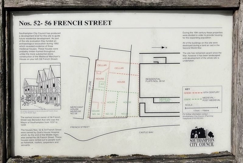
1. Nos. 52-56 French Street Marker
The earliest known owner of 56 French Street was Benedict Ace who was the Mayor of Southampton from 1237 to 1249.
The houses Nos. 52 & 54 French Street were owned by God's House Hospital which, by the end of the Middle Ages also owned No. 56 French Street. These houses were rented out to people such as fisherfolk, roofers, carpenters and servants.
During the 19th century these properties were divided in order to provide housing for the expanding population.
All of the buildings on this site were destroyed during a land air raid in the Second World War.
The site has remained vacant since the War, however it has been landscaped until development of the whole site is undertaken.
Erected by Southampton
this page online
Topics. This historical marker is listed in these topic lists: Anthropology & Archaeology • Architecture.
Location. 50° 53.919′ N, 1° 24.309′ W. Marker is in Southampton, England. It is in Southampton City Centre. It is on Saint Michael's Street, on the right when traveling south. Touch for map. Marker is at or near this postal address: 4 St Michael's Street, Southampton, England SO14, United Kingdom. Touch for directions.

Regionally, this marker is in England’s Hampshire Ports. Globally, it is on the Atlantic Ocean, in the North Atlantic Region, in Europe, in Atlantic Europe, on one of the British Isles, in the Western World, and in the Anglosphere. Historically, it finds itself in what was once the Roman Empire.
Other nearby markers. At least 8 other markers are within walking distance of this marker: St. Michael's Church (about 120 meters away, measured in a direct line); St Michael's Square (about 120 meters away); Walter Taylor (about 120 meters away); Westgate (about 120 meters away); Southampton's Medieval West Quay c.1450 (about 150 meters
Photographed by Ray Gurganus, April 1, 2025
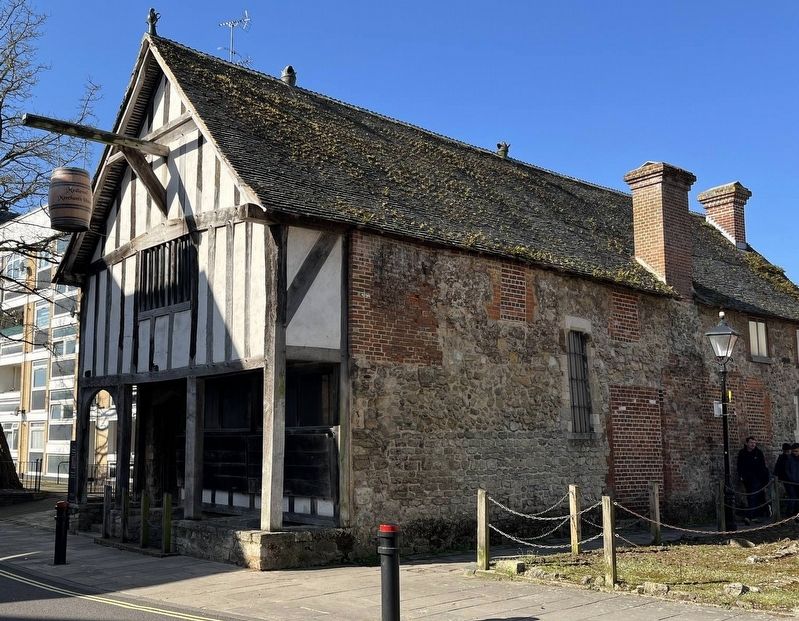
2. Medieval Merchant's House
Credits. This page was last revised on July 20, 2025. It was originally submitted on July 20, 2025, by Ray Gurganus of Washington, District of Columbia. This page has been viewed 101 times since then and 19 times this year. Photos: 1, 2. submitted on July 20, 2025, by Ray Gurganus of Washington, District of Columbia. • Andrew Ruppenstein was the editor who published this page.
