
Daily in Kathryn in Barnes County, North Dakota — The American Midwest (Upper Plains)
The Great American Barn
⎯⎯⎯
Rural Architecture
Photographed by Mark Parker, June 27, 2025
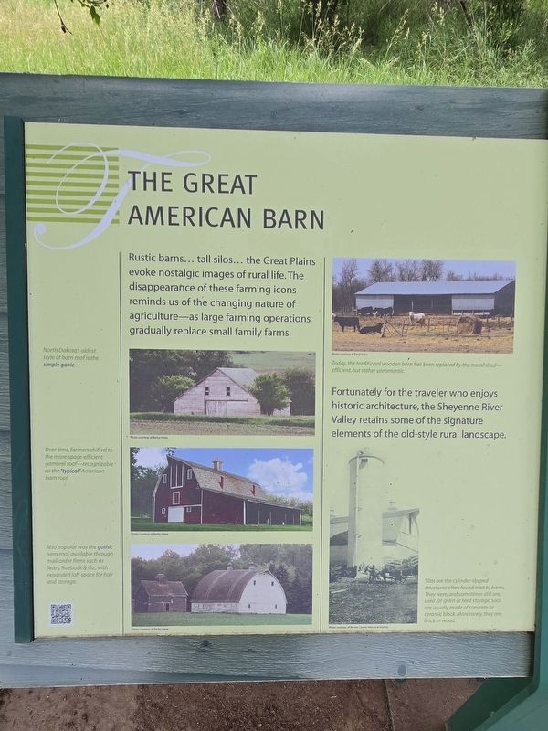
1. The Great American Barn (left side of the marker)
The Great American Barn
Rustic barns... tall silos... the Great Plains evoke nostalgic images of rural life. The disappearance of these farming icons reminds us of the changing nature of agriculture — as large farming operations gradually replace small family farms.
Fortunately for the traveler who enjoys historic architecture, the Sheyenne River Valley retains some of the signature elements of the old-style rural landscape.
Captions
North Dakota's oldest style of barn roof is the simple gable. Photo courtesy of Becky Heise.
Over time, farmers shifted to the more space-efficient gambrel roof-recognizable as the "typical" American Barn roof. Photo courtesy of Becky Heise.
Also popular was the gothic barn roof available through mail-order firms such as Sears, Roebuck & Co, with expanded loft space for hay and storage. Photo courtesy of Becky Heise.
Today the traditional wooden barn has been replaced by the metal shed — efficient, but rather unromantic. Photo courtesy of Daryl Heise.
Silos are the cylinder-shaped structures often found next to barns. They were, and sometimes still are, used for grain or feed storage. Silos are usually made of concrete or ceramic block. More rarely, they are brick or wood. Photo courtesy of Barnes County Historical Society
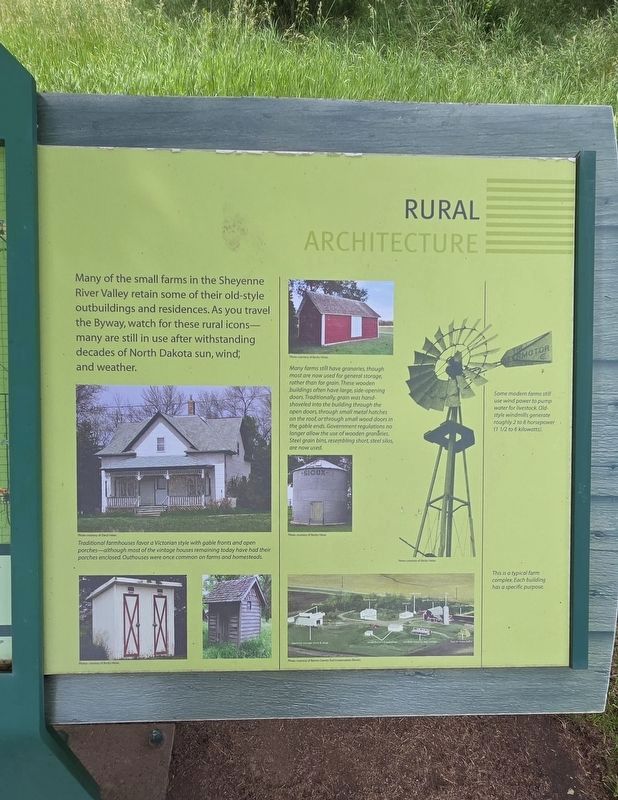
Rural Architecture
Many
this page online
Captions
Traditional farmhouses favor a Victorian style with gable fronts and open porches-although most of the vintage houses remaining today have had their porches enclosed Outhouses were once common on forms and homesteads.Photo courtesy of Daryl Heise. Photos courtesy of Becky Heise.
Many farms sell have granaries, though most are now used for general storage, rather than for grain. These wooden buildings often have large side-opening doors. Traditionally grain was hand-shoveled into the building through the open doors through small metal hatches on the roof, or through small wood doors in the gable ends. Government regulations no longer allow the use of wooden granaries. Steel grain bins, resembling short, steel silos are now used.
Photo courtesy of Becki Heise.
Some modern farms still use wind power to pump water for livestock. Old-style windmills generate by roughly 2 to 8 horsepower (1 1/2 to 6 kilowatts) Photos courtesy of Becki Heise.
This is a typical complex. Each building has a specific purpose. Photo courtesy of Barnes County Soil Conservation District
Topics and series.
Photographed by Mark Parker, June 27, 2025
2. Rural Architecture (right side of the marker)
Location. 46° 43.057′ N, 97° 58.525′ W. Marker is in Kathryn, North Dakota, in Barnes County. It is in Daily. It is on 48th Street east of County Route 21. The marker is at a turnoff north of 48th Street. Touch for map. Marker is at or near this postal address: 4744 Co Rd 21, Kathryn ND 58049, United States of America. Touch for directions.

Regionally, this marker is in North Dakota’s Red River Valley. It is also in the American Lewis & Clark Corridor, on the prairies, and on the Northern Plains. Globally, it is in North America, the Western Hemisphere, the Western World, and the Anglosphere. Historically, it finds itself in what was once Rupert’s Land and also the Louisiana Purchase.
Other nearby markers. At least 8 other markers are within 8 miles of this marker, measured as the crow flies: Site of Daily School No. 1 / Site of Daily Dak. Ter. (here, next to this marker); Kathryn / Sentinels of the Prairie (approx. 2.6 miles
Photographed by Mark Parker, June 27, 2025
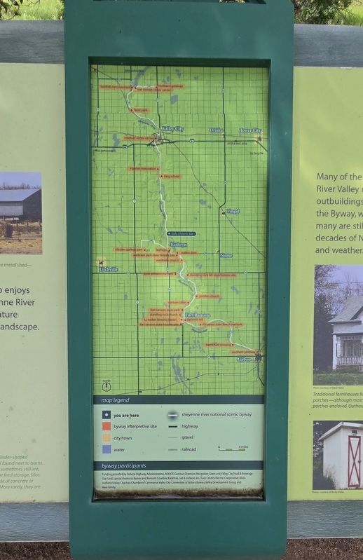
3. Sheyenne River National Scenic Byway Map
Situated between the two sides of the marker, this shows the locations of other interpretive sites along the byway.

Photographed by Mark Parker, June 27, 2025
4. The Great American Barn / Rural Architecture Marker
Credits. This page was last revised on July 21, 2025. It was originally submitted on July 20, 2025, by Mark Parker of Hickory, North Carolina. This page has been viewed 138 times since then and 29 times this year. Photos: 1. submitted on July 20, 2025, by Mark Parker of Hickory, North Carolina. 2, 3, 4. submitted on July 21, 2025, by Mark Parker of Hickory, North Carolina. • J. Makali Bruton was the editor who published this page.
