Better Waverly in Baltimore, Maryland — The American Northeast (Mid-Atlantic)
Waverly Town Hall
Baltimore City Landmark
| — | Baltimore National Heritage Area | — |
Photographed by Mark P Brock-Cancellieri, July 18, 2025
1. Waverly Town Hall Marker
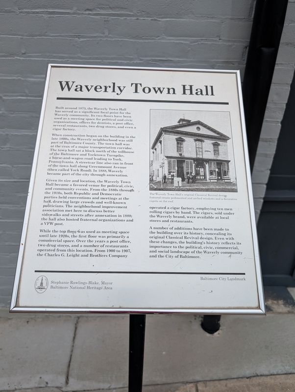
When construction began on the building in the late 1800s, the Waverly neighborhood was still part of Baltimore Country. The town hall was at the crux of a major transportation corridor. The town hall sat a block north of the tollhouse of the Baltimore and Yorktown Turnpike, a horse-and-wagon road leading to York, Pennsylvania. A streetcar line also ran in front of the town hall along Greenmount Avenue (then called York Road). in 1888, Waverly became part of the city through annexation.
Given its size and location, the Waverly Town Hall became a favored venue for political, civic, and community events. From the 1880s through the 1910s, both Republic and Democratic parties held conventions and meetings at the hall, drawing large crows and well-known politicians. The neighborhood improvement association met here to discuss
this page online
While the top floor was used as a meeting space until late 1920s, the first floor was primarily a commercial space. Over the year a post office, two drug stores, and a number of restaurants operated from this location. From 1900 to 1907, the CHarles G. Leight and Brothers Company operated a cigar factory, employing ten men rolling cigars by hand. The cigars, sold under the Waverly brand, were available at local stores and restaurants.
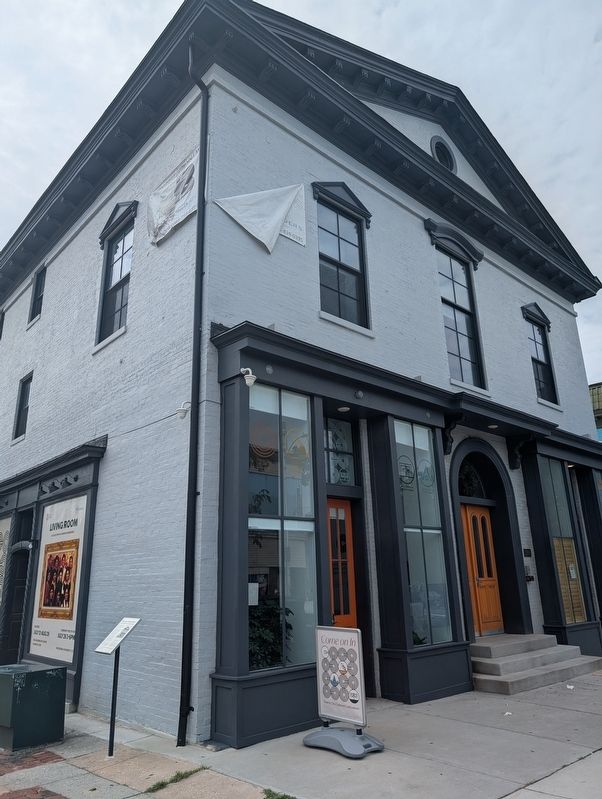
A number of additions have been made to the building over its history, concealing its original Classical Revival design. Even with these changes, the building's history reflects its importance to the political, civic, commercial, and social landscape of the Waverly community and the City of Baltimore.
Stephanie Rawlings-Blake, Mayor
Baltimore National Heritage Area
Baltimore City Landmark
Topics. This historical marker is listed in these topic lists: Fraternal or Sororal Organizations • Industry & Commerce • Railroads & Streetcars • Roads & Vehicles. A significant historical year for this entry is 1873.
Location. 39° 19.569′ N,
Photographed by Mark P Brock-Cancellieri, July 18, 2025
2. Waverly Town Hall Marker

Regionally, this marker is in Central Maryland. It is also in the American Mid-Atlantic, in the Chesapeake Bay Region, and on the Eastern Seaboard. Globally, it is in the North Atlantic Region, North America, the Western Hemisphere, the Western World, and the Anglosphere. Historically, it finds itself in what was once one of the original Thirteen Colonies and also the Antebellum South.
Other nearby markers. At least 8 other markers are within walking distance of this marker: Giving Voice to the Community (a few steps from this marker); "Old" Oriole Park (about 600 feet away, measured in a direct line); Connection to Nature & Learning (approx. 0.2 miles away); Village life goes on along Old York Road.. (approx. 0.2 miles away); Eastern High School Monument (approx. 0.4 miles away); Welcome to ThanksGiving Place (approx. half a mile away); Gatehouse (approx. half a mile away); Charles Street at Wyman Park Dell (approx. half a mile away). Touch for a list and map of all markers in Baltimore.
Credits. This page was last revised on July 23, 2025. It was originally submitted on July 21, 2025, by Mark P. Brock-Cancellieri of Baltimore, Maryland. This page has been viewed 126 times since then and 29 times this year. Photos: 1, 2. submitted on July 21, 2025, by Mark P. Brock-Cancellieri of Baltimore, Maryland. • Bill Pfingsten was the editor who published this page.
