Welland in Niagara Region, Ontario — Central Canada (North America)
The Origins
Welland Feeder Canal
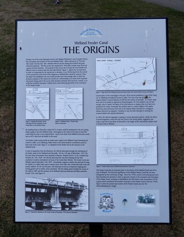
Photographed by Kevin Westell, July 21, 2025
1. The Origins - Marker
Construction on
this page online
In 1826, Mr. Merritt organised a meeting to review alternative options. Under the advice of several engineers, some from the Erie Canal in the United States, suggestion was made to dam the Grand River at Dunnville to the height of 8ft. and extend a feeder canal to Broad Creek in Wetland.
By installing locks at Dunnville a head of 8 ft. of water could be maintained in the river giving ample supply to feed the Welland
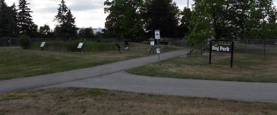
Photographed by Kevin Westell, July 21, 2025
2. The Origins - Marker in context
The photo faces east and south-east from Prince Charles Drive. The marker is one of the six around the marsh-pond within the feeder canal lock.
The Feeder Canal would provide an ample water supply to the Welland Canal eliminated the need for a 60ft. cut at Allanburg. Water levels in the canal would be controlled by locks at both ends of the canal. Figure 3. is a blueprint of the feeder lock at the entrance to the Welland Canal.
In spite of opposition from the Directors, Mr. Merritt advocated strongly the undertaking of the feeder canal to Port Maitland and Dunnville. On the 12th day of September, 1827, the first nine miles of excavation were awarded to Monson, Simpson and Co. to be completed by October the 15th, 1828. Mr. Merritt advocated this new idea stressing the fact that production would be stimulated in all areas of the Grand River District. The Feeder Canal was officially opened November 14th 1829. Immediately, engineers realised the potential of using the Feeder as a viable trade route to eastern ports. Soon after, this commercial trade route was quickly realised. For the next 60 years, this waterway served as an important shipping lane moving goods such as timber, stone and bricks. The last sailing vessel travelled the course of the canal in 1892 and the entrance at the Welland Canal was dammed and filled sometime around 1926. (see Figure 4)
The Feeder Canal has an important place in the history of the Welland Canal and of the City of Welland. The historical significance of the Welland Feeder Canal has not been disregarded by the community at-large. Since the 1970s, several community groups have been founded and operated in order to generate interest in the excavation and restoration of the Feeder Canal, including the Rehabilitate the Old Feeder Canal Association (1979), a group which considered the possible restoration of the Feeder Canal in the late 1970s. Figure 5 show the present day location of the Feeder Canal Lock near the Ontario/Broadway St. bridge.
Erected by Welland Canal Recreational Canal Corporation.
Topics and series. This historical marker is listed in this topic list: Waterways & Vessels. In addition, it is included in the The Welland Canals series list. A significant historical year for this entry is 1818.
Location. 42° 58.445′ N, 79° 15.47′ W. Marker is in Welland, Ontario, in Niagara Region. It is at the intersection of Prince Charles Drive S and Ontario Road, on the right when traveling north on Prince Charles Drive S. Touch for map. Marker is at or near this postal address: 383 Prince Charles Drive S, Welland ON L3B 3P2, Canada. Touch for directions.

Regionally, this marker is on Ontario’s Golden Horseshoe and in Niagara Canada. It is also in Central Canada. Globally, it is in North America, on the Great Lakes, in the Western Hemisphere, in the Western World, and in the Anglosphere. Historically, it finds itself in what was once a British colony, the Viceroyalty of New France, the Haudenosaunee (Iroquois) Confederacy, and Rupert’s Land.
Other nearby markers. At least 8 other markers are within walking distance of this marker: Junction Village (here, next to this marker); The Decline (here, next to this marker); The Feeder Canal - Junction Lock - 1845 (here, next to this marker); The Raceway (here, next to this marker); The Eight Bridges (a few steps from this marker); Economic Impact (a few steps from this marker); Artist - Catharine Mills "Hockey" (approx. 0.9 kilometers away); Ukrainian Labour Temple 2005 (approx. one kilometer away). Touch for a list and map of all markers in Welland.
More about this marker. The marker is one of six in a semi-circle around a small marsh-pond around the feeder canal lock, between two dog park fenced areas, 40 metres east of Prince Charles Drive and 40 metres east of Ontario Road. The best parking is at the dog park, off of Federal Road.
Credits. This page was last revised on July 23, 2025. It was originally submitted on July 23, 2025, by Kevin Westell of St. Catharines, Ontario. This page has been viewed 80 times since then and 17 times this year. Photos: 1, 2. submitted on July 23, 2025, by Kevin Westell of St. Catharines, Ontario. • Andrew Ruppenstein was the editor who published this page.
