Welland in Niagara Region, Ontario — Central Canada (North America)
The Feeder Canal - Junction Lock - 1845
Le Canal Feeder - Écluse De Jonction - 1845
Photographed by Kevin Westell, July 21, 2025
1. The Feeder Canal - Junction Lock - 1845 - Marker

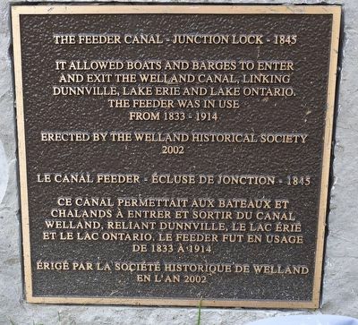
The Feeder Canal - Junction Lock - 1845
It allowed boats and barges to enter and exit the Welland Canal, linking Dunnville, Lake Erie and Lake Ontario. The feeder was in use from 1833 - 1914
Le Canal Feeder - Écluse De Jonction - 1845
Ce canal permettait aux bateaux et chalands à entrer et sortir du canal Welland, reliant Dunnville, le lac Érié et le lac Ontario. Le feeder fut en usage de 1833 à 1914
Erected 2002 by Welland Historical Society.
Topics and series. This historical marker is listed in this topic list: Waterways & Vessels. In addition, it is included in the The Welland Canals series list. A significant historical year for this entry is 1833.
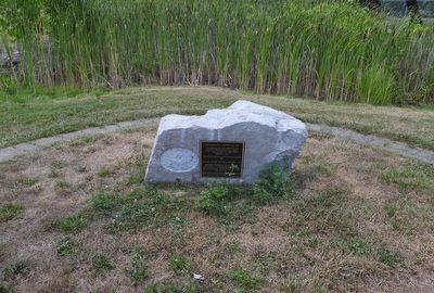
Location. 42° 58.443′ N, 79° 15.468′ W. Marker is in Welland, Ontario, in Niagara Region. It is on Prince Charles Drive S. The marker is mounted low on a rock, in a group of markers in a semi-circle around a small marsh-pond around the feeder canal lock, between two dog park fenced areas, 40 metres east of Prince Charles Drive and 40 metres east of Ontario Road. Touch for map. Marker is at or near this postal address: 383 Prince Charles Drive
this page online

Regionally, this marker is on Ontario’s Golden Horseshoe and in Niagara Canada. It is also in Central Canada. Globally, it is in North America, on the Great Lakes, in the Western Hemisphere, in the Western World, and in the Anglosphere. Historically, it finds itself in what was once a British colony, the Viceroyalty of New France, the Haudenosaunee (Iroquois) Confederacy, and Rupert’s Land.
Other nearby markers. At least 8 other markers are within walking distance of this marker: The Decline (here, next to this marker); The Origins (here, next to this marker); Junction Village (here, next to this marker); Economic Impact (here, next to this marker); The Raceway (a few steps from this marker); The Eight Bridges (a few steps from this marker); Artist - Catharine Mills "Hockey" (approx. 0.9 kilometers away); Ukrainian Labour Temple 2005 (approx. one kilometer away). Touch for a list and map of all markers in Welland.
Photographed by Kevin Westell, July 21, 2025
2. The Feeder Canal - Junction Lock - 1845 - Marker
Photographed by Kevin Westell, July 21, 2025
3. The Feeder Canal - Junction Lock - 1845 - Marker in context
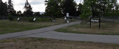
The photo faces east and south-east from Prince Charles Drive. The marker is on the rock the bicycle (centre) is leaning on.

Photographed by Kevin Westell, July 21, 2025
4. The Feeder Canal Junction Lock
The little pond for the marsh plants is within the stone walls of the junction lock. The lock is only partially excavated - the benches and pathway lie where the western end of the lock was.
Credits. This page was last revised on July 23, 2025. It was originally submitted on July 23, 2025, by Kevin Westell of St. Catharines, Ontario. This page has been viewed 97 times since then and 19 times this year. Photos: 1, 2, 3, 4. submitted on July 23, 2025, by Kevin Westell of St. Catharines, Ontario. • Andrew Ruppenstein was the editor who published this page.
