Welland in Niagara Region, Ontario — Central Canada (North America)
The Decline
Welland Feeder Canal
Photographed by Kevin Westell, July 21, 2025
1. The Decline - Marker
this page online
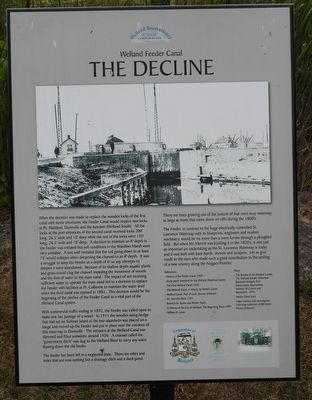
With commercial traffic ending in 1892, the Feeder was called upon to make one last passage of a vessel. In 1911 the wooden swing bridge that had sat on Sullivan Island at the two aqueducts was placed on a barge and moved up the Feeder and put in place near the entrance of this waterway is Dunnville. The entrance at the Welland Canal was dammed and filled sometime around 1926. A channel called the "government ditch" was dug to the Welland River to carry any water flowing down the old feeder.
The feeder has been left in a neglected state. There are miles and miles that are now nothing but a drainage ditch and a duck pond. There are trees growing out of the bottom of that once-busy waterway as large as many that came down on rafts during the 1800's.
The Feeder, in contrast to the huge electrically-controlled St. Lawrence Waterway with its blueprints, engineers and modern machinery, would be no more than a mere furrow through a ploughed field. But when Mr. Merritt was building it in the 1820's, it was just as important an undertaking
Photographed by Kevin Westell, July 21, 2025
2. The Decline - Marker in context
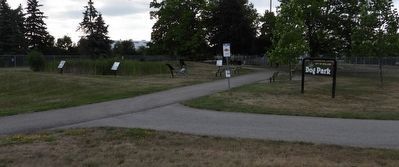
The photo faces east and south-east from Prince Charles Drive. The marker is one of the six around the marsh-pond within the feeder canal lock.
References:
- History of the Feeder Canal 1959
- Study paper prepared for the Welland Historical Society
- The first Welland Canal 1959
- The Welland Canal, A History by DeWitt Carter
- Welland Canal; Plan of Lock, Source Unknown
- Mr. Merrill's Ditch 1992
- Roberta M, Styran and Robert Taylor
- A History of the City of Welland, The Beginning Years 1997
- William H. Lewis
Maps:
- The Routes of the Welland Canals, The Welland Canals: Historical Resource Analysis And Preservation Alternatives; Ministry of Culture and Recreation, 1976
- Feeder Canal Lock
- maps redrawn and reconfigured from map collection of Bill Lewis; Source Unknown
Erected by Welland Canal Recreational Canal Corporation.
Topics and series. This historical marker is listed in this topic list: Waterways & Vessels. In addition, it is included in the The Welland Canals series list. A significant historical year for this entry is 1845.
Location. 42° 58.444′ N,
Photographed by Kevin Westell, July 21, 2025
3. The Decline - Marker in context
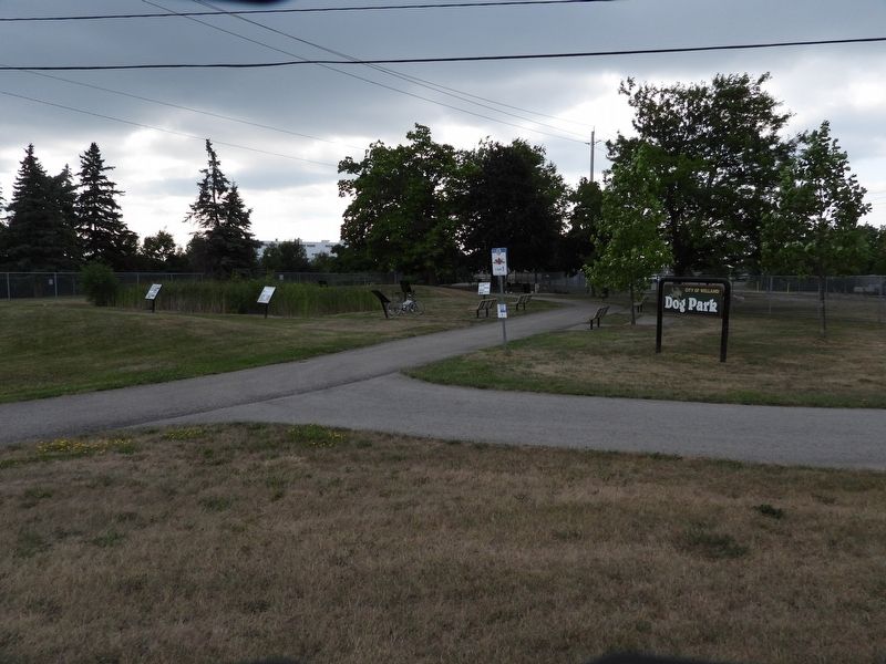
The photo faces east and south-east from Prince Charles Drive. The marker is one of the six around the marsh-pond within the feeder canal lock.

Regionally, this marker is on the Golden Horseshoe and in Niagara Canada. It is also in Central Canada. Globally, it is in North America, on the Great Lakes, in the Western Hemisphere, in the Western World, and in the Anglosphere. Historically, it finds itself in what was once a British colony, the Viceroyalty of New France, the Haudenosaunee (Iroquois) Confederacy, and Rupert’s Land.
Other nearby markers. At least 8 other markers are within walking distance of this marker: The Feeder Canal - Junction Lock - 1845 (here, next to this marker); The Origins (here, next to this marker); Junction Village (here, next to this marker); The Raceway (here, next to this marker); Economic Impact (a few steps from this marker); The Eight Bridges (a few steps from this marker); Artist - Catharine Mills "Hockey" (approx. 0.9 kilometers away); Ukrainian Labour Temple 2005 (approx. one kilometer away). Touch for a list and map of all markers in Welland.
More about this marker. The marker is one of six in a semi-circle around a small marsh-pond at the feeder canal lock, between two dog park fenced areas, 40 metres east of Prince Charles Drive and 40 metres east of Ontario Road.
Credits. This page was last revised on July 23, 2025. It was originally submitted on July 23, 2025, by Kevin Westell of St. Catharines, Ontario. This page has been viewed 91 times since then and 19 times this year. Photos: 1, 2, 3. submitted on July 23, 2025, by Kevin Westell of St. Catharines, Ontario. • Andrew Ruppenstein was the editor who published this page.
