Paignton in Torbay, England, United Kingdom — Northwestern Europe (the British Isles)
Paignton: Episcopal Manor, Town and Palace
Photographed by Ray Gurganus, April 6, 2025
1. Paignton: Episcopal Manor, Town and Palace Marker
Manor
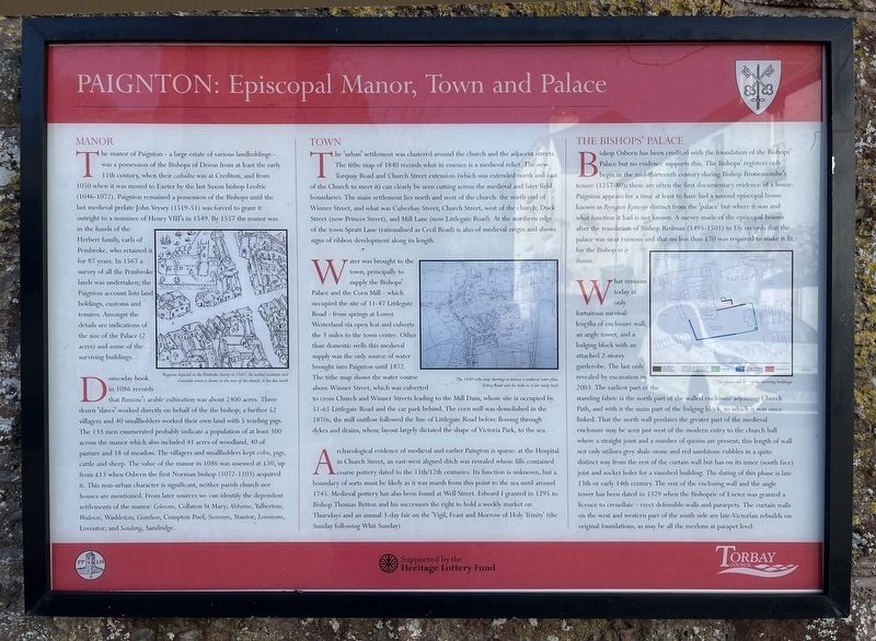
The manor of Paignton - a large estate of various landholdings - was a possession of the Bishops of Devon from at least the early 1050 when it was moved to Exeter by by the last Saxon bishop Leofric (1046-1072). Paignton remained a possession of the Bishops until the last medieval prelate John Veysey (1519-51) was forced to grant it outright to a nominee of Henry VIII's in 1549. By 1557 the manor was in the hands of the Herbert family, earls of Pembroke, who retained it for 87 years. In 1567 a survey of all the Pembroke lands was undertaken; the Paignton account lists land holdings, customs and tenures. Amongst the details are indications of the size of the Palace (2 acres) and some of the surviving buildings.
Domesday book in 1086 records that Peintone's arable cultivation was about 2400 acres. Three down 'slaves' worked directly on behalf of the the bishop; a further 52 villagers and 40 smallholders worked their own land with 5 tending pigs. The 133 men enumerated probably indicate a population of at least 300 across the manor which also included 41 acres of woodland, 40 of pasture and 18 of meadow. The villagers
this page online
Town
The 'urban' settlement was clustered around the church and the adjacent streets. The tithe map of 1840 records what in essence is a medieval relict. The new Torquay Road and Church Street extension (which was extended north and east of the Church to meet it) can clearly be seen cutting across the medieval and later field boundaries. The main settlement lies north and west of the church: the north end of Winner Street, and what was Culverhay Street; Church Street, west of the church; Duck Street (now Princes Street), and Mill Lane (now Littlegate Road). At the northern edge of the town Spratt Lane (rationalised as Cecil Road) is also of
Photographed by Ray Gurganus, April 6, 2025
2. Paignton: Episcopal Manor, Town and Palace Marker
Water was brought to the town, principally to supply the Bishops' Palace and the Corn Mill - which occupied the site of 31-47 Littlegate Road - from springs at Lower Westerland via open leat and culverts the 3 miles to the town centre. Other than domestic wells this medieval supply was the only source of water brought into Paignton until 1872. The tithe map shows the water course above Winner Street, which was culverted to cross Church and Winner Streets leading to the Mill Darn, whose site is occupied by 51-65 Littlegate Road and the car park behind. The corn mill was demolished in the 1870s; the mill outflow followed the line of Littlegate Road before flowing through dykes and drains, whose layout largely dictated the shape of Victoria Park, to the sea.
Archaeological evidence of medieval and earlier Paington is sparse: at the Hospital in Church Street, an east-west aligned ditch was revealed whose fills contained coarse pottery dated to the 1lth/12th centuries. Its function is unknown, but a boundary of sorts must be likely as it was marsh from this point to the sea until around 1745. Medieval pottery has also been found at Well Street. Edward I granted in 1295 to Bishop Thomas Bytton and his successors the right to hold a weekly market on Thursdays and an annual 3-day fair on the 'Vigil, Feast and Morrow of Holy Trinity' (the Sunday following Whit Sunday).
The Bishops' Palace
Bishop Osbern has been credited with the foundation of the Bishops' Palace but no evidence supports this. The Bishops' registers only begin in the mid-thirteenth century during Bishop Bronescombe's tenure (1257-80); these are often the first documentary evidence of a house. Paignton appears for a time at least to have had a second episcopal house known as Peyngton Episcopi distinct from the 'palace' but where it was and what function it had is not known. A survey made of the episcopal houses after the translation of Bishop Redman (1495-1501) to Ely records that the palace was near ruinous and that no less than £70 was required to make it fit for the Bishop to ly therein.
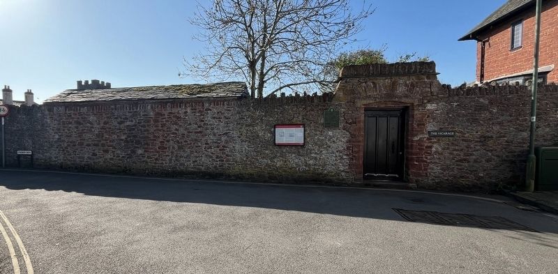
What remains today is only fortuitous survival: lengths of enclosure wall, an angle tower, and a lodging block with an attached 2-storey garderobe. The last only revealed by excavation in 2003. The earliest part of the standing fabric is the north part of the walled enclosure adjoining Church Path, and with it the main part of the lodging block, to which it was once linked. That the north wall predates the greater part of the medieval enclosure may be seen just west of the modern entry to the church hall where a straight joint and a number of quoins are present; this length of wall not only utilises grey shale-stone and red sandstone rubbles in a quite distinct way from the rest of the curtain wall but has on its inner (south face) joist and socket holes for a vanished building. The dating of this phase is late 13th or early 14th century. The rest of the enclosing wall and the angle tower has been dated to 1379 when the Bishopric of Exeter was granted a licence to crenellate - erect defensible walls and pararpets. The curtain walls on the west and western part of the south side are late-Victorian rebuilds on original foundations, as may be all the merlons at parapet level.
Topics. This historical marker is listed in these topic lists: Anthropology & Archaeology • Settlements & Settlers. A significant historical year for this entry is 1086 CE.
Location. 50° 26.182′ N, 3° 34.194′ W. Marker is in Paignton, England, in Torbay. It is on Palace Place, on the left when traveling north. Touch for map. Marker is at or near this postal address: 7 Palace Place, Paignton, England TQ3 3AQ, United Kingdom. Touch for directions.

Regionally, this marker is in South West England. Globally, it is on the Atlantic Ocean, in the North Atlantic Region, in Europe, in Atlantic Europe, on one of the British Isles, in the Western World, and in the Anglosphere. Historically, it finds itself in what was once the Roman Empire.
Other nearby markers. At least 8 other markers are within 10 kilometers of this marker, measured as the crow flies: Paignton Palace: The Medieval Bishop's Hall (here, next to this marker); Totnes Town Mill (approx. 8 kilometers away); The Posts of the Town Marsh Gate (approx. 8 kilometers away); The Shady Garden (approx. 8.2 kilometers away); Ann Ball (approx. 8.4 kilometers away); Welcome to The Market Square (approx. 8.5 kilometers away); The Medieval Town of Totnes (approx. 8.6 kilometers away); The Shell Keep (approx. 8.6 kilometers away).
Credits. This page was last revised on July 29, 2025. It was originally submitted on July 23, 2025, by Ray Gurganus of Washington, District of Columbia. This page has been viewed 91 times since then and 24 times this year. Photos: 1, 2. submitted on July 23, 2025, by Ray Gurganus of Washington, District of Columbia. • Andrew Ruppenstein was the editor who published this page.
