Port Colborne in Niagara Region, Ontario — Central Canada (North America)
West Street
Serving the marine trade since 1833/ Au service de la marine marchande depuis 1833
Photographed by Tim Boyd, March 14, 2025
1. West Street Marker

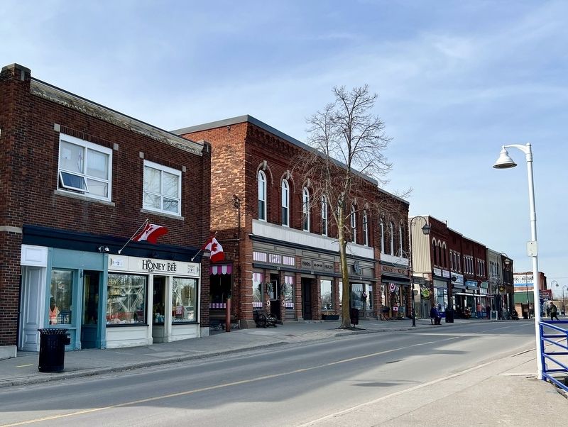
Serving the marine trade since 1833
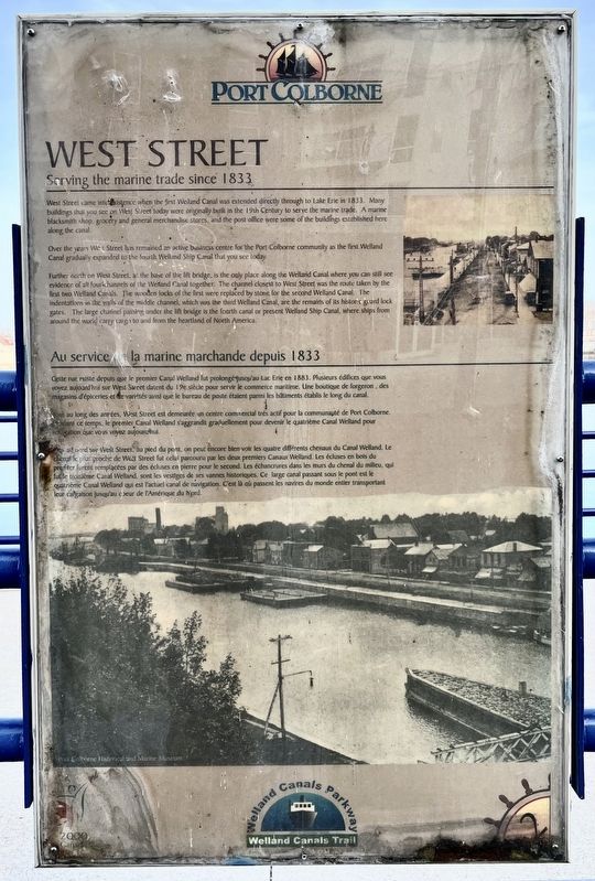
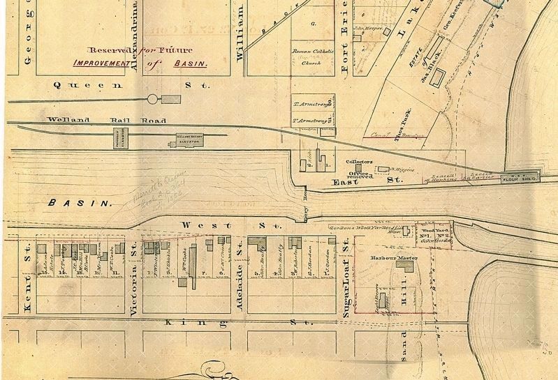
West Street came into existence when the first Welland Canal was extended directly through to Lake Erie in 1833. Many buildings that you see on West Street today were originally built in the 19th Century to serve the marine trade. A marine blacksmith shop, grocery and general merchandise stores, and the post office were some of the buildings established here along the canal.
Over the years West Street has remained an active business centre for the Port Colborne community as the first Welland Canal gradually expanded to the fourth Welland Ship Canal that you see today.
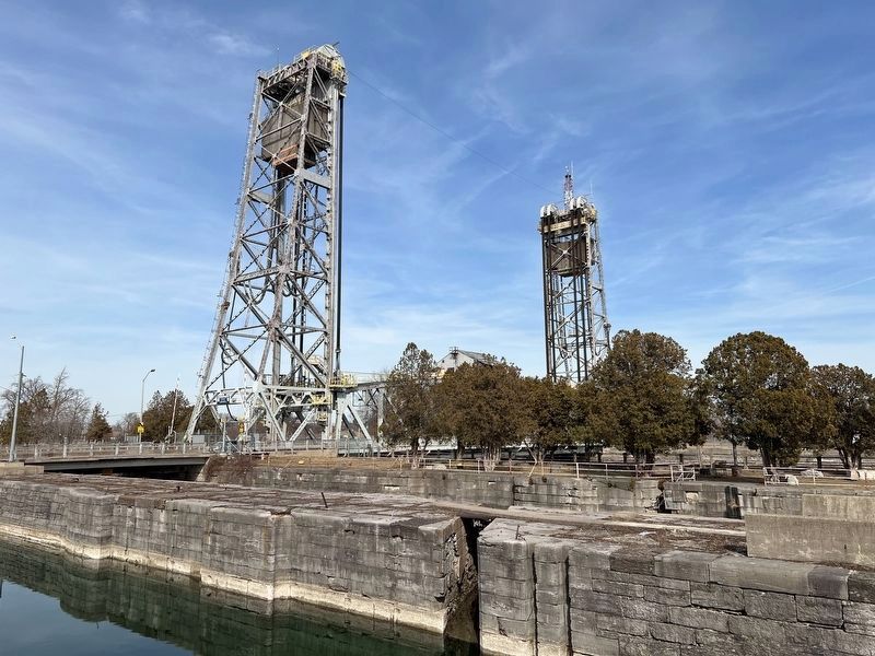
Further north on West Street, at the base of the lift bridge, is the only place along the Welland Canal where you can still see evidence of all four channels of the Welland Canal together. The channel closest to West Street was the route taken by the first two Welland Canals. The wooden locks of the first were replaced by stone for the second Welland Canal. The indentations in the walls of the middle channel, which was the third Welland Canal, are the remains of its historic guard lock gates. The large channel passing under the lift bridge is the fourth canal or present Welland Ship Canal, where ships from around the world carry cargo to and from the heartland of North America.
Cette rue existe depuis que le premier Canal Welland fut prolongé jusqu'au Lac Erie en 1883. Plusieurs édifices que vous voyez aujourd'hui sur West Street datent du 19e siècle pour servir le commerce maritime. Une boutique de forgeron, des magasins d'épiceries et le variétés ainsi que le bureau de poste étaient parmi les bâtiments établis le long du canal.
Tout au long des années, West Street est demeurée un centre commercial trés actif pour la communauté de
this page online
Plus au nord sur West Street, au pied du pont, on peut encore bien voir les quatre différents chenaux du Canal Welland. Le chenal le plus proche de West Street fut celui parcouru par les deux premiers Canaux Welland. Les écluses en bois du premier furent remplacées par des écluses en pierre pour le second. Les échancrures dans les murs du chenal du milieu, qui fut le troisième Canal Welland, sont les vestiges de ses vannes historiques. Ce large canal passant sous le pont est le quatrième Canal Welland qui est l'actuel canal de navigation. C'est là où passent les navires du monde entier transportant leur cargaison jusqu’au coeur de l'Amérique du Nord.
Erected 2000 by City of Port Colborne.
Topics and series. This historical marker is listed in these topic lists: Industry & Commerce • Settlements & Settlers • Waterways & Vessels. In addition, it is included in the The Welland Canals series list. A significant historical year for this entry is 1833.
Location. 42° 52.973′ N,
Photographed by Tim Boyd, March 14, 2025
2. West Street Marker

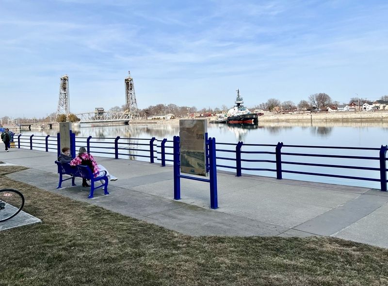
Regionally, this marker is on the Golden Horseshoe and in Niagara Canada. It is also in Central Canada. Globally, it is in North America, on the Great Lakes, in the Western Hemisphere, in the Western World, and in the Anglosphere. Historically, it finds itself in what was once a British colony, the Viceroyalty of New France, the Haudenosaunee (Iroquois) Confederacy, and Rupert’s Land.
Other nearby markers. At least 8 other markers are within walking distance of this marker: Welland Canals / Les Canaux Welland (here, next to this marker); Canal Commerce and Industry / Le Canal: Commerce et Industrie (about 90 meters away, measured in a direct line); Settlement Begins - Port Colborne's Early Inhabitants (about 240 meters away); Imperial Bank of Canada Building (approx. 0.3 kilometers away);
circa 1855
3. Port Colborne in ca 1855, showing West Street
Photographed by Tim Boyd, March 14, 2025
4. The Welland Canal from West Street, showing the stonework of the original channels
Photographed by Tim Boyd, March 14, 2025
5. West Street, 2025
Credits. This page was last revised on July 26, 2025. It was originally submitted on March 16, 2025, by Tim Boyd of Hamilton, Ontario. This page has been viewed 140 times since then and 31 times this year. Last updated on July 25, 2025, by Kevin Westell of St. Catharines, Ontario. Photos: 1, 2, 3, 4, 5. submitted on March 16, 2025, by Tim Boyd of Hamilton, Ontario. • Devry Becker Jones was the editor who published this page.
