Near Ducktown in Polk County, Tennessee — The American South (East South Central)
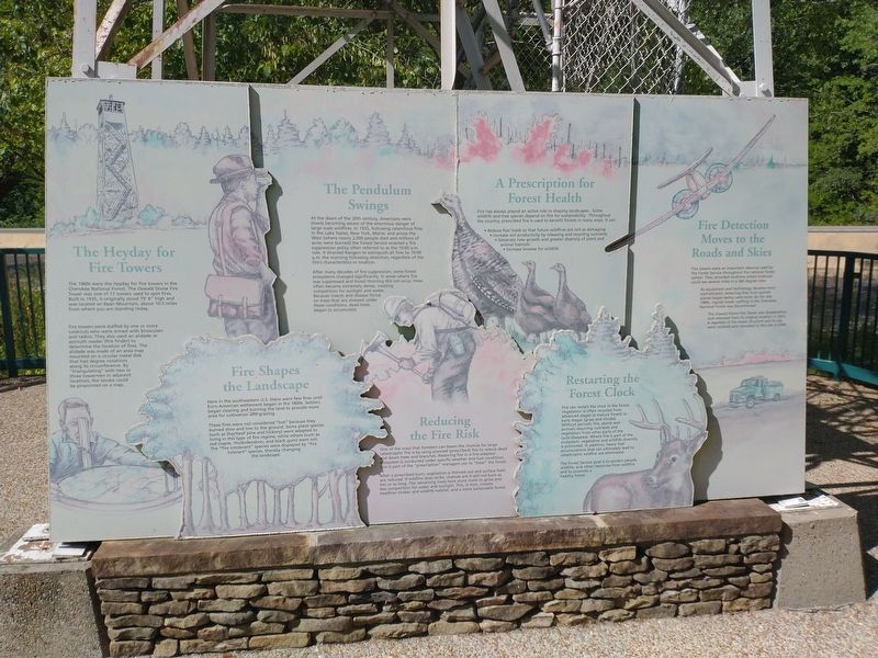
The Heyday for Fire Towers
Photographed by Tom Bosse, July 26, 2025
1. The Heyday for Fire Towers Marker
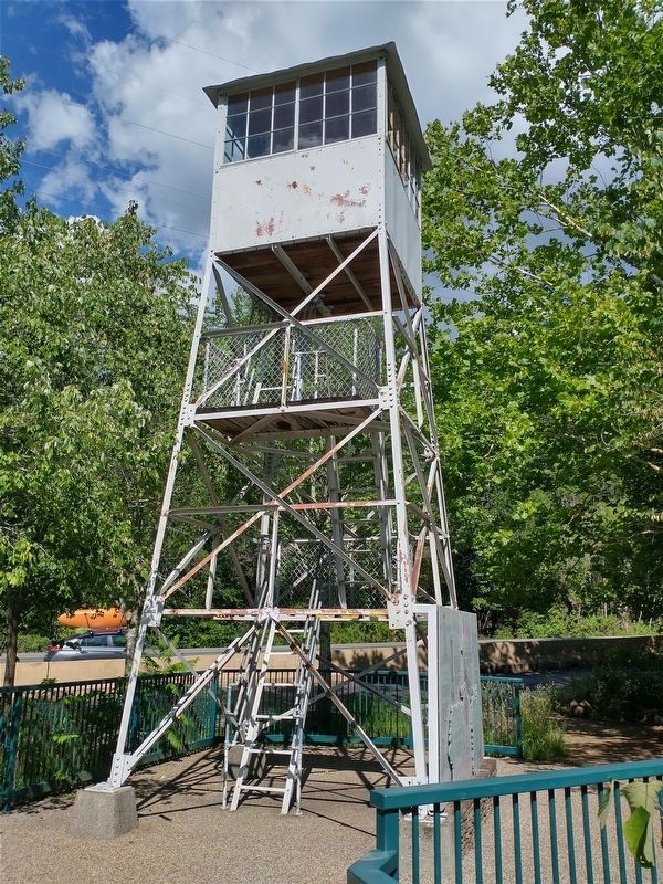
The 1960s were the heyday for fire towers in the Cherokee National Forest. The Oswald Dome Fire Tower was one of 17 towers used to spot fires. Built in 1935, it originally stood 79’ 6” high and was located on Bean Mountain, about 10.5 miles from where you are standing today.
Fire towers were staffed by one of more Lookouts who were armed with binoculars and radios. They also used an alidade or azimuth reader (fire finder) to determine the location of fires. The alidade was made of an area map mounted on a circular metal disk that had degree notations along its circumference. By “triangulating” with two or three towermen in adjacent locations, the smoke could be pinpointed on a map.
Fire Shapes the Landscape
Here in the southeastern U.S. there were few fires until Euro-American settlement began in the 1800s. Settlers began clearing and burning the land to provide more area for cultivation and grazing.
These fires were not considered “hot” because they burned slow and low to the ground. Some plant species (such as shortleaf pine and hickory) were adapted to living in this type of fire
this page online
The Pendulum Swings
At the dawn of the 20th century, Americans were slowly becoming aware of the enormous danger of large scale wildfires. In 1935, following calamitous fires in the Lake States, New York, Maine, and across the West (where nearly 2,000 people died and millions of acres were burned) the Forest Service enacted a fire suppression policy often referred to as the 10:00 a.m. rule. It directed Rangers to extinguish all fires by 10:00 a.m. the morning following detection, regardless of the fire’s characteristics or location.
After many decades of fire suppression, some forest ecosystems changed significantly. In areas where fire was suppressed and forest thinning did not occur, trees became extremely dense, creating competition for sunlight and water. Because insects and disease thrive on trees that are stressed under these conditions, dead trees began to accumulate.
Reducing the Fire Risk
One of the ways that foresters can lessen the
Photographed by Tom Bosse, July 26, 2025
2. The Heyday for Fire Towers Marker
After a prescribed burn, vegetation is thinned out and surface fuels are reduced. If wildfire does strike, chances are it will not burn as hot or as long. The remaining trees have more room to grow and less competition for water and sunlight. This, in turn creates healthier timber and wildlife habitat, and a more sustainable forest.
A Prescription for Forest Health
Fire has always played an active role in shaping landscapes. Some wildlife and tree species depend on fire for sustainability. Throughout the country, prescribed fire is used to benefit forests in many ways. It can:
• Reduce fuel loads so that future wildfires are not as damaging.
• Increase soil productivity by releasing and recycling nutrients.
• Generate new growth and greater diversity of plant and animal habitats.
• Increase browse for wildlife.
Restarting the Forest Clock
Fire
Photographed by Tom Bosse, July 26, 2025
3. The Heyday for Fire Towers Marker
The Forest Service goal is to protect people, wildlife, and other resources from wildfire and to promote a healthy forest.
Fire Detection Moves to the Road and Skies
Fire towers were an important resource used by the Forest Service throughout the national forest system. They provided locations where lookouts could see several miles in a 360 degree view.
As equipment and technology became more sophisticated, detecting fires from spotter planes began being used more. By the late 1980s, regular tower staffing in the Cherokee National Forest was discontinued.
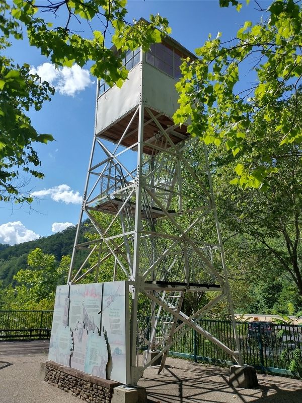
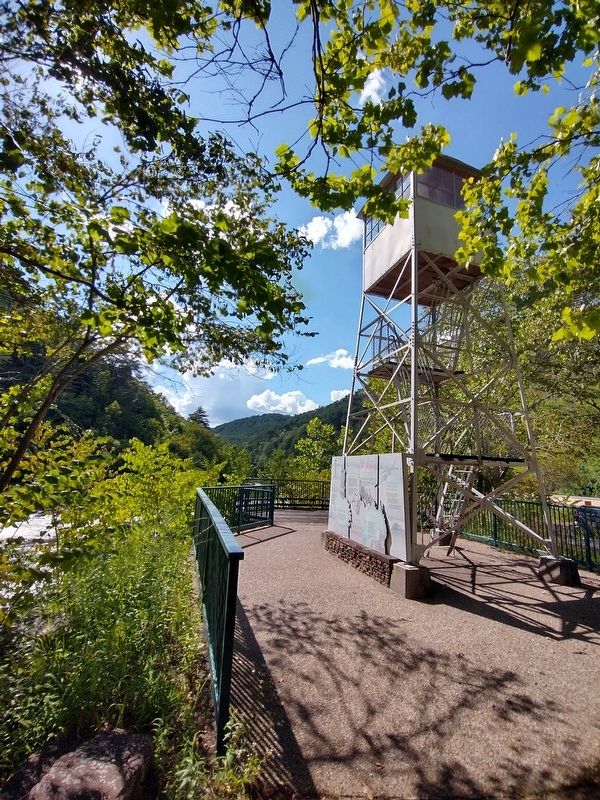
The Oswald Dome Fire Tower was disassembled and removed from its original location in 2003. A segment of the tower structure and
Photographed by Tom Bosse, July 26, 2025
4. The Heyday for Fire Towers Marker
Erected by Cherokee National Forest.
Topics. This historical marker is listed in these topic lists: Environment • Horticulture & Forestry. A significant historical year for this entry is 1935.
Location. 35° 4.073′ N, 84° 27.708′ W. Marker is near Ducktown, Tennessee, in Polk County. It is on U.S. 64 6 miles west of Tennessee Highway 68, on the left when traveling west. Marker and tower are located near the Ocoee Whitewater Center. Touch for map. Marker is at or near this postal address: 4400 US-64, Ducktown TN 37326, United States of America. Touch for directions.

Regionally, this marker is in East Tennessee. It is also in the American South, specifically in the Upper South, in Appalachia, and specifically in Southern Appalachia. Globally, it is in North America, the Western Hemisphere, the Western World, and the Anglosphere. Historically, it finds itself in what was once the original Cherokee Nation, the territory of the Mississippian Culture, one of the Confederate States of America, and the Antebellum South.
Other nearby markers. At least 8 other markers are within 6 miles of this marker, measured as the crow flies: Cherokee Heritage Trails (about 500 feet away, measured in a direct line); Traveling the Old Copper Road (about 600 feet away); The Old Copper Road (about 600 feet away); Tennessee Society DAR Memorial Forest (approx. 3½ miles away); Ball Field (approx. 5.1 miles away); Clinic (approx. 5.1 miles away); Company Houses (approx. 5.1 miles away); Walkway Tunnel (approx. 5.1 miles away). Touch for a list and map of all markers in Ducktown.
Credits. This page was last revised on July 30, 2025. It was originally submitted on July 27, 2025, by Tom Bosse of Jefferson City, Tennessee. This page has been viewed 92 times since then and 30 times this year. Photos: 1, 2, 3, 4. submitted on July 27, 2025, by Tom Bosse of Jefferson City, Tennessee. • James Hulse was the editor who published this page.
