Huntsville in Madison County, Alabama — The American South (East South Central)
Lynching in America ⎯⎯⎯ The Lynching of Robert Mosley
Community Remembrance Project
Photographed by Darren Jefferson Clay, July 26, 2025
1. Lynching in America / The Lynching of Robert Mosley
Inscription.
Lynching in America
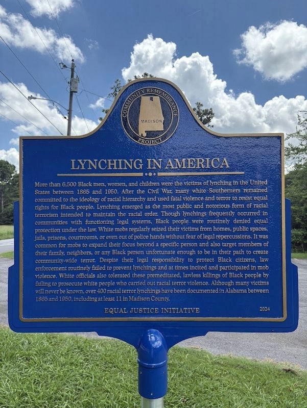
More than 6,500 Black men, women, and children were the victims of lynching in the United States between 1865 and 1950. After the Civil War, many white Southerners remained committed to the ideology of racial hierarchy and used fatal violence and terror to resist equal rights for Black people. Lynching emerged as the most public and notorious form of racial terrorism intended to maintain the racial order. Though lynchings frequently occurred in communities with functioning legal systems. Black people were routinely denied equal protection under the law. White mobs regularly seized their victims from homes, public spaces, jails, prisons, courtrooms, or even out of police hands without fear of legal repercussions. It was common for mobs to expand their focus beyond a specific person and also target members of their family, neighbors, or any Black person unfortunate enough to be in their path to create community-wide terror. Despite their legal responsibility to protect Black citizens, law enforcement routinely failed to prevent lynchings and at times incited and participated in mob violence. White officials
Click or scan to see this page online
also tolerated these premeditated, lawless killings of Black people by failing to prosecute white people who carried out racial terror violence. Although many victims will never be known, over 400 racial terror lynchings have been documented in Alabama between 1885 and 1950, including at least 11 in Madison County.
The Lynching of Robert Mosley
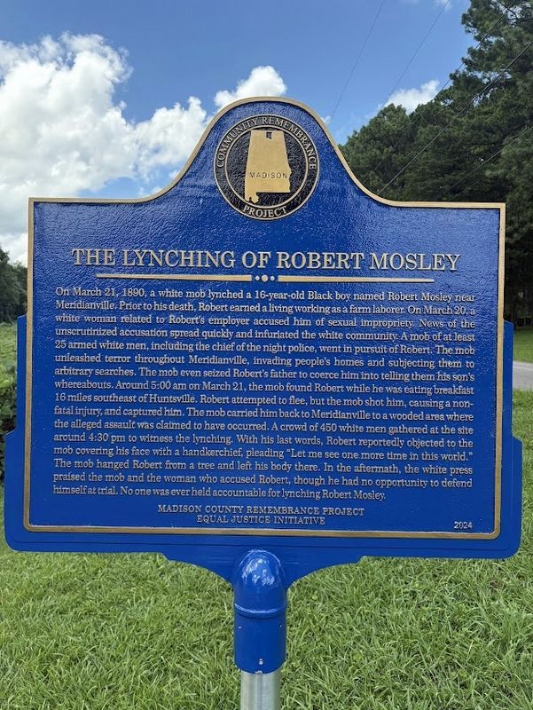
On March 21, 1890, a white mob lynched a 16-year-old Black boy named Robert Mosley near Meridianville. Prior to his death, Robert earned a living working as a farm laborer. On March 20, a white woman related to Robert's employer accused him of sexual impropriety. News of the unscrutinized accusation spread quickly and infuriated the white community. A mob of at least 25 armed white men, including the chief of the night police, went in pursuit of Robert. The mob unleashed terror throughout Meridianville, invading people's homes and subjecting them to arbitrary searches. The mob even seized Robert's father to coerce him into telling them his son's whereabouts. Around 5:00 am on March 21, the mob found Robert while he was eating breakfast 16 miles southeast of Huntsville. Robert attempted
Photographed by Darren Jefferson Clay, July 26, 2025
2. Lynching in America / The Lynching of Robert Mosley
to flee, but the mob shot him, causing a non-fatal injury, and captured him. The mob carried him back to Meridianville to a wooded area where the alleged assault was claimed to have occurred. A crowd of 450 white men gathered at the site around 4:30 pm to witness the lynching. With his last words, Robert reportedly objected to the mob covering his face with a handkerchief, pleading "Let me see one more time in this world." The mob hanged Robert from a tree and left his body there. In the aftermath, the white press praised the mob and the woman who accused Robert, though he had no opportunity to defend himself at trial. No one was ever held accountable for lynching Robert Mosley.
Erected 2024 by Madison County Remembrance Project and Equal Justice Initiative.
Topics and series. This historical marker is listed in these topic lists: African Americans • Civil Rights. In addition, it is included in the Lynching in America series list. A significant historical date for this entry is March 21, 1890.
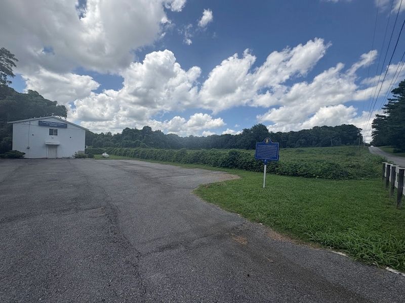
Location. 34° 47.244′ N, 86° 33.282′ W. Marker is in Huntsville, Alabama, in Madison County. It is on Higdon Road Northeast north of Chase Rd NE,
Photographed by Darren Jefferson Clay, July 26, 2025
3. Lynching in America / The Lynching of Robert Mosley
on the left when traveling north. Touch for map. Marker is at or near this postal address: 5907 Higdon Rd NE, Huntsville AL 35811, United States of America. Touch for directions.
Regionally, this marker is in North Alabama. It is also in the American South, specifically in the Deep South, in Appalachia, and specifically in Southern Appalachia. Globally, it is in North America, a Gulf of Mexico state, the Western Hemisphere, the Western World, and the Anglosphere. Historically, it finds itself in what was once the original Cherokee Nation, the territory of the Mississippian Culture, one of the Confederate States of America, and the Antebellum South.
Credits. This page was last revised on July 29, 2025. It was originally submitted on July 28, 2025, by Darren Jefferson Clay of Duluth, Georgia. This page has been viewed 302 times since then and 62 times this year. Photos:1, 2, 3. submitted on July 28, 2025, by Darren Jefferson Clay of Duluth, Georgia. • James Hulse was the editor who published this page.