
Near Celeste in Hunt County, Texas — The American South (West South Central)
Lane Cemetery
Photographed by James Hulse, July 28, 2025
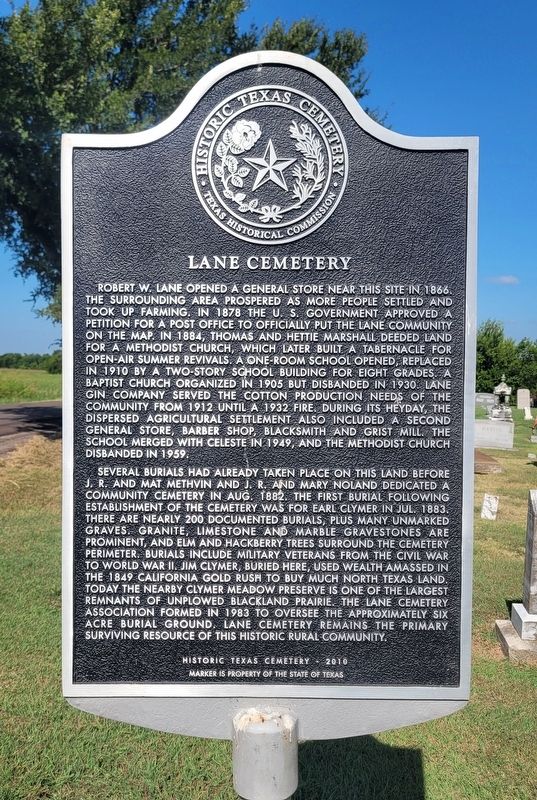
1. Lane Cemetery Marker
Several burials had already taken place on this land before J.R. and Mat Methvin and J.R. and Mary Noland dedicated a community cemetery in Aug. 1882. The first burial following establishment of the cemetery was for Earl Clymer in Jul. 1883. There are nearly 200 documented burials, plus many unmarked graves. Granite, limestone and marble gravestones are prominent, and elm and hackberry trees surround the cemetery perimeter. Burials include military veterans from the Civil War to World War II. Jim Clymer, buried here, used wealth amassed in the 1849 California Gold Rush to buy much North Texas land. Today the nearby Clymer Meadow Preserve is one of the largest remnants of unplowed blackland prairie. The Lane Cemetery Association formed in 1983 to oversee the approximately six acre burial ground. Lane Cemetery remains the primary surviving resource of this historic rural community.
Erected 2010 by Texas Historical Commission. (Marker
this page online
Topics. This historical marker is listed in these topic lists: Cemeteries & Burial Sites • Settlements & Settlers. A significant historical month for this entry is July 1883.
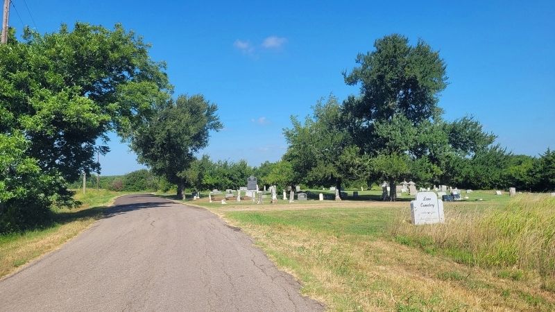
Location. 33° 18.322′ N, 96° 15.819′ W. Marker is near Celeste, Texas, in Hunt County. It is on County Road 1133 0.1 miles north of Farm to Market Road 1562, on the right when traveling north. The marker is located at the front of the cemetery. Touch for map. Marker is at or near this postal address: 5982 Co Rd 1133, Leonard TX 75452, United States of America. Touch for directions.

Regionally, this marker is in the Prairies & Lakes Region and in the Dallas-Fort Worth Metropolitan Area. It is also in the American South. Globally, it is in North America, a Gulf of Mexico state, the Western Hemisphere, the Western World, and the Anglosphere. Historically, it finds itself in what was once New Spain, the Republic of Texas, one of the Confederate States of America, and the Antebellum South.
Other nearby markers. At least 8 other markers are within 6 miles of this marker, measured as the crow flies: Headwaters of the Sabine River (approx. 3½

Photographed by James Hulse, July 28, 2025
2. Lane Cemetery and Marker
Photographed by James Hulse, July 28, 2025
3. The view of the Lane Cemetery and Marker from the street
Credits. This page was last revised on July 29, 2025. It was originally submitted on July 28, 2025, by James Hulse of Medina, Texas. This page has been viewed 119 times since then and 31 times this year. Photos: 1, 2, 3. submitted on July 29, 2025, by James Hulse of Medina, Texas.
