St. Catharines in Niagara Region, Ontario — Central Canada (North America)
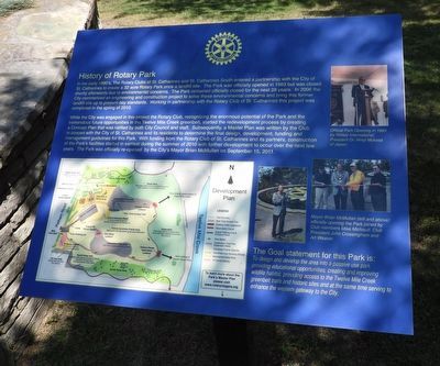
History of Rotary Park
Photographed by Kevin Westell, July 28, 2025
1. History of Rotary Park - Marker
While the City was engaged in this project the Rotary Club, recognizing the enormous potential of the Park and the tremendous future opportunities in the Twelve Mile Creek greenbelt, started the redevelopment process by creating a concept plan that was ratified by both City council and staff. Subsequently, a Master Plan was written by the Club in concert with the City of St. Catharines and its residents to determine the final design, development, funding and management guidelines for this Park.
this page online
The Goal statement for this Park is: To design and develop the area into a passive use park providing educational opportunities, creating and improving wildlife habitat, providing access to the Twelve Mile Creek greenbelt rails and historic sites and at the same time serving to enhance the western gateway to the City.
Erected by Rotary International.
Topics and series. This historical marker is listed in these topic lists: Charity & Public Work • Fraternal or Sororal Organizations • Parks & Recreational Areas. In addition, it is included in the Rotary International series list. A significant historical year for this entry is 1983.
Location. 43° 7.429′ N, 79° 15.947′ W. Marker is in St. Catharines, Ontario, in Niagara Region. It can be reached from Pelham Road, on the right when traveling north. The marker is 50
Photographed by Kevin Westell, July 28, 2025
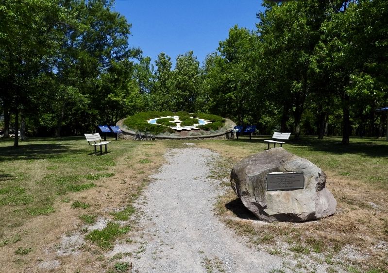
2. History of Rotary Park - Marker in context
Photo faces north, on the walking path from the parking lot. This panel is one of four arrayed beside the giant Rotary International logo.

Regionally, this marker is on the Golden Horseshoe and in Niagara Canada. It is also in Central Canada. Globally, it is in North America, on the Great Lakes, in the Western Hemisphere, in the Western World, and in the Anglosphere. Historically, it finds itself in what was once a British colony, the Viceroyalty of New France, the Haudenosaunee (Iroquois) Confederacy, and Rupert’s Land.
Other nearby markers. At least 8 other markers are within walking distance of this marker: Rotary Club of St. Catharines History (a few steps from this marker); Rotary International History (a few steps from this marker); The Bridge at Laura's Crossing (approx. one kilometer away); Major-General Sir Isaac Brock, K.B. 1769-1812 (approx. 1.5 kilometers away); Morningstar Mill - Wilson's Grandchildren (approx. 1.5 kilometers away); Morningstar Mill - The Spiral Staircase (approx. 1.5 kilometers away); Morningstar Mill - The Miller's House
Photographed by Kevin Westell, July 28, 2025
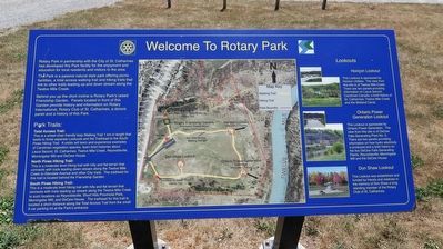
3. Rotary Park Map, beside parking lot
Credits. This page was last revised on July 30, 2025. It was originally submitted on July 30, 2025, by Kevin Westell of St. Catharines, Ontario. This page has been viewed 115 times since then and 38 times this year. Photos: 1, 2, 3. submitted on July 30, 2025, by Kevin Westell of St. Catharines, Ontario. • Andrew Ruppenstein was the editor who published this page.
