Near Glenwood in Catron County, New Mexico — The American Mountains (Southwest)
Mogollon
Photographed by Bill Kirchner, September 19, 2010
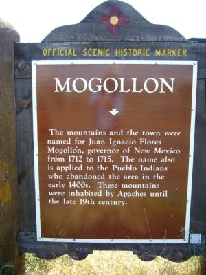
1. Mogollon Marker
The mountains and the town were named for Juan Ignacio Flores Mogollón, governor of New Mexico from 1712 to 1715. The name also is applied to the Pueblo Indians who abandoned the area in the early 1400s. These mountains were inhabited by Apaches until the late 19th Century.
Erected by New Mexico Historic Preservation Division.
Topics. This historical marker is listed in this topic list: Indigenous Peoples and Communities. A significant historical year for this entry is 1712.
Location. 33° 21.798′ N, 108° 54.083′ W. Marker is near Glenwood, New Mexico, in Catron County. It is at the intersection of U.S. 180 at milepost 47.2 and Bursum Road (State Road 159), on the right when traveling north on U.S. 180. Touch for map. Marker is in this post office area: Glenwood NM 88039, United States of America. Touch for directions.

Regionally, this marker is in Southwest New Mexico. It is also in the American Southwest. Globally, it is in North America, the Western Hemisphere, the Western World, and the Anglosphere. Historically, it finds itself in what was once New Spain.
Other nearby markers. At least 2 other markers are
this page online
Also see . . . The Mogollon. Several Mogollon groups clustered within roughly 100 miles east and west of the New Mexico and Arizona border and extended some unknown distance southward into Chihuahua and Sonora. (Submitted on September 29, 2010.)
Photographed by Bill Kirchner, September 19, 2010
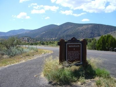
2. Mogollon Marker
Photographed by Bill Kirchner, September 19, 2010
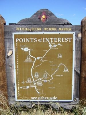
3. Rear of the Mogollon Marker
Credits. This page was last revised on August 25, 2025. It was originally submitted on September 28, 2010, by Bill Kirchner of Tucson, Arizona. This page has been viewed 1,629 times since then and 43 times this year. Last updated on July 30, 2025, by Bill Wingate of Albuquerque, New Mexico. Photos: 1, 2, 3. submitted on September 28, 2010, by Bill Kirchner of Tucson, Arizona. • J. Makali Bruton was the editor who published this page.
