Las Cruces in Doña Ana County, New Mexico — The American Mountains (Southwest)
La Mesilla
Photographed by Bill Kirchner, November 4, 2010
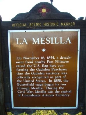
1. La Mesilla Marker
On November 16, 1854, a detachment from nearby Fort Fillmore raised the U.S. flag here confirming the Gadsden Purchase; thus the Gadsden territory was officially recognized as part of the United States. In 1858, the Butterfield stage began its run through Mesilla. During the Civil War, Mesilla was the capital of Confederate Arizona Territory.
Erected by New Mexico Historic Preservation Division.
Topics and series. This historical marker is listed in this topic list: War, US Civil. In addition, it is included in the Butterfield Overland Mail, and the El Camino Real de Tierra Adentro series lists. A significant historical month for this entry is November 1846.
Location. 32° 16.661′ N, 106° 47.766′ W. Marker is in Las Cruces, New Mexico, in Doña Ana County. It is at the intersection of State Road 28 and State Road 292, on the right when traveling south on State Road 28. Touch for map. Marker is in this post office area: Las Cruces NM 88005, United States of America. Touch for directions.

Regionally, this marker is in the Rio Grande Valley. It is also in the American Borderlands and in the Southwest. Globally, it is in North
this page online
Other nearby markers. At least 8 other markers are within walking distance of this marker: Butterfield Overland Trail (approx. ¼ mile away); a different marker also named La Mesilla (approx. ¼ mile away); Billy the Kid (approx. ¼ mile away); Civil War Battle of Mesilla & Major Lynde's Retreat (approx. ¼ mile away); Plaza de Mesilla (approx. ¼ mile away); All Servicemen and Women (approx. ¼ mile away); Head Quarters, Dept. of New Mexico (approx. ¼ mile away); The Gadsden Purchase Celebration (approx. ¼ mile away).
Another marker is no longer nearby. Doña Ana County Courthouse and Jail (was approx. ¼ mile away but has been confirmed missing).
Photographed by Bill Kirchner, November 4, 2010
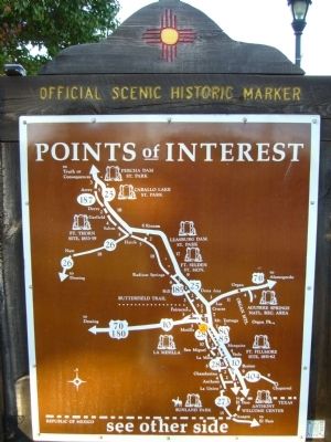
2. Rear of La Mesilla Marker
Photographed by Bill Kirchner, November 4, 2010
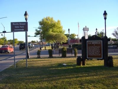
3. La Mesilla Marker
View south on highway 28.
Credits. This page was last revised on October 1, 2025. It was originally submitted on November 18, 2010, by Bill Kirchner of Tucson, Arizona. This page has been viewed 1,519 times since then and 55 times this year. Last updated on July 30, 2025, by Bill Wingate of Albuquerque, New Mexico. Photos: 1, 2, 3. submitted on November 18, 2010, by Bill Kirchner of Tucson, Arizona. • J. Makali Bruton was the editor who published this page.
