Near Las Cruces in Doña Ana County, New Mexico — The American Mountains (Southwest)
Site of San Agustín Springs
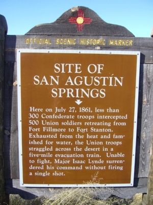
Photographed by Bill Kirchner, November 5, 2010
1. Site of San Agustín Springs Marker
Here on July 27, 1861, less than 300 Confederate troops intercepted 500 Union soldiers retreating from Fort Fillmore to Fort Stanton. Exhausted from the heat and famished for water, the Union troops straggled across the desert in a five-mile evacuation train. Unable to fight, Major Isaac Lynde surrendered his command without firing a single shot.
Erected by New Mexico Historic Preservation Division.
Topics. This historical marker is listed in this topic list: War, US Civil. A significant historical date for this entry is July 27, 1861.
Location. 32° 25.809′ N, 106° 35.101′ W. Marker is near Las Cruces, New Mexico, in Doña Ana County. It is on U.S. 70 at milepost 177, on the right when traveling west. Touch for map. Marker is in this post office area: Las Cruces NM 88011, United States of America. Touch for directions.

Regionally, this marker is in the Rio Grande Valley. It is also in the American Borderlands and in the Southwest. Globally, it is in North America, the Western Hemisphere, the Western World, and the Anglosphere. Historically, it finds itself in what was once New Spain, the Gadsden Purchase, and the
this page online
Other nearby markers. At least 8 other markers are within 7 miles of this marker, measured as the crow flies: San Augustín Pass (approx. 1.2 miles away); Nike Hercules Missile (approx. 1.3 miles away); Pogo and Pogo-HI (approx. 6.9 miles away); XQ-4 Drone (approx. 6.9 miles away); Shavetail (approx. 6.9 miles away); PGM-11 Redstone Tactical Version (approx. 6.9 miles away); a different marker also named PGM-11 Redstone Tactical Version (approx. 6.9 miles away); Beechcraft MQM-61 Cardinal Target Drone (approx. 6.9 miles away). Touch for a list and map of all markers in Las Cruces.

Photographed by Bill Kirchner, November 5, 2010
2. Site of San Agustín Springs Marker Reverse
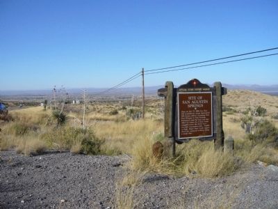
Photographed by Bill Kirchner, November 5, 2010
3. Site of San Agustín Springs Marker
Credits. This page was last revised on October 1, 2025. It was originally submitted on November 18, 2010, by Bill Kirchner of Tucson, Arizona. This page has been viewed 2,227 times since then and 107 times this year. Last updated on July 30, 2025, by Bill Wingate of Albuquerque, New Mexico. Photos: 1, 2, 3. submitted on November 18, 2010, by Bill Kirchner of Tucson, Arizona. • J. Makali Bruton was the editor who published this page.
