
Columbus in Luna County, New Mexico — The American Mountains (Southwest)
Pancho Villa’s Raid
Photographed by Bill Kirchner, November 3, 2010
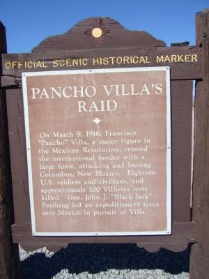
1. Pancho Villa’s Raid Marker
On March 9, 1916, Francisco “Pancho” Villa, a major figure in the Mexican Revolution, crossed the international border with a large force, attacking and looting Columbus, New Mexico. Eighteen U.S. soldiers and civilians, and approximately 100 Villistas were killed. Gen John J. "Black Jack" Pershing led an expeditionary force into Mexico in pursuit of Villa.
Erected by New Mexico Historic Preservation Division.
Topics. This historical marker is listed in this topic list: Wars, Non-US. A significant historical month for this entry is March 1916.
Location. 31° 49.565′ N, 107° 38.559′ W. Marker is in Columbus, New Mexico, in Luna County. It can be reached from South Pancho Villa Loop. The marker is at the entrance to Pancho Villa State Park, just south of Highway 9. Touch for map. Marker is in this post office area: Columbus NM 88029, United States of America. Touch for directions.

Regionally, this marker is in Southwest New Mexico. It is also in the American Southwest. Globally, it is in North America, the Western Hemisphere, the Western World, and the Anglosphere. Historically, it finds itself in what was once New Spain
this page online
Other nearby markers. At least 8 other markers are within walking distance of this marker: Pancho Villa State Park (here, next to this marker); Last Hostile Action by Foreign Troops (about 500 feet away, measured in a direct line); a different marker also named Pancho Villa State Park (about 600 feet away); The First Grease Rack (about 700 feet away); 1st Military Airbase (approx. 0.2 miles away); United States Custom House (approx. 0.2 miles away); Pershing's Review Stand (approx. 0.2 miles away); Camp at Columbus (approx. 0.2 miles away). Touch for a list and map of all markers in Columbus.
Also see . . . A Collection of Photos of Pancho Villa. (Submitted on November 12, 2010.)
Additional keywords. Mexican Revolution - Pancho Villa
Photographed by Bill Kirchner, November 3, 2010
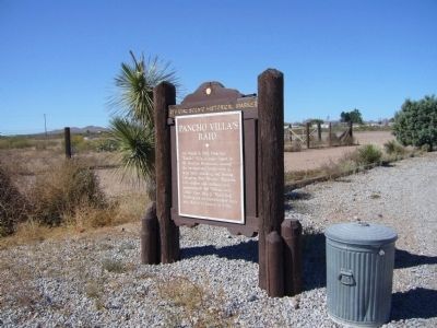
2. Pancho Villa’s Raid Marker
August 1, 1914
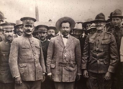
3. Álvaro Obregón, Pancho Villa, John Pershing and other military members.
Taken in Ciudad Juarez, Chihuahua. Courtesy Casasola Archive, SINAFO-Fototeca Nacional de INAH and the Museo Nacional de Intervenciones, Mexico City.
Photographed by Bill Kirchner, November 3, 2010
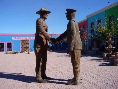
4. Gen John J. Pershing and Francisco “Pancho” Villa Sculpture.
Sculpture is in Puerto Palomas, CHIH, Mexico about 3 miles south of Columbus. (GPS 31.782314 -107.626912)
Credits. This page was last revised on October 1, 2025. It was originally submitted on November 10, 2010, by Bill Kirchner of Tucson, Arizona. This page has been viewed 1,921 times since then and 60 times this year. Last updated on July 30, 2025, by Bill Wingate of Albuquerque, New Mexico. Photos: 1, 2. submitted on November 10, 2010, by Bill Kirchner of Tucson, Arizona. 3. submitted on November 10, 2015, by J. Makali Bruton of Washington, District of Columbia. 4. submitted on November 10, 2010, by Bill Kirchner of Tucson, Arizona. • J. Makali Bruton was the editor who published this page.
