Galisteo in Santa Fe County, New Mexico — The American Mountains (Southwest)
Galisteo Pueblo
Photographed by J. J. Prats, April 13, 2012
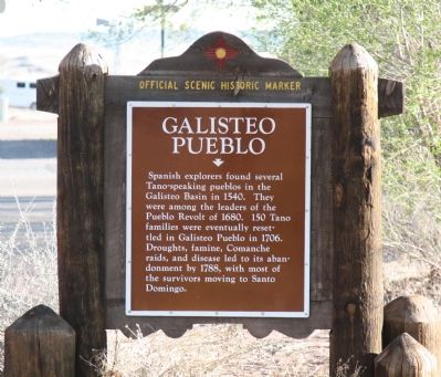
1. Galisteo Pueblo Marker
Spanish explorers found several Tano-speaking pueblos in the Galisteo Basin in 1540. They were among the leaders of the Pueblo Revolt in 1680. 150 Tano families were eventually resettled in Galisteo Pueblo in 1706. Droughts, famine, Comanche raids, and disease led to its abandonment by 1788, with most of the survivors moving to Santo Domingo.
Erected by New Mexico Historic Preservation Division.
Topics. This historical marker is listed in these topic lists: Exploration • Indigenous Peoples and Communities • Settlements & Settlers. A significant historical year for this entry is 1540.
Location. 35° 23.754′ N, 105° 56.801′ W. Marker is in Galisteo, New Mexico, in Santa Fe County. It is on State Road 41, on the right when traveling south. Touch for map. Marker is in this post office area: Lamy NM 87540, United States of America. Touch for directions.

Regionally, this marker is in Northern New Mexico. It is also in the American Southwest, in the Mountain West, and on the Santa Fe Trail Corridor. Globally, it is in North America, the Rocky Mountains, the Western Hemisphere, the Western World, and the
this page online
Other nearby markers. At least 8 other markers are within 11 miles of this marker, measured as the crow flies: Southern Rockies / Galisteo Basin (approx. 5.7 miles away); Galisteo Basin / Southern Rockies (approx. 5.7 miles away); Cerrillos (approx. 10.2 miles away); Briggs Building (approx. 10.4 miles away); The Cerrillos Bar (approx. 10.4 miles away); R. Granito's General Store (approx. 10.4 miles away); The Simoni Store (approx. 10.4 miles away); DeLallo-Simoni-Torres Building (approx. 10.4 miles away).
Photographed by J. J. Prats, April 13, 2012
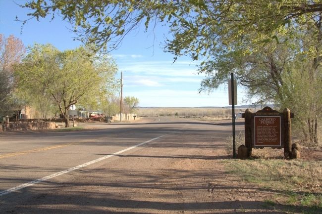
2. Galisteo Pueblo Marker
Credits. This page was last revised on September 25, 2025. It was originally submitted on April 27, 2013, by J. J. Prats of Powell, Ohio. This page has been viewed 1,492 times since then and 77 times this year. Last updated on July 30, 2025, by Bill Wingate of Albuquerque, New Mexico. Photos: 1, 2. submitted on April 27, 2013, by J. J. Prats of Powell, Ohio. • J. Makali Bruton was the editor who published this page.
