Mountainair in Torrance County, New Mexico — The American Mountains (Southwest)
Mountainair
Population 1,170 - Elevation 6,535
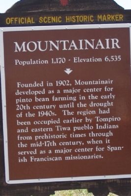
Photographed by Maribeth Robison, July 20, 2014
1. Mountainair (West) Marker
Erected by New Mexico Historic Preservation Division.
Topics. This historical marker is listed in these topic lists: Indigenous Peoples and Communities • Settlements & Settlers. A significant historical year for this entry is 1902.
Location. 34° 30.914′ N, 106° 15.016′ W. Marker is in Mountainair, New Mexico, in Torrance County. It is at the intersection of U.S. 60, on the right when traveling east on U.S. 60. Touch for map. Marker is at or near this postal address: 901 Highway 60, Mountainair NM 87036, United States of America. Touch for directions.

Regionally, this marker is in Greater Albuquerque. It is also in the American Southwest. Globally, it is in North America, the Western Hemisphere, the Western World, and the Anglosphere. Historically, it finds itself in what was once New Spain.
Other nearby markers. At least 8 other markers are within 7 miles of this marker, measured as the crow flies: Salt Mission Trail (a few steps from this marker); Saint Francis of Assisi / San Francisco de Asís (approx. 0.6 miles away); Shaffer Hotel (approx. 0.6 miles away); Sôr María de Ágreda (approx. 0.7 miles away); Willard Mercantile Company (approx. 0.7 miles away); a different marker also named Mountainair (approx. one mile away); Famine and War / Hambruna y guerra (approx. 6.1 miles away); Torreón (approx. 6.1 miles away). Touch for a list and map of all markers in Mountainair.
this page online
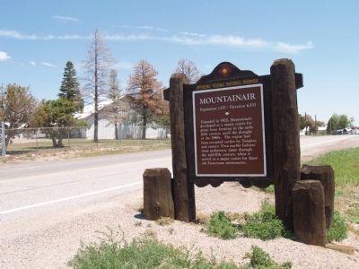
Photographed by Maribeth Robison, July 20, 2014
2. Mountainair (West) Marker
Credits. This page was last revised on August 8, 2025. It was originally submitted on July 20, 2014, by Maribeth Robison of Moriarty, New Mexico. This page has been viewed 611 times since then and 25 times this year. Last updated on July 30, 2025, by Bill Wingate of Albuquerque, New Mexico. Photos: 1, 2. submitted on July 20, 2014, by Maribeth Robison of Moriarty, New Mexico. • Devry Becker Jones was the editor who published this page.
