
Lakewood in Pierce County, Washington — The American West (Northwest)
Military Road
Photographed by Beth Bowen, February 27, 2010
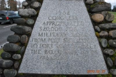
1. Military Road Marker (Side A)
Side B
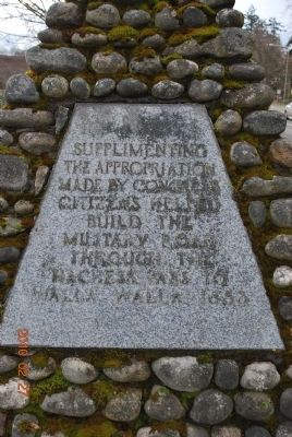
Supplementing the appropriation made by congress citizens helped build the military road through the Nachess pass to Walla Walla 1853
Side C
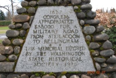
Erected 1925 by Washington State Historical Society.
Topics. This historical marker is listed in these topic lists: Military • Roads & Vehicles. A significant historical year for this entry is 1852.
Location. 47° 10.629′ N, 122° 33.869′ W. Marker is in Lakewood, Washington, in Pierce County. It is on Steilacoom Boulevard SW near Sequoia Street, on the right when traveling east. Touch for map. Marker is in this post office area: Lakewood WA 98498, United States of America. Touch for directions.

Regionally, this marker is in the Puget Sound Region and in Greater Seattle. It is also on the American Pacific Coast, in the Pacific Northwest, and in the Lewis & Clark Corridor. Globally, it is in North America, in the Cascade Range, in the Inside
this page online
Other nearby markers. At least 8 other markers are within 5 miles of this marker, measured as the crow flies: Western State Hospital Historical Cemetery, 1876-1953 (approx. 0.3 miles away); Two-Story Log House (approx. 1.6 miles away); Lakewood Veterans Memorial (approx. 2½ miles away); In Memory Of (approx. 3.3 miles away); Revolutionary War Patriots (approx. 3.3 miles away); The Liberty Bell (approx. 3.3 miles away); 36th Airlift Squadron Memorial (approx. 4.4 miles away); Loadmasters Memorial (approx. 4.4 miles away). Touch for a list and map of all markers in Lakewood.
Photographed by Beth Bowen, February 27, 2010
2. Military Road Marker (Side B)
Photographed by Beth Bowen, February 27, 2010
3. Military Road Marker (Side C)
Photographed by Beth Bowen, February 27, 2010
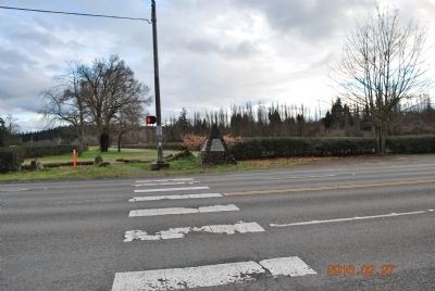
4. Military Road Marker
Credits. This page was last revised on June 16, 2016. It was originally submitted on February 27, 2010, by Beth Bowen of Lakewood, Washington. This page has been viewed 1,861 times since then and 56 times this year. Photos: 1, 2, 3, 4. submitted on February 27, 2010, by Beth Bowen of Lakewood, Washington. • Bill Pfingsten was the editor who published this page.
