Valley Head in DeKalb County, Alabama — The American South (East South Central)
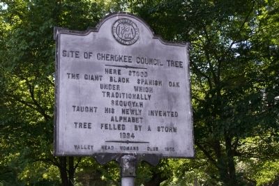
Site of Cherokee Council Tree
Photographed by Tim Carr, June 15, 2008
1. Site of Cherokee Council Tree Marker
The giant Black Spanish Oak
Under which
Traditionally
Sequoyah
Taught his newly invented
Alphabet
Tree felled by a storm
1934
Erected 1955 by Valley Head Womens Club.
Topics and series. This historical marker is listed in these topic lists: Education • Horticulture & Forestry • Indigenous Peoples and Communities. In addition, it is included in the Historic Trees series list. A significant historical year for this entry is 1934.
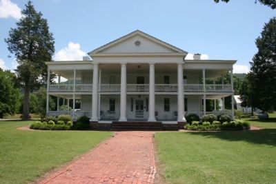
Location. 34° 34.074′ N, 85° 36.891′ W. Marker is in Valley Head, Alabama, in DeKalb County. It is at the intersection of Railroad Avenue and Mountain Street, on the right when traveling west on Railroad Avenue. Marker is located on the grounds of the Winston Place Antebellum Mansion. Touch for map. Marker is at or near this postal address: 353 Railroad Avenue, Valley Head AL 35989, United States of America. Touch for directions.

Regionally, this marker is in North Alabama. It is also in the American South, specifically in the Deep South, in Appalachia, and specifically in Southern Appalachia. Globally, it is in North America, a Gulf of Mexico state, the Western
this page online
Other nearby markers. At least 8 other markers are within 11 miles of this marker, measured as the crow flies: Former Site of Battelle (approx. 0.2 miles away); Town Of Mentone (approx. 1.7 miles away); The A. A. Miller Dam (approx. 1.9 miles away); Sally A. Howard Memorial Chapel (approx. 4.3 miles away); The Road to Chickamauga (approx. 6½ miles away); Site of the Willstown Mission (approx. 7½ miles away); Coe Incline (approx. 9.1 miles away); Veterans Memorial (approx. 10.1 miles away).
Also see . . . History of Valley Head, Alabama. (Submitted on February 27, 2010, by Timothy Carr of Birmingham, Alabama.)
Photographed by Tim Carr
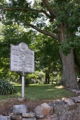
2. Site of Cherokee Council Tree Marker
Photographed by Tim Carr, June 15, 2008
3. Winston Place Antebellum Mansion built 1831
Credits. This page was last revised on December 3, 2019. It was originally submitted on February 27, 2010, by Timothy Carr of Birmingham, Alabama. This page has been viewed 2,993 times since then and 71 times this year. Photos: 1, 2, 3. submitted on February 27, 2010, by Timothy Carr of Birmingham, Alabama. • Craig Swain was the editor who published this page.
