Remington in Fauquier County, Virginia — The American South (Mid-Atlantic)
The Mill Along the River
Photographed by Mike McKeown, August 2, 2025
1. The Mill Along the River Marker
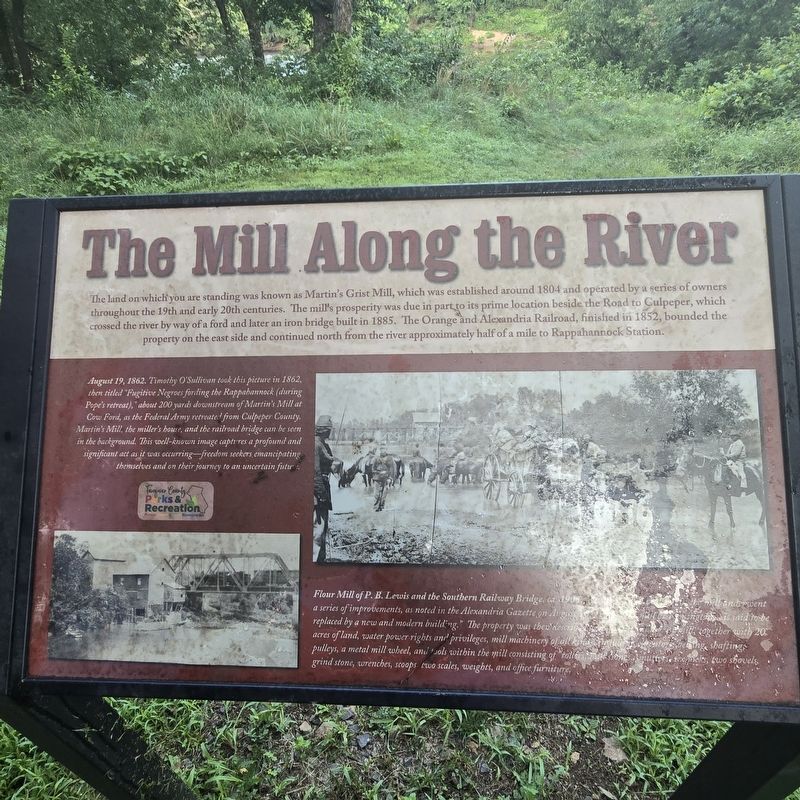
The land on which you are standing was known as Martin's Grist Mill, which was established around 1804 and operated by a series of owners throughout the 19th and early 20th centuries. The mill's prosperity was due in part its prime location beside the Road to Culpeper, which crossed the river by way of a ford and later an iron bridge built in 1885. The Orange and Alexandria Railroad, finished in 1152, bounded the property on the east side and continued north from the river approximately half of a mile to Rappahannock Station.
August 19, 1862. Timothy O'Sullivan look this picture in 1862, then titled "Fugitive Negroes fording the Rappahannock (during Pope's retreat)," about 200 yards downstream of Martin's Mill at Cow Ford, as the Federal Army retreated from Culpeper County. Martin's Mill, the miller's house, and the railroad bridge can be seen in the background. This well-known image captures a profound and significant act as it was occurring—freedom seekers, emancipating themselves and on their journey to an uncertain future.
Flour Mill of P. B. Lewis and the Southern Railway Bridge, ca. 1905. Between 1894 and 1910, the mill underwent a series of improvements, as noted in the Alexandria Gazette on August 16, 1894: "The mill at Remington... is said to be replaced by a new and modern building." The property was then described as a flouring and grist mill, together with 20 acres of land, water power rights and privileges, mill machinery of all kinds, including elevators, belting, shafting, pulleys, a metal mill wheel, and tool within the mill consisting of "rollers, mill stones, smutters, six picks, two shovels, grind stone, wrenches, scoops, two scales, weights, and office furniture."
Erected by Fauquier
this page online
Topics. This historical marker is listed in these topic lists: African Americans • Industry & Commerce • Railroads & Streetcars • War, US Civil. A significant historical date for this entry is August 19, 1862.
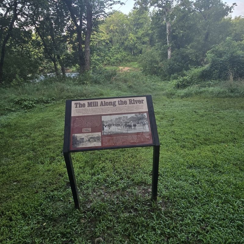
Location. 38° 31.729′ N, 77° 48.746′ W. Marker is in Remington, Virginia, in Fauquier County. It can be reached from Willis Avenue west of Hord Avenue, on the left when traveling west. The marker stands in the Rector Tract on the trail from the parking lot to the boat launch at the river. Touch for map. Marker is at or near this postal address: 12233 River Rd, Remington VA 22734, United States of America. Touch for directions.

Regionally, this marker is in the Washington Metropolitan Area and in Northern Virginia. It is also in the American South, specifically in the Upper South, and in the Mid-Atlantic. Globally, it is in North America, the Western Hemisphere, the Western World, and the Anglosphere. Historically, it finds itself in what was once the territory of the Mississippian Culture, one of the original Thirteen Colonies, one of the Confederate States of America, and the Antebellum
Photographed by Mike McKeown, August 2, 2025
2. The Mill Along the River Marker
Other nearby markers. At least 8 other markers are within 3 miles of this marker, measured as the crow flies: Martin's Grist Mill (a few steps from this marker); Francis Hume (approx. 0.2 miles away); a different marker also named Rappahannock Station (approx. ¼ mile away); Fauquier County / Culpeper County (approx. 0.4 miles away); Battle of Kelly's Ford (approx. 1.4 miles away); a different marker also named Battle of Kelly's Ford (approx. 1.4 miles away); Where Pelham Fell (approx. 2.4 miles away); a different marker also named The Battle of Brandy Station (approx. 2½ miles away). Touch for a list and map of all markers in Remington.
Other markers no longer nearby. Rappahannock Station (was approx. ¼ mile away but has been replaced with another marker now near it); The Battle of Brandy Station (was approx. 2½ miles away but has been permanently removed).
Also see . . . Rector Tract (Fauquier County Parks and Recreation). (Submitted on August 2, 2025, by Mike McKeown of Baltimore, Maryland.)
Photographed by Evan Dwyer, February 16, 2026
3. The Mill Along the River
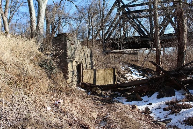
Foundation ruins of Martin's Mill, with the millrace for the mill's undershot water wheel running through them (ditch in center). There are other stone foundations to the southwest on the river-side of the millrace as well.
Photographed by Evan Dwyer, February 16, 2026
4. Railroad Bridge
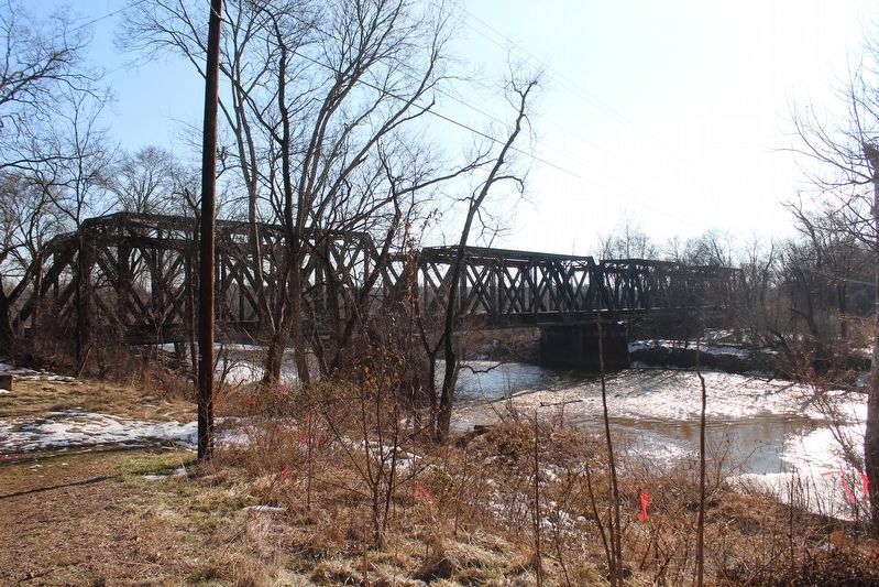
The marker describes the Orange & Alexandria Railroad as beginning operation through this site in 1852. The current bridge, though, dates to about 1925 when the route was double-tracked. The second track of the bridge was discontinued from use in the 1970s but the other track is still active. The route of the current railroad, owned by Norfolk Southern, follows the historic route (more or less) of the Orange & Alexandria Railroad.
Photographed by Evan Dwyer, February 16, 2026
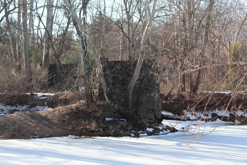
5. Iron Bridge Remnants
The 1885 iron bridge mentioned in the marker no longer stands. These two stone bridge piers, on the Culpeper County side of the river but visible from the marker, are on the right of way that carried the Culpeper Road across the Rappahannock until the erection of the current Remington Bridge on the Route 29 right of way in 1930. The iron bridge in this location was originally sited near to ground level, and may be the source of the deep-cut road trace that parallels the Rector Tract parking lot today. In 1903, Fauquier County accepted a bid from Virginia Bridge and Iron Company of Roanoke to raise the bridge and replace its wooden trestle with "a stone abutment, two piers, three steel spans of sixty-eight feet each" - and on the site today are two piers and a stone abutment. A Remington town tour pamphlet from the 2000s lists these piers as being the remains of the old railroad bridge, but the Civil War photos of the site clearly show the railroad bridge as being east of the grist mill and the mill's ruins are easy to identify on the riverbank.
Credits. This page was last revised on March 30, 2026. It was originally submitted on August 2, 2025, by Mike McKeown of Baltimore, Maryland. This page has been viewed 196 times since then and 91 times this year. Last updated on March 19, 2026, by Evan Dwyer of Richmond, Virginia. Photos: 1, 2. submitted on August 2, 2025, by Mike McKeown of Baltimore, Maryland. 3, 4, 5. submitted on March 19, 2026, by Evan Dwyer of Richmond, Virginia. • Devry Becker Jones was the editor who published this page.
