Bedford in Bedford County, Virginia — The American South (Mid-Atlantic)
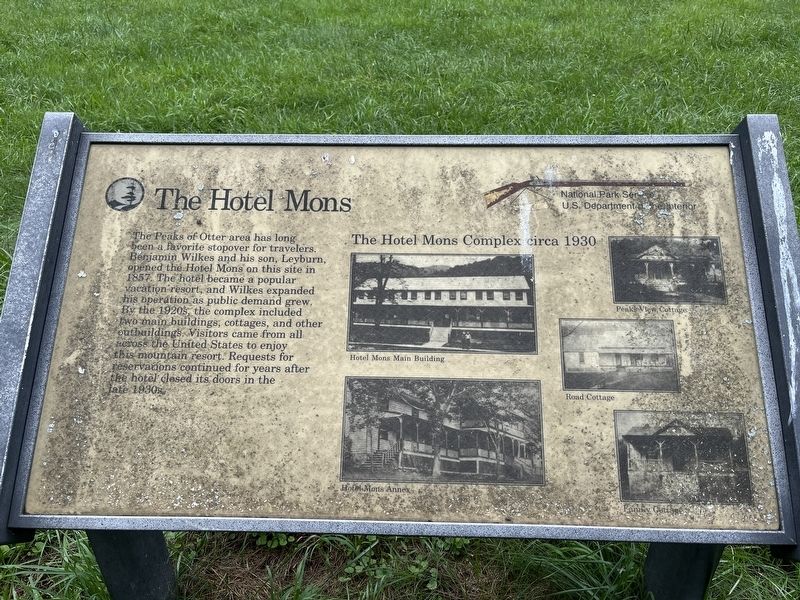
The Hotel Mons
Photographed by Craig Swain, August 2, 2025
1. The Hotel Mons Marker
Erected by National Park Service, U.S. Department of the Interior.
Topics. This historical marker is listed in this topic list: Parks & Recreational Areas. A significant historical year for this entry is 1857.
Location. 37° 26.945′ N, 79° 36.371′ W. Marker is in Bedford, Virginia, in Bedford County. It can be reached from Blue Ridge Parkway, on the right when traveling south. The marker is located on the Johnson Farm Trail, part of the Peaks of Otter unit of the Blue Ridge Parkway. Touch for map. Marker is at or near this postal address: 85554 Blue Rdg Pkwy, Buchanan VA 24066, United States of America. Touch for directions.

Regionally,
this page online
Other nearby markers. At least 8 other markers are within walking distance of this marker: Abbott Lake (approx. 0.2 miles away); A Community at "the Mons" (approx. 0.3 miles away); Peaks of Otter (approx. 0.3 miles away); Polly Woods' Ordinary (approx. 0.4 miles away); Johnson Farm (approx. 0.4 miles away); Johnson Farm Apple House (approx. 0.4 miles away); The Johnson Farmhouse (approx. half a mile away); Sharp Top Mountain (approx. half a mile away). Touch for a list and map of all markers in Bedford.
Also see . . . Hotel Mons, Camp Kewanzee, and the Appalachian Trail. Prior to the 1930s, the Appalachian Trail passed through Peaks of Otter at Hotel Mons. In order to make room for the Blue Ridge Parkway, the
Photographed by Craig Swain, August 2, 2025
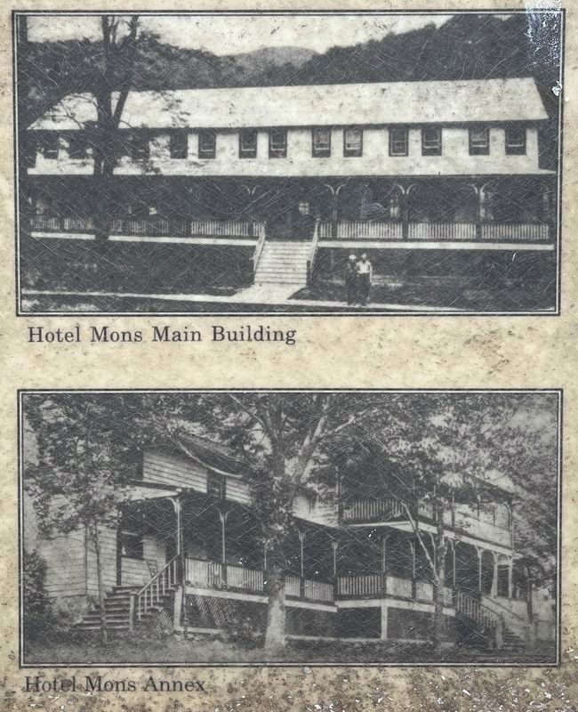
2. Photos in the Center of the Marker
Photos in the center show the Hotel Mons main building and annex. The photos were taken in the 1930s.
Photographed by Craig Swain, August 2, 2025
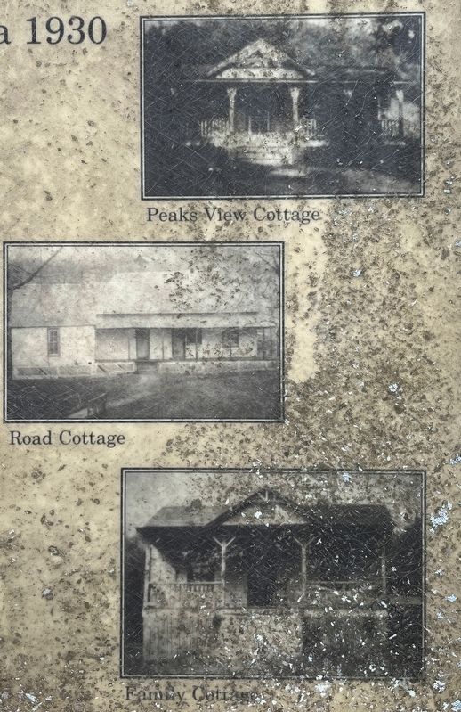
3. Photos on the Right Side of the Marker
On the right side of the marker are photos of the Peaks View Cottage, Road Cottage, and Family Cottage. These are all from the 1930s.
Photographed by Craig Swain, August 2, 2025
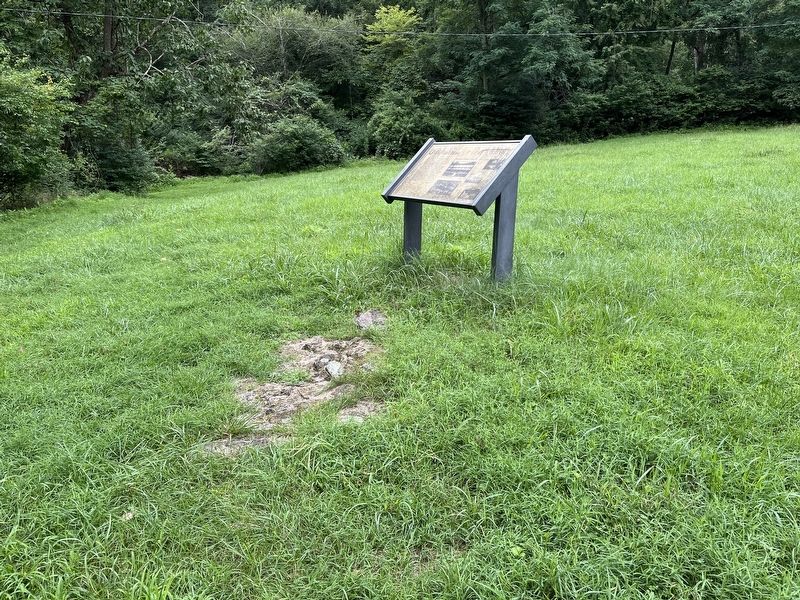
4. The Hotel Mons Marker
Photographed by Craig Swain, August 2, 2025
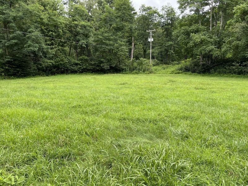
5. Site of the Hotel Complex Today
Only some variations in the surface remain. Using maps from the National Park Service surveys for the parkway, the marker's location is oriented directly in front of the site of the hotel's main building. The location of the hotel and outer buildings is now an open pasture.
Credits. This page was last revised on August 6, 2025. It was originally submitted on August 6, 2025, by Craig Swain of Leesburg, Virginia. This page has been viewed 179 times since then and 45 times this year. Photos: 1, 2, 3, 4, 5. submitted on August 6, 2025, by Craig Swain of Leesburg, Virginia.
