Fairgrounds in Columbus in Franklin County, Ohio — The American Midwest (Great Lakes)
Geological Cross Section of Ohio
Photographed by Craig Doda, July 27, 2025
1. Geological Cross Section of Ohio Marker
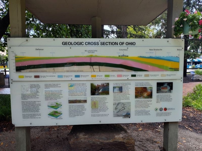
Beginning at the Ohio-West Virginia border, rock layers present thousands of feet below the surface rise in elevation westward until they reach the surface in west-central Ohio. Traversing northwest from the Bellefontaine area, rock layers lie generally flat but then gently descend into the Michigan Basin.
Rock units at great depths (tan and brown on the cross section) can be sedimentary, igneous, or metamorphic rocks older than 542 million years. These rocks are deeply buried and poorly understood because of limited sampling.
Beginning about 2.6 million years ago (mya), sheets of ice up to a mile thick repeatedly advanced from and melted back to Canada. Those glaciers flattened the landscape by shaving off hills and filling in valleys, which is why western Ohio is so flat.
During later stages of the Ice Age, Lake Erie covered much more of northern Ohio
this page online
Thick layers of limestone and dolomite of the Silurian Period (440-416 mya) formed beneath tropical ocean waters. These rocks are responsible for the scenery at Clifton Gorge State Nature Preserve and John Bryan State Park. Silurian rocks are a major source of aggregate used in construction.
Near Bellefontaine is a feature geologists call the Bellefontaine Outlier. Here, resistant bedrock deflected the advancing glaciers, leaving behind Ohio's highest elevation point at 1,549 ft above sea rocks between Bellefontaine and Columbus have been stripped away by erosion.
Beneath the Fairgrounds, about 165 ft of glacial debris (called drift) sit on rocks from the Devonian Period (416-359 mya). Those rocks formed from sediment deposited in a shallow sea when Ohio was south of the equator. The change from white Columbus Limestone (the stone used to build the Ohio State Capitol) to the dark shale at Highbanks Metro Park marks the uplift and erosion of
Photographed by Craig Doda, July 27, 2025
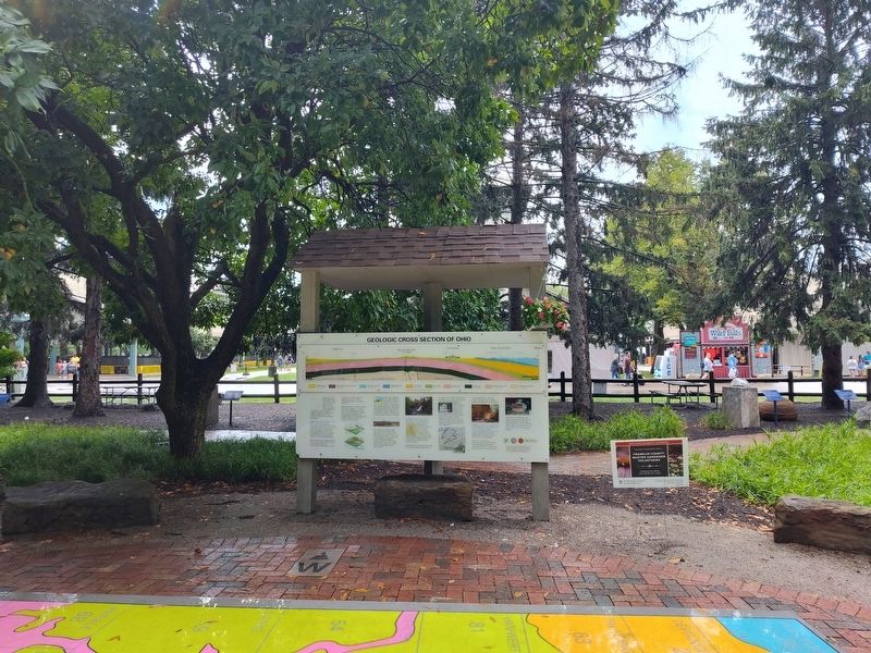
2. Geological Cross Section of Ohio Marker
The Hocking Hills, in Hocking County, owe their scenic beauty largely to the Black Hand Sandstone, a resistant rock unit formed during the Mississippian Period (359-318 mya) by streams carrying tremendous quantities of sand and gravel eroded from ancestral Appalachian Mountains as they were rising to the southeast.
Coal from rocks of the Pennsylvanian Period (318-299 mya) powered the industrial revolution in Ohio. Those rocks also supplied clay and shale that made Ohio the brick and clay capitol of the world. Ohio was a major producer of iron in the nation at the time of the Civil War (1861-1865) and supplied the iron used in the Union iron-clad ship Monitor.
Erected by Ohio Department Of Natural Resources Division Of Geological Survey / Friends of the Ohio's Governors Residence / Heritage Garden / Ohio Department of Natural Resources.
Topics. This historical marker is listed in these topic lists: Environment • Industry & Commerce.
Location. 39° 59.713′ N, 82° 59.338′ W. Marker is in Columbus, Ohio, in Franklin County. It is in Fairgrounds. It is at the intersection of East 11th Avenue and Essex Avenue, on the right when traveling north on East 11th Avenue. Touch for map. Marker is at or near this postal address: 632 E 11th Ave, Columbus OH 43211, United States of America. Touch for directions.

Regionally, this marker is in the Scioto Valley. It is also in the American Midwest and in the Corn Belt. Globally, it is in North America, the Western Hemisphere, the Western World, and the Anglosphere. Historically, it finds itself in what was once the Haudenosaunee (Iroquois) Confederacy, the territory of the Mississippian Culture, and the Northwest Territory.
Other nearby markers. At least 8 other markers are within walking distance of this marker: Serpent Mound Impact Structure (here, next to this marker); Flint: Ohio's State Gemstone (a few steps from this marker); Grindstones (a few steps from this marker); Beneath Your Feet (a few steps from this marker); Mothman (a few steps from this marker); Ohio Buckeye (within shouting distance of this marker); Apple Tree (within shouting distance of this marker); Buckeye Grove (within shouting distance of this marker). Touch for a list and map of all markers in Columbus.
Credits. This page was last revised on August 22, 2025. It was originally submitted on August 6, 2025, by Craig Doda of Napoleon, Ohio. This page has been viewed 212 times since then and 78 times this year. Photos: 1, 2. submitted on August 6, 2025, by Craig Doda of Napoleon, Ohio. • Devry Becker Jones was the editor who published this page.
