Fairgrounds in Columbus in Franklin County, Ohio — The American Midwest (Great Lakes)
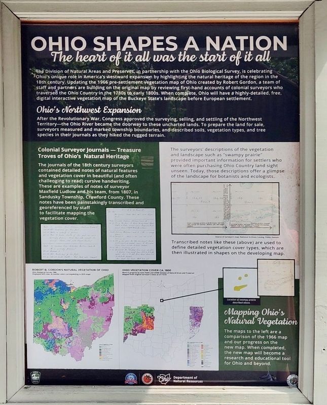
Ohio Shapes A Nation
The heart of it all was the start of it all
Photographed by Craig Doda, July 27, 2025
1. Ohio Shapes A Nation Marker
Ohio's Northwest Expansion
After the Revolutionary War, Congress approved the surveying, selling, and settling of the Northwest Territory-the Ohio River became the doorway to these uncharted lands. To prepare the land for sale, surveyors measured and marked township boundaries, and described soils, vegetation types, and tree species in their journals as they hiked the rugged terrain.
Colonial Surveyor Journals - Treasure Troves of Ohio's Natural Heritage
The journals of the 18th century
this page online
The surveyors' descriptions of the vegetation and landscape such as "swampy prairie" provided important information for settlers who were often purchasing Ohio Country land sight unseen. Today, those descriptions offer a glimpse of the landscape for botanists and ecologists.
Transcribed notes like these (above) are used to define detailed vegetation cover types, which are then illustrated in shapes on the developing map.
Mapping Ohio's Natural Vegetation
The maps to the left are a comparison of the 1966 map and our progress on the new map. When completed, the new map will become a research and educational tool for Ohio and beyond.
Erected by Ohio Department of Natural Resorces, Ohio Department of Natural Resorces Division of Natural Areas & Preserves

Photographed by Craig Doda, July 27, 2025
2. Ohio Shapes A Nation Marker
Topics and series. This historical marker is listed in these topic lists: Exploration • Parks & Recreational Areas • Settlements & Settlers. In addition, it is included in the America 250: Ohio Commission series list. A significant historical year for this entry is 1966.
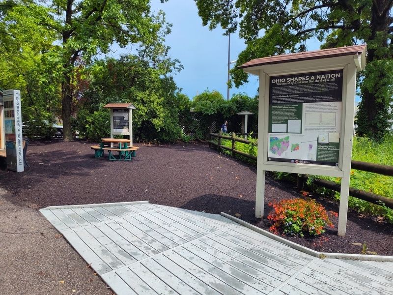
Location. 39° 59.66′ N, 82° 59.266′ W. Marker is in Columbus, Ohio, in Franklin County. It is in Fairgrounds. It is at the intersection of East 11th Avenue and Essex Avenue, on the right when traveling west on East 11th Avenue. In Natural Resources Park. Touch for map. Marker is at or near this postal address: 632 E 11th Avenue, Columbus OH 43211, United States of America. Touch for directions.

Regionally, this marker is in the Scioto Valley. It is also in the American Midwest and in the Corn Belt. Globally, it is in North America, the Western Hemisphere, the Western World, and the Anglosphere. Historically, it finds itself in what was once the Haudenosaunee (Iroquois) Confederacy, the territory of the Mississippian Culture, and the Northwest Territory.
Other nearby markers. At least 8 other markers
Photographed by Craig Doda, July 27, 2025
3. Ohio Shapes A Nation Marker
Credits. This page was last revised on May 3, 2026. It was originally submitted on August 6, 2025, by Craig Doda of Napoleon, Ohio. This page has been viewed 111 times since then and 39 times this year. Photos: 1, 2, 3. submitted on August 6, 2025, by Craig Doda of Napoleon, Ohio. • Andrew Ruppenstein was the editor who published this page.
