Rogersville in Lauderdale County, Alabama — The American South (East South Central)
Heritage Park
Photographed by Sandra Hughes, June 5, 2010
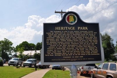
1. Heritage Park Marker Side 1
The settlement of what is now eastern Lauderdale County (known as "Over Elk)" by non-Native Americans commenced by 1807. Federal land sales were held in Huntsville during the spring of 1818. Although much of the land was described as a "howling wilderness," there was a rush to buy. Records of these sales show purchasers were Samuel Burney, Andrew Rodgers, Archibald Fuqua and dozens more. Andrew Rodgers bought 79 acres in what became the downtown business district and as a trading center, the village became known as Rodgersville. Businesses were set up at this site because of the three thoroughfares that intersected. One followed an old Indian trail which extended from what is now Florence to present-day Huntsville. This became U.S. Highway 72. Another led to a shallow ford across Elk River. This road is now called Snake Road. The third was between Giles County, Tennessee and the Tennessee River. It was the route known today as Lamb's Ferry Road. Heritage Park was built at the SW corner of this intersection.
(Continued on other side)
Side B
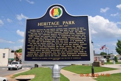
(Continued from the other side)
Worship services by non-native settlers
this page online
Erected 2010 by Erected by the Alabama Tourism Department and the Town of Rogersville June 2010.
Topics and series. This historical marker is listed in
Photographed by Sandra Hughes, June 5, 2010
2. Heritage Park Marker side 2
Location. 34° 49.544′ N, 87° 17.685′ W. Marker is in Rogersville, Alabama, in Lauderdale County. It is at the intersection of Lee Street and Wheeler Street, on the right when traveling east on Lee Street. Touch for map. Marker is at or near this postal address: 1609 Lee Street, Rogersville AL 35652, United States of America. Touch for directions.

Regionally, this marker is in North Alabama and in the Shoals. It is also in the American South, specifically in the Deep South, in Appalachia, and specifically in Southern Appalachia. Globally, it is in North America, a Gulf of Mexico state, the Western Hemisphere, the Western World, and the Anglosphere. Historically, it finds itself in what was once the territory of the Mississippian Culture, one of the Confederate States of America, and the Antebellum South.
Other nearby markers. At least 8 other markers are within 2 miles of this marker, measured
Photographed by Sandra Hughes, June 5, 2010
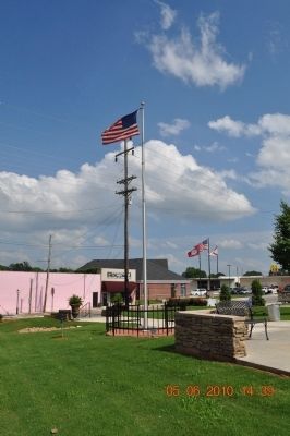
3. Heritage Park
Photographed by Sandra Hughes, June 5, 2010
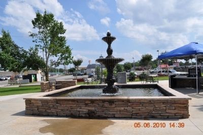
4. Heritage Park
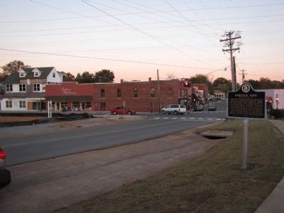
Photographed by Lee Hattabaugh, November 6, 2010
5. Heritage Park Marker
Looking east along Lee Street into downtown Rogersville.
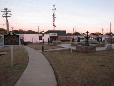
Photographed by Lee Hattabaugh, November 6, 2010
6. Heritage Park & the Marker
Looking east-southeast
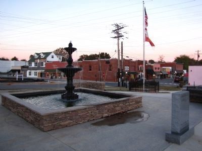
Photographed by Lee Hattabaugh, November 6, 2010
7. Heritage Park & downtown Rogersville
The monument on the right in this view lists the Ten Commandments; dedicated by the Anderson family.
Credits. This page was last revised on August 30, 2025. It was originally submitted on June 30, 2010, by Sandra Hughes Tidwell of Killen, Alabama, USA. This page has been viewed 2,302 times since then and 78 times this year. Last updated on August 10, 2025, by Deborah Spencer of Huntsville, Alabama. Photos: 1, 2, 3, 4. submitted on June 30, 2010, by Sandra Hughes Tidwell of Killen, Alabama, USA. 5, 6, 7. submitted on November 7, 2010, by Lee Hattabaugh of Capshaw, Alabama. • James Hulse was the editor who published this page.
