Near Mountainair in Torrance County, New Mexico — The American Mountains (Southwest)
A Trap for Runoff
⎯⎯⎯
Trampa de agua
Photographed by James Hulse, April 10, 2025
1. A Trap for Runoff / Trampa de agua Marker
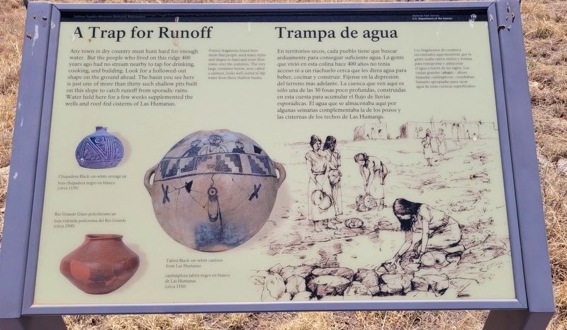
 Any town in dry country must hunt hard for enough water. But the people who lived on this ridge 400 years ago had no stream nearby to tap for drinking, cooking, and building. Look for a hollowed-out shape on the ground ahead. The basin you see here is just one of more than thirty such shallow pits built on this slope to catch runoff from sporadic rains. Water held here for a few weeks supplemented the wells and roof-fed cisterns of Las Humanas.
Pottery fragments found here show that people used many styles and shapes to haul and store their water over the centuries. The very large container below, now called a canteen, looks well-suited to dip water from these shallow basins.
Captions
(Photo #1) Chupadera Black-on-white storage jar
(Photo #2) Rio Grande Glaze polychrome jar
(Photo #3) Tabirá Black-on-white canteen from Las Humanas
En territorios secos, cada pueblo tiene que buscar arduamente para conseguir suficiente agua. La gente que vivió en esta colina hace 400 años no tenía acceso ni a un riachuelo cerca que les diera agua para beber, cocinar y construir. Fíjense en la depresión del
this page online
Los fragmentos de cerámica encontrados aqui muestran que la gente usaba varios estilos y formas para transportar y almacenar el agua a través de los siglos. Las vasijas grandes (abajo) - ahora llamadas cantimploras - resultaban bastante apropiadas para sacar agua de estas cuencas superficiales.
Didascalie
(Foto #1) loza chupadera negro en blanco (circa 1150)
(Foto #2) loza vidriada policroma del Río Grande (circa 1500)
(Foto #3) cantimplora tabirá negro en blanco de Las Humanas (circa 1550)
Erected by Salinas Pueblo Missions National Monument and National Park Service, U.S. Department of the Interior.
Topics. This historical marker is listed in these topic lists: Indigenous Peoples and Communities • Settlements & Settlers.
Location. 34° 15.648′ N, 106° 5.577′ W. Marker is near
Photographed by James Hulse, April 10, 2025
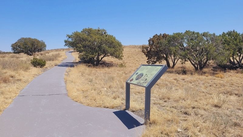
2. The view of the marker along the trail

Regionally, this marker is in Greater Albuquerque. It is also in the American Southwest. Globally, it is in North America, the Western Hemisphere, the Western World, and the Anglosphere. Historically, it finds itself in what was once New Spain.
Other nearby markers. At least 8 other markers are within walking distance of this marker: Underground Housing / Hogares subterráneas (within shouting distance of this marker); Dryland Crops and Game / Cazar y cosechar en tierra seca (within shouting distance of this marker); Exploring Las Humanas / Explorando Las Humanas (about 400 feet away, measured in a direct line); A Larger Church: 1659-1670 / Una iglesia más grande: 1659-1670 (about 400 feet away); One-seed juniper (about 500 feet away); Soaptree yucca (about 500 feet away); Mission Church 1630-1650 / Iglesia misionera 1630-1650 (about 500 feet away); Underground Worship / Ceremonias clandestinas (about 500 feet away). Touch for a list and map of all markers in Mountainair.
Also see . . . Gran Quivira. National Park Service
The Gran Quivira unit of Salinas Pueblo Missions National Monument is the largest of the three units at 611 acres. Prior to Spanish contact, Gran Quivira was a vast city with multiple pueblos, and kivas. Mound 7, a 226 room structure from the Pueblo IV period (A.D.1275/1300-1600), is the largest and only fully excavated pueblo at the site. During the excavation, an older Circular Pueblo was discovered under Mound 7. First contact with the Spanish probably happened in 1583 with the arrival of Don Antonio de Espejo who mentions a settlement that sounds very similar to Gran Quivira. The Spanish returned in 1598 with the expedition of Don Juan de Oñate who was the first Spaniard to colonize what would become New Mexico. Oñate visited a pueblo he called Las Humanas which was the southernmost settlements. As part of the mission system, Las Humanas (Gran Quivira) was first placed under the Pecos Mission District. Later, with the arrival of Fray Alonso de Benavides in 1626, Gran Quivira was given more attention and later became a visita (a satellite mission without a resident Father) of Abó in 1629. That same year construction began on the first permanent mission at Gran Quivira. Under the supervision of Fray Francisco Letrado, rooms on the west end of Mound 7 (Letrado's Convento) were used by the Spanish for housing and probably an early chapel. Letrado was moved to the Zuni Pueblo in 1631 and Gran Quivira came under the control of Fray Francisco de Acevedo at the Abó Mission. Construction on Iglesia de San Isidro was completed in 1635. In 1659 Fray Diego de Santander was permanently assigned to Gran Quivira. Soon after, construction on a new larger church, San Buenaventura, began. By 1672 a combination of disease, drought, famine, and Apache raiding led to the abandonment of Gran Quivira.(Submitted on August 10, 2025, by James Hulse of Medina, Texas.)
Credits. This page was last revised on August 11, 2025. It was originally submitted on August 10, 2025, by James Hulse of Medina, Texas. This page has been viewed 78 times since then and 13 times this year. Photos: 1, 2. submitted on August 10, 2025, by James Hulse of Medina, Texas.
