Near Mountainair in Socorro County, New Mexico — The American Mountains (Southwest)
Underground Worship
⎯⎯⎯
Ceremonias clandestinas
Photographed by James Hulse, April 10, 2025
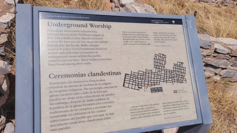
1. Underground Worship / Ceremonias clandestinas Marker
 Franciscan missionaries tolerated the kachina dances of the Puebloan religion at first. For a while, a new church coexisted next to the kiva you see just down the hillside behind you. But by the 1660s, changes in church policy forced traditional believers to hide non-Christian ceremonies in underground rooms within the pueblo complex you see here. Many hidden kivas have been found among these walls.
There is a sweat room (kiva) painted all over with large and small idols in the same manner that they paint devils here. In the middle are sculpted idols of stone or wood to which they offer maize, small birds of various colors, reeds, lizards, and other reptiles and when they make a sacrifice, they all join in a great circle to dance...
Marcelo de Espinosa, 1601
Al principio, los misioneros franciscanos toleraron las danzas de kachina de la religión de los gentes indígenas. Por un tiempo, una nueva iglesia coexistió lado a lado de la kiva que pueden ver abajo en la colina detrás de ustedes. Sin embargo, después de 1660s cambios en la política de la iglesia forzaron a los creyentes tradicionales de
this page online
...está una estufa (kiva) toda pintada de ydolos grandes y pequeños a manera que aca pintan los diablos y en medio les tienen ydolos de bulto de piedra y palo a los quales se les ofrecen maíz y paxaros de diferentes colores pequeños y cañas y lagartixas y otras sauredixas y quando han de haber sacrificio se juntan a baylar todos en un corro grande...
Marcelo de Espinosa, 1601
Erected by Salinas Pueblo Missions National Monument and National Park Service, U.S. Department of the Interior.
Topics. This historical marker is listed in these topic lists: Indigenous Peoples and Communities • Religion & Religious Structures • Settlements & Settlers. A significant historical year for this entry is 1601.
Location. 34° 15.593′ N, 106° 5.491′ W. Marker is near Mountainair, New Mexico, in Socorro County. It is on Wsmr S Rte 41 south of New Mexico Route 55. The marker is located on the grounds of the Salinas Pueblo Missions National Monument - Gran Quivíra Ruins.
Photographed by James Hulse, April 10, 2025
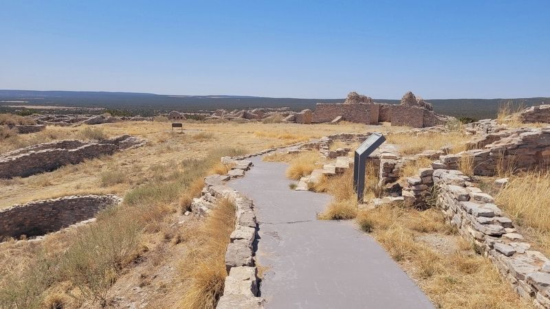
2. The view of the marker along the trail

Regionally, this marker is in Southwest New Mexico and in the Rio Grande Valley. It is also in the American Southwest. Globally, it is in North America, the Western Hemisphere, the Western World, and the Anglosphere. Historically, it finds itself in what was once New Spain and also the Republic of Texas.
Other nearby markers. At least 8 other markers are within walking distance of this marker: Mission Church 1630-1650 / Iglesia misionera 1630-1650 (within shouting distance of this marker); You Must Be Crazy! / ¡Sois tan locos! (within shouting distance of this marker); Plaza - Heart of the Pueblo / Plaza - centro del pueblo (within shouting distance of this marker); A Larger Church: 1659-1670 / Una iglesia más grande: 1659-1670 (within shouting distance of this marker); Dryland Crops and Game / Cazar y cosechar en tierra seca (about 400 feet away, measured in a direct line); Exploring Las Humanas / Explorando Las Humanas (about 500 feet away); A Trap for Runoff / Trampa de agua (about 500 feet away);
Photographed by James Hulse, April 10, 2025
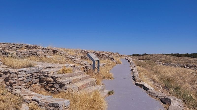
3. The view of the marker looking east along the trail
Also see . . . Gran Quivira. National Park Service
The Gran Quivira unit of Salinas Pueblo Missions National Monument is the largest of the three units at 611 acres. Prior to Spanish contact, Gran Quivira was a vast city with multiple pueblos, and kivas. Mound 7, a 226 room structure from the Pueblo IV period (A.D.1275/1300-1600), is the largest and only fully excavated pueblo at the site. During the excavation, an older Circular Pueblo was discovered under Mound 7. First contact with the Spanish probably happened in 1583 with the arrival of Don Antonio de Espejo who mentions a settlement that sounds very similar to Gran Quivira. The Spanish returned in 1598 with the expedition of Don Juan de Oñate who was the first Spaniard to colonize what would become New Mexico. Oñate visited a pueblo he called Las Humanas which was the southernmost settlements. As part of the mission system, Las Humanas (Gran Quivira) was first placed under the Pecos Mission District. Later, with the arrival of Fray Alonso de Benavides in 1626, Gran Quivira was given more attention and later became a visita (a satellite mission without a resident Father) of Abó in 1629. That same year construction began on the first permanent mission at Gran Quivira. Under the supervision of Fray Francisco Letrado, rooms on the west end of Mound 7 (Letrado's Convento) were used by the Spanish for housing and probably an early chapel. Letrado was moved to the Zuni Pueblo in 1631 and Gran Quivira came under the control of Fray Francisco de Acevedo at the Abó Mission. Construction on Iglesia de San Isidro was completed in 1635. In 1659 Fray Diego de Santander was permanently assigned to Gran Quivira. Soon after, construction on a new larger church, San Buenaventura, began. By 1672 a combination of disease, drought, famine, and Apache raiding led to the abandonment of Gran Quivira.(Submitted on August 10, 2025, by James Hulse of Medina, Texas.)
Credits. This page was last revised on August 11, 2025. It was originally submitted on August 10, 2025, by James Hulse of Medina, Texas. This page has been viewed 78 times since then and 15 times this year. Photos: 1, 2, 3. submitted on August 11, 2025, by James Hulse of Medina, Texas.
