Near Mountainair in Socorro County, New Mexico — The American Mountains (Southwest)
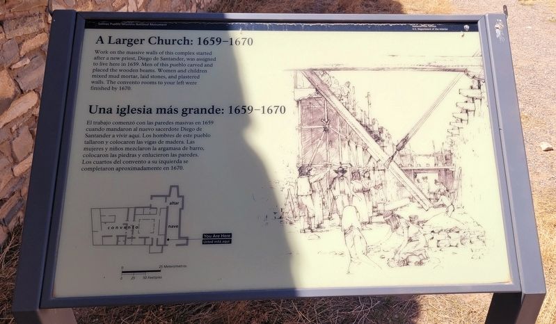
A Larger Church: 1659-1670
⎯⎯⎯
Una iglesia más grande: 1659-1670
Photographed by James Hulse, April 10, 2025
1. A Larger Church: 1659-1670 / Una iglesia más grande: 1659-1670 Marker
 Work on the massive walls of this complex started after a new priest, Diego de Santander, was assigned to live here in 1659. Men of this pueblo carved and placed the wooden beams. Women and children mixed mud mortar, laid stones, and plastered walls. The convento rooms to your left were finished by 1670.
El trabajo comenzó con las paredes masivas en 1659 cuando mandaron al nuevo sacerdote Diego de Santander a vivir aquí. Los hombres de este pueblo tallaron y colocaron las vigas de madera. Las mujeres y niños mezclaron la argamasa de barro, colocaron las piedras y enlucieron las paredes. Los cuartos del convento a su izquierda se completaron aproximadamente en 1670.
Erected by Salinas Pueblo Missions National Monument and National Park Service, U.S. Department of the Interior.
Topics. This historical marker is listed in these topic lists: Indigenous Peoples and Communities • Religion & Religious Structures • Settlements & Settlers. A significant historical year for this entry is 1659.
Location. 34° 15.588′ N, 106° 5.533′ W. Marker is near Mountainair, New Mexico, in Socorro County. It is
this page online

Regionally, this marker is in Southwest New Mexico and in the Rio Grande Valley. It is also in the American Southwest. Globally, it is in North America, the Western Hemisphere, the Western World, and the Anglosphere. Historically, it finds itself in what was once New Spain and also the Republic of Texas.
Other nearby markers. At least 8 other markers are within walking distance of this marker: Mission Church 1630-1650 / Iglesia misionera 1630-1650 (within shouting distance of this marker); Underground Worship / Ceremonias clandestinas (within shouting distance of this marker); Exploring Las Humanas / Explorando Las Humanas (about 300 feet away, measured in a direct line); Dryland Crops and Game / Cazar y cosechar en tierra seca (about 300 feet away); Soaptree yucca (about 400 feet away); One-seed juniper (about 400 feet away); You Must Be Crazy! / ¡Sois tan locos!
Photographed by James Hulse, April 10, 2025
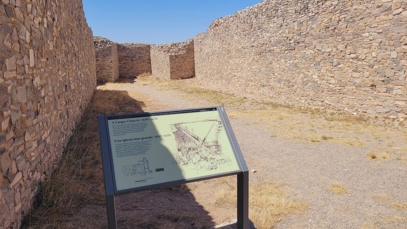
2. The walls of the church and mmarker
Also see . . . Gran Quivira. National Park Service
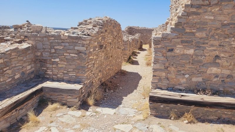
The Gran Quivira unit of Salinas Pueblo Missions National Monument is the largest of the three units at 611 acres. Prior to Spanish contact, Gran Quivira was a vast city with multiple pueblos, and kivas. Mound 7, a 226 room structure from the Pueblo IV period (A.D.1275/1300-1600), is the largest and only fully excavated pueblo at the site. During the excavation, an older Circular Pueblo was discovered under Mound 7. First contact with the Spanish probably happened in 1583 with the arrival of Don Antonio de Espejo who mentions a settlement that sounds very similar to Gran Quivira. The Spanish returned in 1598 with the expedition of Don Juan de Oñate who was the first Spaniard to colonize what would become New Mexico. Oñate visited a pueblo he called Las Humanas which was the southernmost settlements. As part of the mission system, Las Humanas (Gran Quivira) was first placed under the Pecos Mission District. Later, with(Submitted on August 10, 2025, by James Hulse of Medina, Texas.)the arrival of Fray Alonso de Benavides in 1626, Gran Quivira was given more attention and later became a visita (a satellite mission without a resident Father) of Abó in 1629. That same year construction began on the first permanent mission at Gran Quivira. Under the supervision of Fray Francisco Letrado, rooms on the west end of Mound 7 (Letrado's Convento) were used by the Spanish for housing and probably an early chapel. Letrado was moved to the Zuni Pueblo in 1631 and Gran Quivira came under the control of Fray Francisco de Acevedo at the Abó Mission. Construction on Iglesia de San Isidro was completed in 1635. In 1659 Fray Diego de Santander was permanently assigned to Gran Quivira. Soon after, construction on a new larger church, San Buenaventura, began. By 1672 a combination of disease, drought, famine, and Apache raiding led to the abandonment of Gran Quivira.Photographed by James Hulse, April 10, 20253. A section of the church
Photographed by James Hulse, April 10, 2025
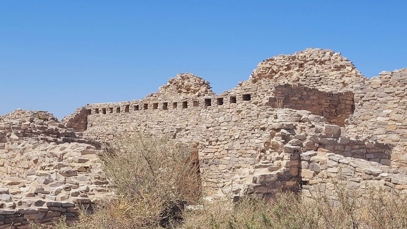
4. Slots in the wall of the church
Photographed by James Hulse, April 10, 2025
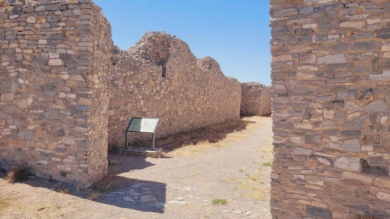
5. The front entrance to the church with the marker
Credits. This page was last revised on August 11, 2025. It was originally submitted on August 10, 2025, by James Hulse of Medina, Texas. This page has been viewed 89 times since then and 18 times this year. Photos: 1, 2, 3, 4, 5. submitted on August 11, 2025, by James Hulse of Medina, Texas.
