Port Dalhousie in St. Catharines in Niagara Region, Ontario — Central Canada (North America)
The Welland Canals Historical Fence

Photographed by Kevin Westell, August 10, 2025
1. The Welland Canals Historical Fence - Marker
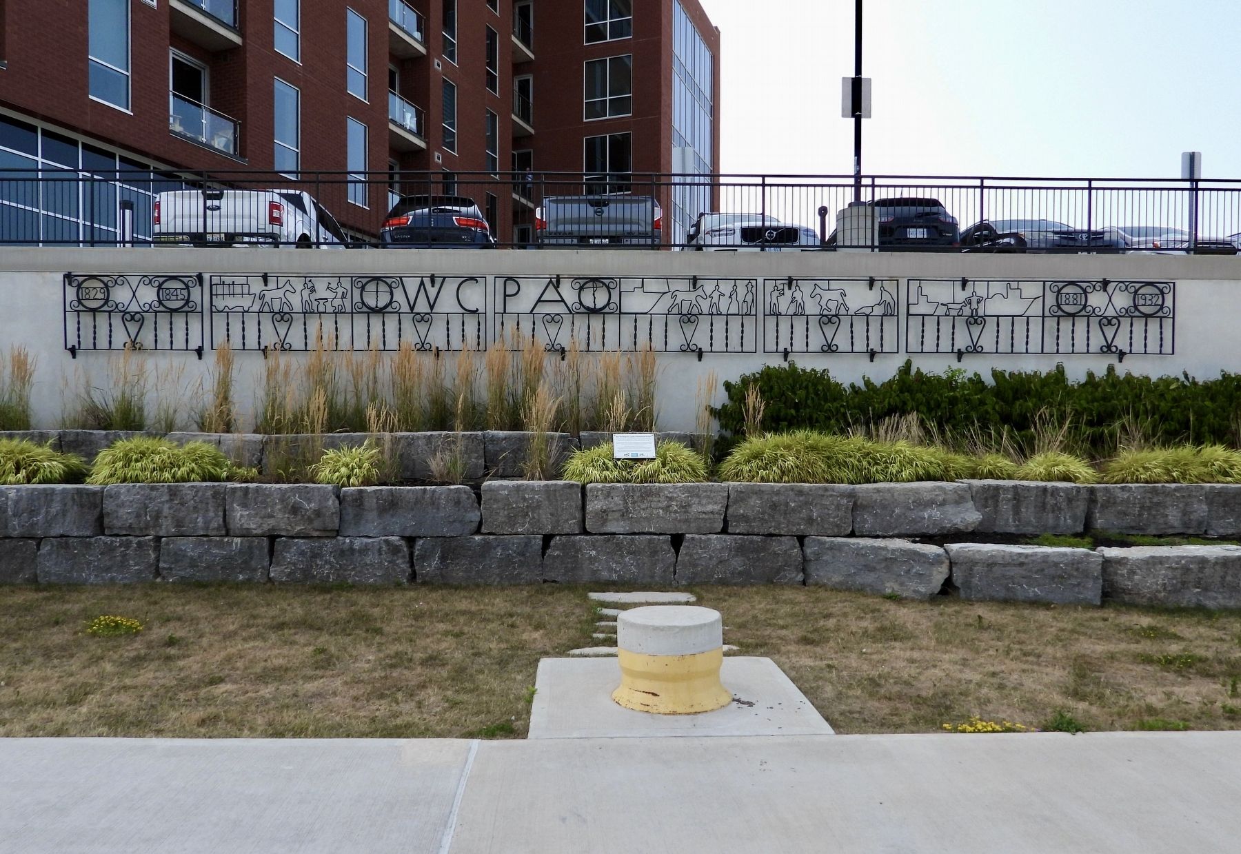
Mr. Donald Frederick Krause (1918-1987), lived here in Port Dalhousie, was a veteran of the Royal Canadian Navy during WWII, a blacksmith, a volunteer Fire Chief and railway enthusiast. He built this beautiful fence which depicts scenes covering the construction of all four of the Welland Canals from 1829-1932.
Unfortunately, the sunken garden was neglected for many years.
"The Port Dalhousie Beautification and Works Committee" (BWC) recognized the historical significance and salvaged the fence from this lock in 2016 as the work of repurposing the lock commenced once again.
With funds from the BWC, the fence was expertly restored in 2023 thanks to the generous assistance given by Hingston Metal Fabricators (1983) Ltd. and Rival Powder Coating, both local St. Catharines
this page online
Topics and series. This historical marker is listed in this topic list: Parks & Recreational Areas. In addition, it is included in the The Welland Canals series list. A significant historical year for this entry is 1977.
Location. 43° 12.07′ N, 79° 15.887′ W. Marker is in St. Catharines, Ontario, in Niagara Region. It is in Port Dalhousie. It can be reached from Lakeport Road, on the right when traveling north. The marker is around the back of 57 Lakeport Rd, on the Waterfront Trail, mounted on a stone wall, just below and east of parking for 57 Lakeport Road. Touch for map. Marker is at or near this postal address: 57 Lakeport Rd, St Catharines ON L2N 4P5, Canada. Touch for directions.

Regionally, this marker is on the Golden Horseshoe and in Niagara Canada. It is also in Central Canada. Globally, it is in North America, on the Great Lakes, in the Western Hemisphere, in the Western World, and in the Anglosphere. Historically, it finds itself in what was once a British colony, the Viceroyalty of New France, the Haudenosaunee (Iroquois) Confederacy, and Rupert’s Land.
Other nearby markers. At least 8 other
Photographed by Kevin Westell, August 10, 2025
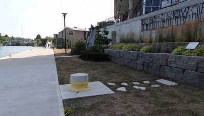
2. The Welland Canals Historical Fence - Marker in context
Photo faces south. Port Dalhousie's harbour (at the level of Lake Ontario) is on the left. This is the Harbour Walkway Trail; the bridge in the distance approaches Lakeport Rd. The marker (extreme right) is on a retaining wall made of stone blocks from the 2nd Welland canal.
Photographed by Kevin Westell, August 10, 2025
3. The Welland Canals Historical Fence
Some portions seem to be --
1829-1845 - the 1st Welland canal era;
horse pulling a ship on the towpath;
blacksmiths working;
horse with tow boy, pulling a ship on the towpath;
two fancy-dressed people;
horse or mule pulling a scraper, during 3rd canal construction;
1881-1932 - the 3rd Welland canal era
Credits. This page was last revised on August 11, 2025. It was originally submitted on August 11, 2025, by Kevin Westell of St. Catharines, Ontario. This page has been viewed 186 times since then and 11 times this year. Photos: 1, 2, 3. submitted on August 11, 2025, by Kevin Westell of St. Catharines, Ontario. • Andrew Ruppenstein was the editor who published this page.
