Tinker Air Force Base in Oklahoma City in Cleveland County, Oklahoma — The American South (West South Central)
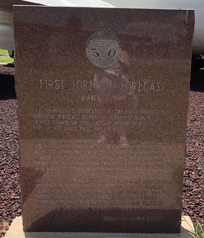
First Tornado Forecast
March 25, 1948
Photographed by Duane and Tracy Marsteller, June 21, 2025
1. First Tornado Forecast Marker
Issued several hours before a tornado struck Tinker Air Force Base, this first forecast proved severe weather could be anticipated with a reasonable degree of accuracy. This focused national attention on forecasting tornadoes and warning the public of their potential danger.
Severe weather pioneers, Major Fawbush and Captain Miller, developed tornado forecasting techniques still in use today. The 1948 tornado forecast was the forerunner of today’s national severe weather forecasting and research program that protects lives and serves the American people.
Erected 1998.
Topics. This historical marker is listed in this topic list: Science & Medicine. A significant historical date for this entry is March 25, 1948.
Location. 35° 26.029′ N, 97° 24.206′ W. Marker is in Oklahoma City, Oklahoma, in Cleveland County. It is in Tinker Air Force Base. It can be reached from South Air Depot Boulevard south of Interstate 40, on the left when traveling south.
this page online

Regionally, this marker is in Central Oklahoma — Frontier Country. It is also in the American South, specifically on the prairies, and on the Southern Plains. Globally, it is in North America, the Western Hemisphere, the Western World, and the Anglosphere. Historically, it finds itself in what was once the territory of the Mississippian Culture and also the Louisiana Purchase.
Other nearby markers. At least 8 other markers are within walking distance of this marker: B-29 “Superfortress” (a few steps from this marker); B-52 “Stratofortress” (within shouting distance of this marker); AGM-129 Advanced Cruise Missile (ACM) (within shouting distance of this marker); F-4D “Phantom II” (within shouting distance of this marker); C-135 “Stratolifter” (within shouting distance of this marker); Douglas Aircraft Historic Buildings (within shouting distance of this marker); Tinker AFB Historic Buildings (about 300 feet away, measured in a direct line); EA-6B “Prowler” (about 300 feet away). Touch for a list and map
Photographed by Duane and Tracy Marsteller, June 21, 2025
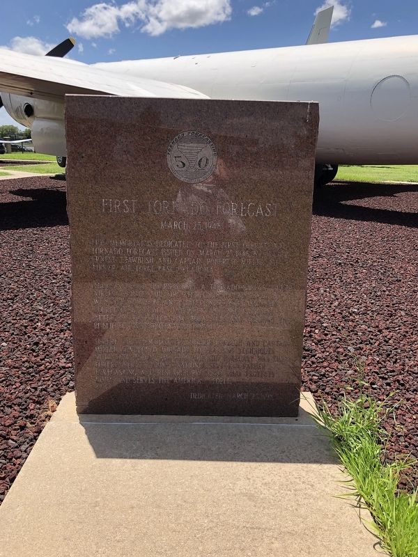
2. First Tornado Forecast Marker
More about this marker. It is in Charles B. Hall Airpark at the entrance to Tinker Air Force Base. The airpark is open to the public from dawn to dusk daily unless heightened security warrants closure.
Also see . . . Tinker's Twin Twisters of 1948 (PDF). The debris and wreckage left in the tornadoes' wake made the airfield look as if the enemy's aerial bombardments had been right on target. The shocking sight would remain in the minds of witnesses long after the final cleanup. The blows were softened only by the realization that the second tornado could have caused much greater damage had not the interaction of a few key men changed the course of events. (James L. Crowder, in The Chronicles of Oklahoma, 2000; via The Gateway to Oklahoma History) (Submitted on August 11, 2025, by Duane and Tracy Marsteller of Murfreesboro, Tennessee.)

Unidentified; via Oklahoma City Air Logistics Center Office of History (Public Domain), circa 1948
3. First Tornado Forecasters
Although Capt. Robert C. Miller (left) and Maj. Ernest J. Fawbush were confident in their forecast that a second tornado would hit Tinker, they feared public humiliation and possible demotion if they were wrong.
Credits. This page was last revised on August 11, 2025. It was originally submitted on August 11, 2025, by Duane and Tracy Marsteller of Murfreesboro, Tennessee. This page has been viewed 130 times since then and 39 times this year. Photos: 1, 2, 3. submitted on August 11, 2025, by Duane and Tracy Marsteller of Murfreesboro, Tennessee.
