La Veta in Huerfano County, Colorado — The American Mountains (Southwest)
Close to Heaven, Down to Earth
| — | Scenic Highway of Legends | — |
Photographed by Cosmos Mariner, July 11, 2025
1. Close to Heaven, Down to Earth Marker
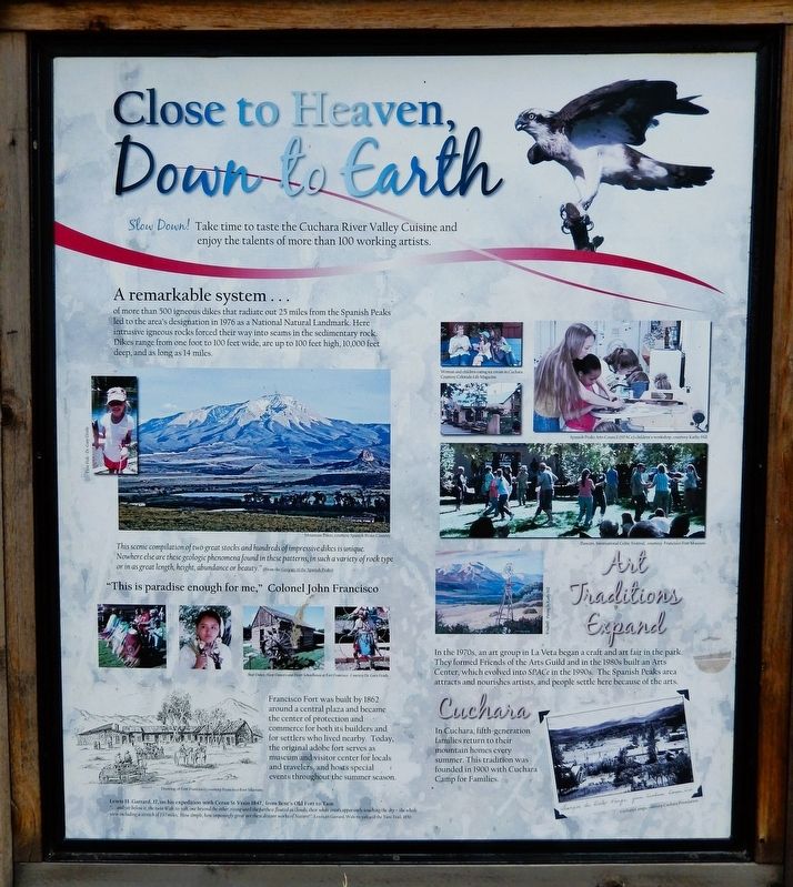
Slow down! Take time to taste the Cuchara River Valley Cuisine and enjoy the talents of more than 100 working artists.
A remarkable system...
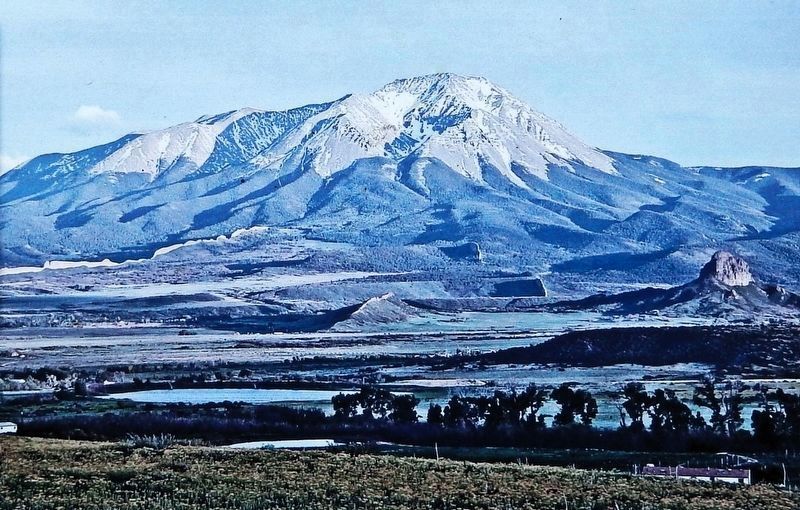
of more than 500 igneous dikes that radiate out 25 miles from the Spanish Peaks led to the area's designation in 1976 as a National Natural Landmark. Here intrusive igneous rocks forced their way into seams in the sedimentary rock. Dikes range from one foot to 100 feet wide, are up to 100 feet high, 10,000 feet deep, and as long as 14 miles.
“This is paradise enough for me,” Colonel John Francisco.
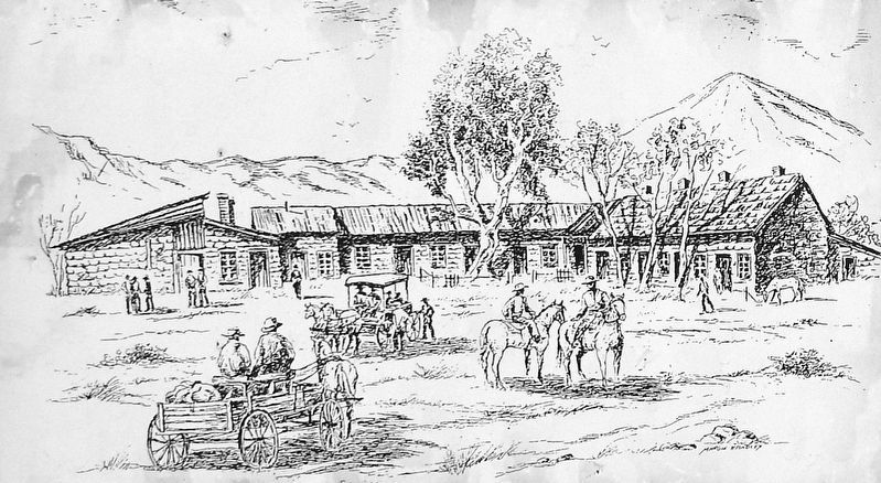
Francisco Fort was built by 1862 around a central plaza and became the center of protection and commerce for both its builders and for settlers who lived nearby. Today, the original adobe fort serves as museum and visitor center for locals and travelers, and hosts special events throughout the summer season.
Lewis H. Garrard, 17, on his expedition with Ceran St Vrain 1847, from Bent's Old Fort to Taos
“…and yet below it, the twin Wah-to-yah, one beyond the other, rising until the furthest floated as clouds, their white crests apparently touching the sky — the whole view including a stretch of 150 miles. How simple, how imposingly great are these distant works of Nature!”
—Lewis
this page online
Art Traditions Expand
In the 1970s, an art group in La Veta began a craft and art fair in the park. They formed Friends of the Arts Guild and in the 1980s built an Arts Center, which evolved into SPACe in the 1990s. The Spanish Peaks area attracts and nourishes artists, and people settle here because of the arts.
Cuchara
In Cuchara, fifth-generation families return to their mountain homes every summer. This tradition was founded in 1900 with Cuchara Camp for Families.
[photo captions]
• Bear Dance, Hoop Dancers and Ritter Schoolhouse at Fort Francisco
• Spanish Peaks Arts Council (SPACe) children’s workshop
• Dancers, International Celtic Festival
• Cuchara Camps
Erected by Colorado Department of Transportation.
Topics. This historical marker is listed in these topic lists: Arts, Letters, Music • Exploration • Forts and Castles • Parks & Recreational Areas. A significant historical year for this entry is 1862.
Location. 37° 32.449′ N, 105° 3.56′ W. Marker is in La Veta, Colorado, in Huerfano County. It is at the intersection of Highway 160 and County Road 450, on the right when
Courtesy Spanish Peaks Country
2. Marker detail: Mountain Dikes
“This scenic compilation of two great stocks and hundreds of impressive dikes is unique. Nowhere else are these geologic phenomena found in these patterns, in such a variety of rock type or in as great length, height, abundance or beauty.” (from The Geology of the Spanish Peaks)

Regionally, this marker is in the American Mountain West and on the Santa Fe Trail Corridor. Globally, it is in North America, the Rocky Mountains, the Western Hemisphere, the Western World, and the Anglosphere. Historically, it finds itself in what was once New Spain, the Comanchería, and the Republic of Texas.
Other nearby markers. At least one other marker is within walking distance of this marker: The Legends of Spanish Peaks (here, next to this marker).
Also see . . .
1. Francisco Plaza (Wikipedia).
Excerpt: Francisco Plaza, also known as Francisco Fort Museum, built in 1862, was the first significant dwelling in the Cuchara Valley at what became La Veta, Colorado. The plaza was originally a U-shaped structure, much modified over the years. It was built by John M. Francisco of Georgia, and his business partner, Henry Daigre, a Frenchman from Quebec, and served as the headquarters for their(Submitted on August 11, 2025, by Cosmos Mariner of Cape Canaveral, Florida.)cattle ranch. The ranch sold beef to the U.S. military forts in the area. The area around the plaza was home to Hispanic workers for the ranch. The plaza served as a supply center to the growing community, occasionally proving protection from Ute Indian attacks. The plaza served as a temporary depot for the Denver and Rio Grande Railroad when it arrived in 1876. Francisco owned the plaza until his death in 1902. It then passed through various family members, and was acquired by the Huerfano County Historical Society in 1958.Courtesy Francisco Fort Museum3. Marker detail: Drawing of Fort Francisco
2. Spanish Peaks (Wikipedia).
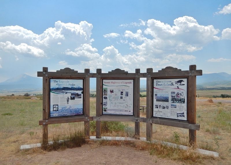
Excerpt: The Spanish Peaks are a pair of prominent mountains located in southwestern Huerfano County, Colorado. The Comanche people call them Huajatolla (or Wa-ha-toy-yah) meaning "double mountain". The two peaks, East Spanish Peak at elevation 12,688 feet and West Spanish Peak at elevation 13,631 feet, are higher than any point in the United States farther east. They were an important landmark on the Santa Fe Trail, the first sighting of the Rocky Mountains for travelers on the trail. The(Submitted on August 11, 2025, by Cosmos Mariner of Cape Canaveral, Florida.)Spanish Peaks were designated a National Natural Landmark in 1976 as two of the best-known examples of igneous dikes.Photographed by Cosmos Mariner, July 11, 20254. Close to Heaven, Down to Earth MarkerLooking south from Colorado Highway 160; the Spanish Peaks are in background. This marker is the rightmost panel in this 3-panel interpretive kiosk.
Credits. This page was last revised on August 11, 2025. It was originally submitted on August 11, 2025, by Cosmos Mariner of Cape Canaveral, Florida. This page has been viewed 111 times since then and 28 times this year. Photos: 1, 2, 3, 4. submitted on August 11, 2025, by Cosmos Mariner of Cape Canaveral, Florida.
