Bessemer in Pueblo in Pueblo County, Colorado — The American Mountains (Southwest)
Karymor
Merry-Go-Round
| — | Steelworks Center of the West | — |
Photographed by Mark Hilton, August 11, 2025
1. Karymor Marker
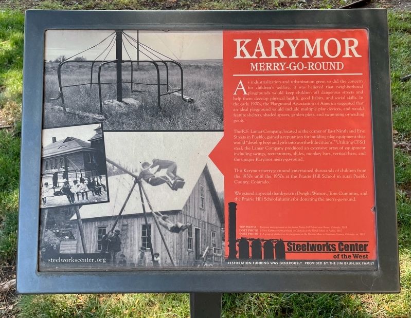
As industrialization and urbanization grew, so did the concern for children's welfare. It was believed that neighborhood playgrounds would keep children off dangerous streets and help them develop physical health, good habits, and social skills. In the early 1900s, the Playground Association of America suggested that an ideal playground would include multiple play devices, and would feature shelters, shaded spaces, garden plots, and swimming or wading pools.
The R.F. Lamar Company, located at the corner of East Ninth and Erie Streets in Pueblo, gained a reputation for building play equipment that would "develop boys and girls into worthwhile citizens." Utilizing CF&I steel, the Lamar Company produced an extensive array of equipment including swings, teeter-totters, slides, monkey bars, vertical bars, and the unique Karymor merry-go-round.
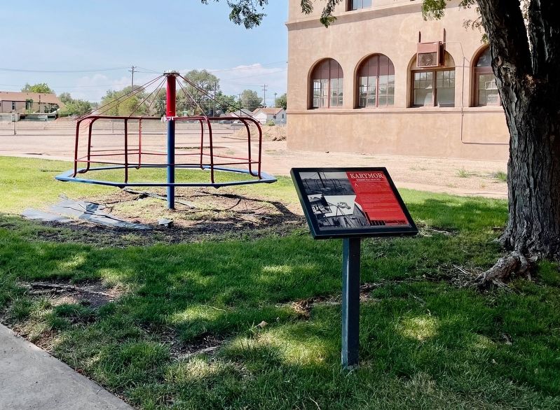
This Karymor merry-go-round entertained thousands of children from the 1930s until the 1950s at the Prairie Hill School in rural Pueblo County, Colorado.
We extend a special thank-you to Dwight Watson, Tom Cummins, and the Prairie Hill School alumni for donating
this page online
Photos:
Top photo: Karymor merry-go-round at the former Prairie Hill School near Boone, Colorado, 2013.
Inset photo: First Karymor merry-go-round in Colorado at the Blend School in Pueblo, 1927.
Inset photo: A group of children on the playground at the Floresta Mine in Gunnison County, Colorado, ca. 1915.
Restoration funding was generously provided by the Jim Brunjak family.
Erected by Steelworks Center of the West.
Topics. This historical marker is listed in these topic lists: Parks & Recreational Areas • Sports. A significant historical year for this entry is 2013.
Location. 38° 14.278′ N, 104° 36.765′ W. Marker is in Pueblo, Colorado, in Pueblo County. It is in Bessemer. It can be reached from Canal Street east of East Abriendo Avenue, on the left when traveling east. Located on west side of the Steelworks Center of the West Museum. Touch for map. Marker is at or near this postal address: 215 Canal St, Pueblo CO 81004, United States of America. Touch for directions.

Regionally, this marker is in Colorado’s Arkansas River Valley and in the Front Range. It is also in the American Mountain
Photographed by Mark Hilton, August 11, 2025
2. Karymor Marker
Other nearby markers. At least 8 other markers are within 2 miles of this marker, measured as the crow flies: Site of YMCA #2 (within shouting distance of this marker); 10 Ton Ladle (within shouting distance of this marker); Ore Carts (within shouting distance of this marker); The Colorado Fuel & Iron Company (within shouting distance of this marker); Rail Manufacturing (within shouting distance of this marker); 1950s Allen Mine (about 300 feet away, measured in a direct line); 130 Ton Ladle (about 300 feet away); The Mormon Battalion (approx. 1.3 miles away). Touch for a list and map of all markers in Pueblo.
Credits. This page was last revised on August 13, 2025. It was originally submitted on August 13, 2025, by Mark Hilton of Montgomery, Alabama. This page has been viewed 118 times since then and 46 times this year. Photos: 1, 2. submitted on August 13, 2025, by Mark Hilton of Montgomery, Alabama.
