
Waynesboro in Burke County, Georgia — The American South (South Atlantic)
The Brier Creek Bridges

Photographed by Tim Fillmon, July 24, 2025
1. The Brier Creek Bridges Marker
In Nov. 1864. movements of Kilpatrick's cavalry division (USA) of Gen. Sherman's army which had left Atlanta on the 15th on its destructive March to the Sea, indicated an advance on Augusta via Waynesboro. To protect this crossing of Brier Creek, strong earthworks were built astride the Augusta road, NW and SE through this point. An attempt by Kilpatrick on the 27th to burn bridges over Brier Creek was defeated by Wheeler's cavalry (CSA). On Dec. 4th, Kilpatrick returned with strong infantry support, drove Wheeler out of Waynesboro and across Brier Creek, and burned the rail and wagon bridges north and east of Waynesboro.
Erected 1958 by Georgia Historical Commission. (Marker Number 017-13.)
Topics. This historical marker is listed in these topic lists: Bridges & Viaducts • War, US Civil. A significant historical month for this entry is November 1864.
Location. 33° 7.064′ N, 81° 57.847′ W. Marker is in Waynesboro, Georgia, in Burke County. It is on Georgia 56 0.1 miles north of Maple Lane, on the right when traveling north. Touch for map. Marker is at or near this postal address: 1126 GA-56, Waynesboro GA 30830, United
this page online

Regionally, this marker is in Georgia’s Coastal Plain. It is also in the American South and specifically in the Deep South. Globally, it is in North America, the Western Hemisphere, the Western World, and the Anglosphere. Historically, it finds itself in what was once the territory of the Mississippian Culture, one of the original Thirteen Colonies, one of the Confederate States of America, and the Antebellum South.
Other nearby markers. At least 8 other markers are within 4 miles of this marker, measured as the crow flies: First Presbyterian Church (approx. 3½ miles away); Waynesborough (approx. 3½ miles away); Burke County (approx. 3½ miles away); Burke County's 8 Governors (approx. 3½ miles away); Shell Bluff (approx. 3½ miles away); Burke County Veterans Memorial (approx. 3½ miles away); Washington’s Southern Tour (approx. 3½ miles away); The J.D. Roberts Home (approx. 3.6 miles away). Touch for a list and map of all markers in Waynesboro.
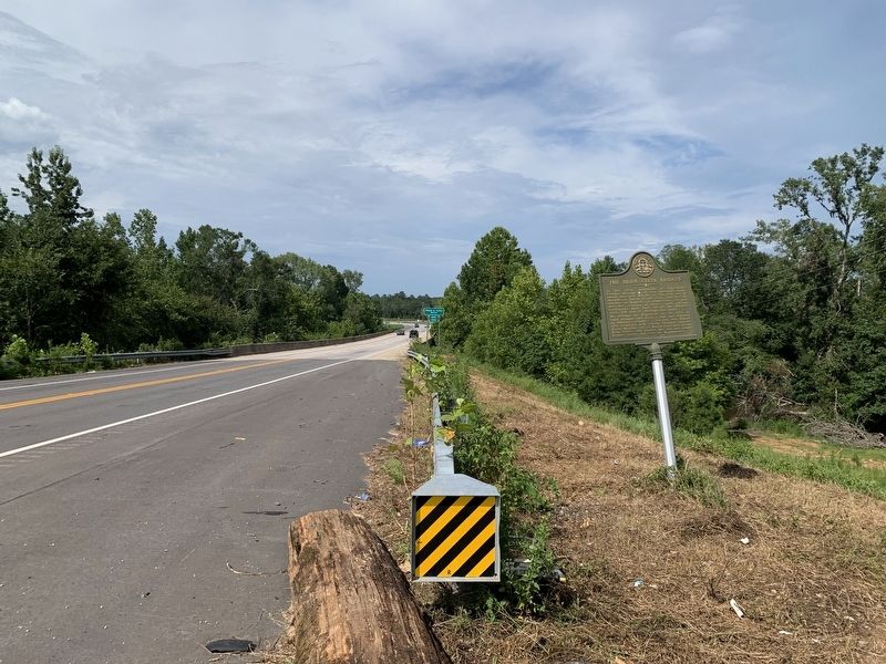
Photographed by Tim Fillmon, July 24, 2025
2. The Brier Creek Bridges Marker
Credits. This page was last revised on August 14, 2025. It was originally submitted on August 13, 2025, by Tim Fillmon of Webster, Florida. This page has been viewed 172 times since then and 46 times this year. Photos: 1, 2. submitted on August 13, 2025, by Tim Fillmon of Webster, Florida.
