Indiana in Indiana County, Pennsylvania — The American Northeast (Mid-Atlantic)
Underground Railroad Mural
Photographed by William Fischer, Jr., August 11, 2025
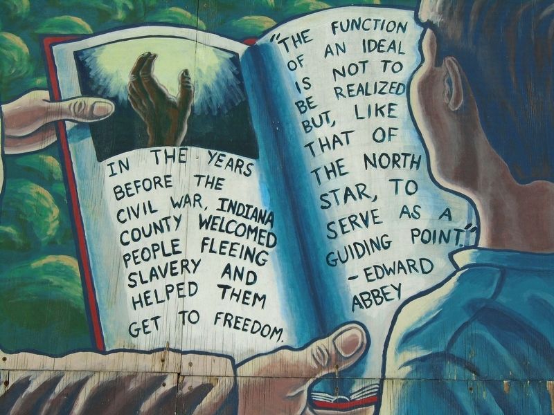
1. Underground Railroad Mural Detail
In the years before the Civil War, Indiana County welcomed
people fleeing slavery and helped them get to freedom.
"The function of an ideal is not to be realized but,
like that of the North Star, to serve as a guiding point."
- Edward Abbey
Topics and series. This historical marker is listed in these topic lists: Abolition & Underground RR • African Americans • Settlements & Settlers. In addition, it is included in the Network to Freedom series list. A significant historical date for this entry is June 26, 1845.
Location. 40° 37.358′ N, 79° 9.037′ W. Marker is in Indiana, Pennsylvania, in Indiana County. It is on 6th Street (Pennsylvania Route 954) near Philadelphia Street, on the left when traveling south. Touch for map. Marker is at or near this postal address: 580 Philadelphia Street, Indiana PA 15701, United States of America. Touch for directions.

Regionally, this marker is in Pennsylvania’s Laurel Highlands. It is also in the American Northeast, in the Mid-Atlantic, in Appalachia, and specifically in Northern Appalachia. Globally, it is in North America, the Western Hemisphere, the Western World,
this page online
Other nearby markers. At least 8 other markers are within walking distance of this marker: Walk of Fame (within shouting distance of this marker); The Rescue of Anthony Hollingsworth (within shouting distance of this marker); James Mitchell House (about 300 feet away, measured in a direct line); Peter Sutton's Tavern, 1806 (about 400 feet away); Property of William & Charlotte Banks (approx. 0.2 miles away); Rest on Arms (approx. 0.2 miles away); The Grand Army of the Republic Post 28 (approx. 0.2 miles away); a different marker also named "Rest on Arms" (approx. 0.2 miles away). Touch for a list and map of all markers in Indiana.
Related markers. Click here for a list of markers that are related to this marker.
Also see . . . Indiana County Underground Railroad Driving Tour. (Submitted on August 15, 2025, by William Fischer, Jr. of Reynoldsburg, Ohio.)

Photographed by William Fischer, Jr., August 11, 2025
2. Underground Railroad Mural
Credits. This page was last revised on August 15, 2025. It was originally submitted on August 15, 2025, by William Fischer, Jr. of Reynoldsburg, Ohio. This page has been viewed 111 times since then and 39 times this year. Photos: 1, 2. submitted on August 15, 2025, by William Fischer, Jr. of Reynoldsburg, Ohio.
