Port Colborne in Niagara Region, Ontario — Central Canada (North America)
SS Hochelaga Lifeboat 1949

Photographed by Kevin Westell, August 14, 2025
1. SS Hochelaga Lifeboat 1949 - Marker
Hochelaga was built in Collingwood in 1949 as a straight deck bulk freighter and converted in 1964 to a self-unloader. She carried ore, coal, grain and stone on the Great Lakes until 1987.
Fortunately, the Lifeboat never had to be launched, but the International Orange of its interior was ready to attract overhead searches if necessary.
Erected 2025 by Port Colborne Historical Museum.
Topics. This historical marker is listed in these topic lists: Disasters • Waterways & Vessels. A significant historical year for this entry is 1949.
Location. 42° 53.259′ N, 79° 15.11′ W. Marker is in Port Colborne, Ontario, in Niagara Region. It can be reached from the intersection of King Street and Princess Street, on the right when traveling south. Touch for map. Marker is at or near this postal address: 280 King Street, Port Colborne ON L3K 5X8, Canada. Touch for directions.

Regionally, this marker is on the Golden Horseshoe and in Niagara Canada.
this page online
Other nearby markers. At least 8 other markers are within walking distance of this marker: Anchor from the Raleigh (here, next to this marker); Steam Tug Yvon Dupré Jr. (a few steps from this marker); Hand operated winch from 2nd Welland Canal Lock Gate (a few steps from this marker); Earth Scraper Used On Construction of Welland Canal (a few steps from this marker); Port Colborne and the Niagara St. Catharines and Toronto Railway (NS&T) (within shouting distance of this marker); Ingleside c. 1867 (about 90 meters away, measured in a direct line); Founding of Port Colborne (about 150 meters away); King George Memorial Park War Memorial (about 180 meters away). Touch for a list and map of all markers in Port Colborne.
Photographed by Kevin Westell, July 21, 2025
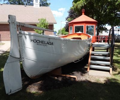
2. SS Hochelaga Lifeboat
Photo faces north and north-east. The marker (not yet mounted, in this picture) hangs from eyelets on the south-east (right) side of the boat, in front of the stairs. The eyelets are visible, below the 4th and 5th fittings (for the boat's cover) from the stern.
Photographed by Kevin Westell, July 21, 2025
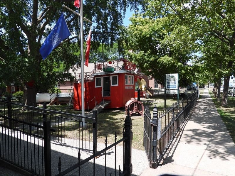
3. Marker in context
Photo faces north and north-west. The lifeboat (partially visible) is in the back-yard of the Port Colborne Historical Museum.

Photographed by Kevin Westell, July 21, 2025
4. SS Hochelaga Lifeboat
Credits. This page was last revised on August 18, 2025. It was originally submitted on August 15, 2025, by Kevin Westell of St. Catharines, Ontario. This page has been viewed 212 times since then and 16 times this year. Photos: 1, 2, 3, 4. submitted on August 15, 2025, by Kevin Westell of St. Catharines, Ontario. • Andrew Ruppenstein was the editor who published this page.
