Ridgeway in Fort Erie in Niagara Region, Ontario — Central Canada (North America)
Buildings on the Battlefield
Photographed by Tim Boyd, April 23, 2025
1. Buildings on the Battlefield Marker
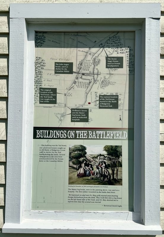
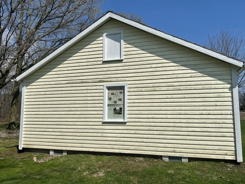
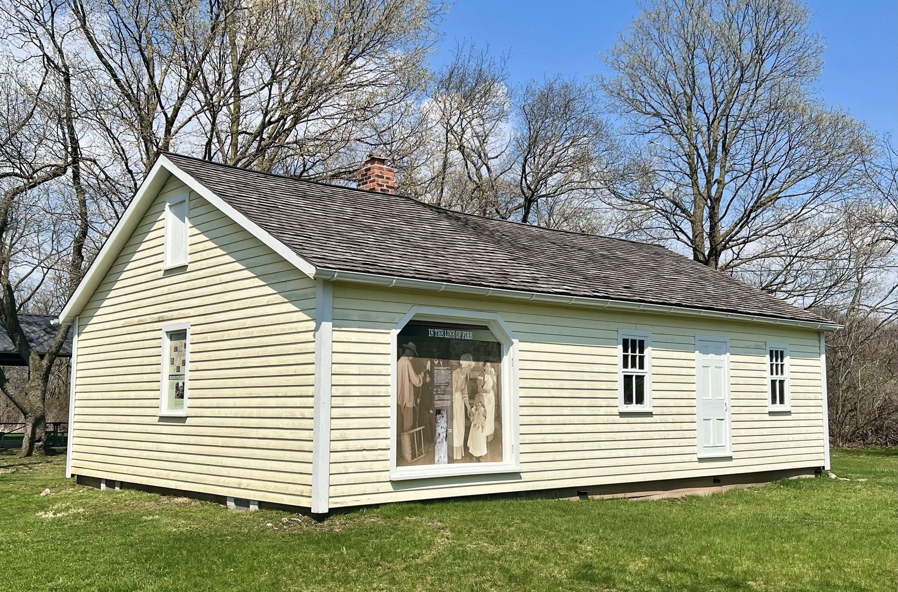
This building was the Teal home, one of several houses caught up in the Battle of Ridgeway. It was used as shelter for the Teal family during the battle. Several other farms in the area were commandeered by the Fenian Army or the Canadian Militia.
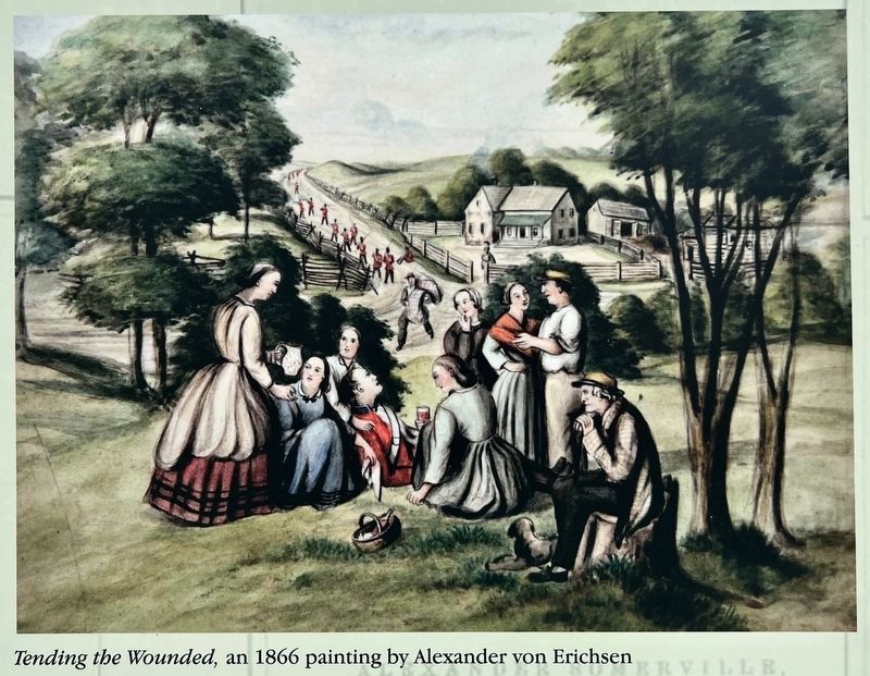
The Baxter log house, seen in the painting above, was used as a hospital. The first soldier wounded in the battle died there.
We hastened on and met Dr. May with several men bearing Ensign McEachren from the field. They took him into a log house on the left hand side of the road, and Dr. May desired me to inform him that his wound was mortal.
~ Reverend David Inglis
Topics. This historical marker is listed in these topic lists: Notable Buildings • Wars, Non-US. A significant historical date for this entry is June 2, 1866.
Location. 42° 54.275′ N, 79° 2.475′ W. Marker is in Fort Erie, Ontario, in Niagara Region. It is in Ridgeway. It can be reached from Garrison Road 0.3 kilometers east of Ridge Road North, on the right when traveling west. The marker is on the grounds of the Ridgeway Battlefield National Historic Site. Touch for map. Marker is at or near this postal address:
this page online

Regionally, this marker is on the Golden Horseshoe and in Niagara Canada. It is also in Central Canada. Globally, it is in North America, on the Great Lakes, in the Western Hemisphere, in the Western World, and in the Anglosphere. Historically, it finds itself in what was once a British colony, the Viceroyalty of New France, the Haudenosaunee (Iroquois) Confederacy, and Rupert’s Land.
Other nearby markers. At least 8 other markers are within walking distance of this marker: Berties Farmers (here, next to this marker); In the Line of Fire (a few steps from this marker); One Farm Family’s Fight (a few steps from this marker); Irelands Farmers (a few steps from this marker); Farm Innovations (a few steps from this marker); Map and Timeline of Events - Fenian Invasion, 1866 (a few steps from this marker); Map of the Battle of Ridgeway Site June 2, 1866 (a few steps from this marker); The Historic Ironwood (within shouting distance of this marker). Touch for a list and map of all markers in Fort Erie.
Photographed by Tim Boyd, April 23, 2027
2. Buildings on the Battlefield Marker

Photographed by Tim Boyd, April 23, 2025
3. Buildings on the Battlefield marker map illustration detail
Photographed by Alexander von Erichsen, 1866
4. Buildings on the Battlefield marker illustration and caption detail
Tending the wounded
Photographed by Tim Boyd, April 23, 2025
5. The Teal House, 2025
Credits. This page was last revised on August 18, 2025. It was originally submitted on April 27, 2025, by Tim Boyd of Hamilton, Ontario. This page has been viewed 178 times since then and 45 times this year. Last updated on August 16, 2025, by Kevin Westell of St. Catharines, Ontario. Photos: 1, 2, 3, 4, 5. submitted on April 27, 2025, by Tim Boyd of Hamilton, Ontario. • Devry Becker Jones was the editor who published this page.
