Fonthill in Fort Erie in Niagara Region, Ontario — Central Canada (North America)
Farm Innovations
Photographed by Tim Boyd, April 23, 2025
1. Farm Innovations Marker
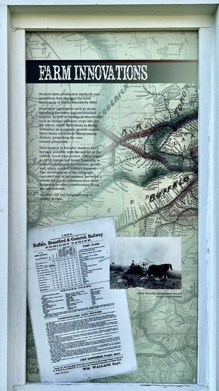
Modern farm production methods and inventions had changed the rural landscapes of North America by 1866.
Innovative equipment such as steam threshing machines and mechanized reapers, as well as biological discoveries such as disease-resistant crops like red fife wheat, made agriculture in Bertie Township an economic growth engine.
Many farms used these labour-saving devices, propelling the area toward prosperity.
Participation in broader markets had become possible with the advent of the railway. Local train service, which began in 1853, connected Bertie Township to larger communities for markets, goods, and, when needed, military support.
The development of the telegraph, operated out of rail stations, provided a means for quick communication from Ridgeway to other communities along the rail network.
An 1867 rail and telegraph map is shown at right.
Topics. This historical marker is listed in these topic lists: Agriculture • Communications • Railroads & Streetcars. A significant historical year for this entry is 1866.
Location. 42° 54.275′ N, 79° 2.464′ W. Marker is in Fort Erie, Ontario, in Niagara Region. It is in Fonthill. It can be reached from Garrison Road 0.3 kilometers east of Ridge Road North, on the right when traveling west. The marker is on the grounds of the Ridgeway Battlefield National Historic Site, on the east side of the Teal House. Touch for map. Marker is at or near this postal address: 3388 Garrison Rd, Fort Erie ON L0S 1N0, Canada. Touch for directions.

Regionally, this marker is on the Golden Horseshoe and in Niagara Canada. It is also in Central Canada. Globally, it is in North America, on the Great Lakes, in the Western Hemisphere, in the Western World, and in the Anglosphere. Historically, it finds itself in what was once a British colony,
this page online
Other nearby markers. At least 8 other markers are within walking distance of this marker: Irelands Farmers (here, next to this marker); One Farm Family’s Fight (here, next to this marker); Berties Farmers (a few steps from this marker); In the Line of Fire (a few steps from this marker); Buildings on the Battlefield (a few steps from this marker); Map and Timeline of Events - Fenian Invasion, 1866 (within shouting distance of this marker); Map of the Battle of Ridgeway Site June 2, 1866 (within shouting distance of this marker); The Historic Ironwood (within shouting distance of this marker). Touch for a list and map of all markers in Fort Erie.

Photographed by Tim Boyd, April 23, 2025
2. Farm Innovations Marker
Photographed by Tim Boyd, April 23, 2025
3. Ridgeway Battlefield National Historic Site
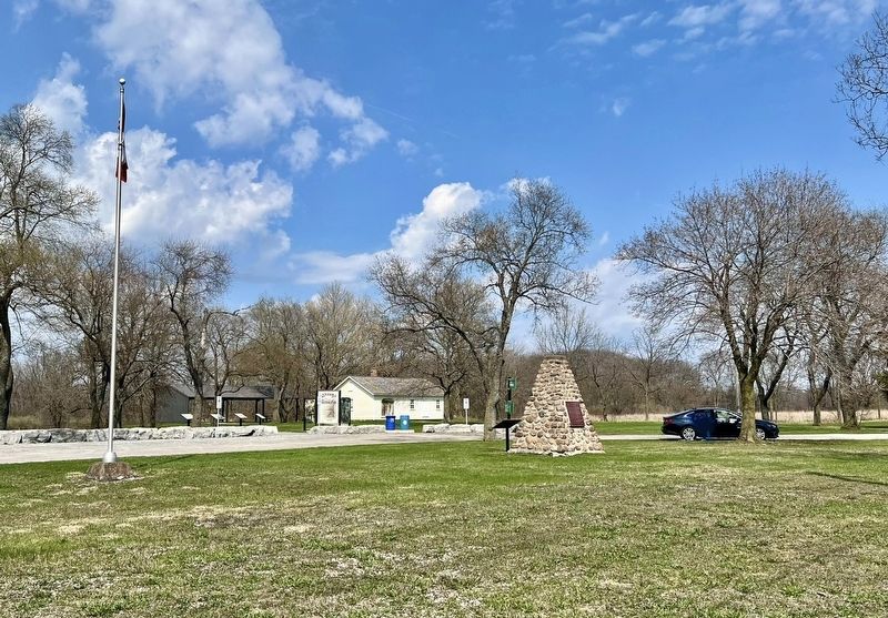
The Teal House is at the centre of the photo
Credits. This page was last revised on August 18, 2025. It was originally submitted on April 30, 2025, by Tim Boyd of Hamilton, Ontario. This page has been viewed 98 times since then and 10 times this year. Last updated on August 16, 2025, by Kevin Westell of St. Catharines, Ontario. Photos: 1, 2, 3. submitted on April 30, 2025, by Tim Boyd of Hamilton, Ontario. • Devry Becker Jones was the editor who published this page.
