Ridgeway in Fort Erie in Niagara Region, Ontario — Central Canada (North America)
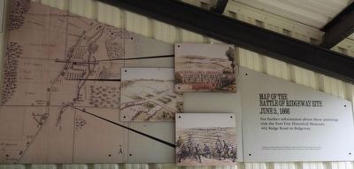
Map of the Battle of Ridgeway Site June 2, 1866
Photographed by Kevin Westell, August 14, 2025
1. Map of the Battle of Ridgeway Site June 2, 1866 - Marker
For further information about these paintings, visit the Fort Erie Historical Museum, 402 Ridge Road in Ridgeway
Graphics used throughout this exhibit are from: Fort Erie Historical Museum, Library and Archives Canada, Library of Congress, McCord Museum, and Niagara Navigator
Topics. This historical marker is listed in this topic list: Wars, Non-US. A significant historical date for this entry is June 2, 1866.
Location. 42° 54.287′ N, 79° 2.481′ W. Marker is in Fort Erie, Ontario, in Niagara Region. It is in Ridgeway. It can be reached from Garrison Road, on the right when traveling west. The marker is with the Battle of Ridgeway Memorial Park, in the interpretive pavilion, which is 100 metres north of Garrison Road. Touch for map. Marker is at or near this postal address: 3388 Garrison Rd, Fort Erie ON L0S 1N0, Canada. Touch for directions.

Regionally, this marker is on the Golden Horseshoe and in Niagara Canada. It is also in Central Canada. Globally, it is in North America, on the Great Lakes, in the Western Hemisphere, in the Western World, and in the Anglosphere.
this page online
Other nearby markers. At least 8 other markers are within walking distance of this marker: Map and Timeline of Events - Fenian Invasion, 1866 (here, next to this marker); The Historic Ironwood (a few steps from this marker); Berties Farmers (a few steps from this marker); Buildings on the Battlefield (a few steps from this marker); One Farm Family’s Fight (within shouting distance of this marker); Irelands Farmers (within shouting distance of this marker); Farm Innovations (within shouting distance of this marker); In the Line of Fire (within shouting distance of this marker). Touch for a list and map of all markers in Fort Erie.
Regarding Map of the Battle of Ridgeway Site June 2, 1866. Where the inscription refers to "Library of Congress", it means the U.S. Library of Congress.
Photographed by Kevin Westell, August 14, 2025
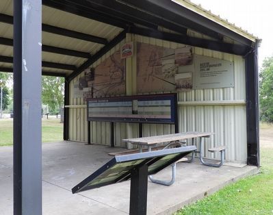
2. Map of the Battle of Ridgeway Site June 2, 1866 - Marker in context
Photo faces south-west into the interpretive pavilion. The marker and map are on the interior wall of the west wall of the pavilion.
Credits. This page was last revised on September 6, 2025. It was originally submitted on August 16, 2025, by Kevin Westell of St. Catharines, Ontario. This page has been viewed 90 times since then and 25 times this year. Photos: 1, 2. submitted on August 16, 2025, by Kevin Westell of St. Catharines, Ontario. • Bill Pfingsten was the editor who published this page.
