Mille Lacs Kathio State Park near Onamia in Mille Lacs County, Minnesota — The American Midwest (Upper Plains)
Early Homestead
| — | Kathio Landmark Trail | — |
Photographed by McGhiever, May 29, 2025
1. Early Homestead Marker
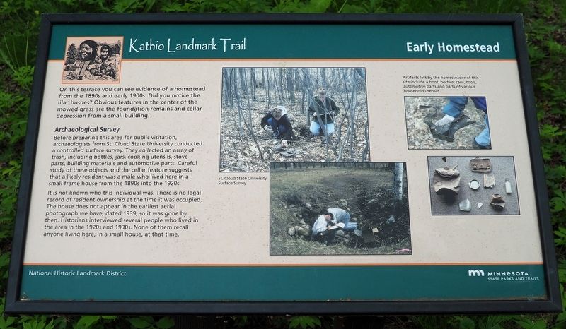
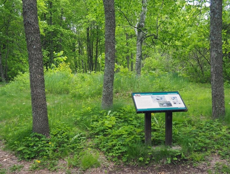
On this terrace you can see evidence of a homestead from the 1890s and early 1900s. Did you notice the lilac bushes? Obvious features in the center of the mowed grass are the foundation remains and cellar depression from a small building.
Archaeological Survey
Before preparing this area for public visitation, archaeologists from St. Cloud State University conducted a controlled surface survey. They collected an array of trash, including bottles, jars cooking utensils, stove parts, building materials and automotive parts. Careful study of these objects and the cellar feature suggests that a likely resident was a male who lived here in a small frame house from the 1890s into the 1920s.
It is not known who this individual was. There is no legal record of resident ownership at the time it was occupied. The house does not appear in the earliest aerial photograph we have, dated 1939, so it was gone by then. Historians interviewed several people who lived in the area in the 1920s and 1930s. None of them recall anyone living here, in a small house, at that time.
St. Cloud State University Surface Survey
Artifacts left by the homesteader of this site include a boot, bottles, cans, tools, automotive parts and parts of various household utensils.
Erected by Minnesota
this page online
Topics. This historical marker is listed in these topic lists: Anthropology & Archaeology • Settlements & Settlers. A significant historical year for this entry is 1890.
Location. 46° 8.998′ N, 93° 46.082′ W. Marker is near Onamia, Minnesota, in Mille Lacs County. It is in Mille Lacs Kathio State Park. It can be reached from no nearby street. The marker is on the Kathio Landmark Trail just south of trail intersection 17. Touch for map. Marker is in this post office area: Onamia MN 56359, United States of America. Touch for directions.

Regionally, this marker is in Central Minnesota. It is also in the American Midwest and in the Corn Belt. Globally, it is in North America, the Western Hemisphere, the Western World, and the Anglosphere. Historically, it finds itself in what was once Rupert’s Land, the territory of the Mississippian Culture, and the Northwest Territory.
Other nearby markers. At least 8 other markers are within walking distance of this marker: Looking Beyond the Objects (within shouting distance of this marker); Why Did People of the Late Prehistoric Period Choose to Live Here?
Photographed by McGhiever, May 29, 2025
2. Early Homestead Marker facing the cabin site
Credits. This page was last revised on February 18, 2026. It was originally submitted on August 17, 2025, by McGhiever of Minneapolis, Minnesota. This page has been viewed 93 times since then and 20 times this year. Photos: 1, 2. submitted on August 17, 2025, by McGhiever of Minneapolis, Minnesota.
