Oakville in Halton Region, Ontario — Central Canada (North America)
Bowbeer House
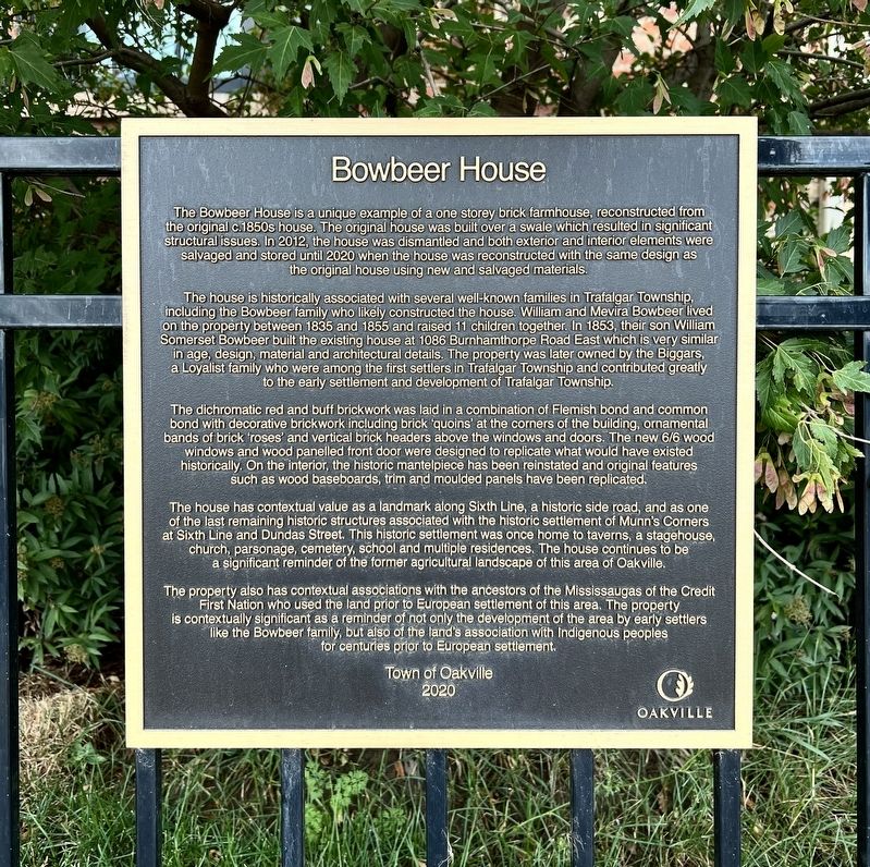
Photographed by Tim Boyd, August 17, 2025
1. Bowbeer House Marker
The house is historically associated with several well-known families in Trafalgar Township including the Bowbeer family who likely constructed the house. William and Mevira Bowbeer lived on the property between 1835 and 1855 and raised 11 children together. In 1853, their son William Somerset Bowbeer built the existing house at 1086 Burnhamthorpe Road East which is very similar in age, design, material and architectural details. The property was later owned by the Biggars, a Loyalist family who were among the first settlers in Trafalgar Township and contributed greatly to the early settlement and development of Trafalgar Township.
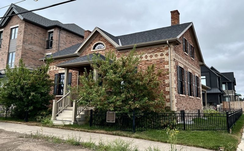
The dichromatic red and buff brickwork was laid in a combination
this page online
The property also has contextual associations with the ancestors of the Mississaugas of the Credit First Nation who used the land prior to European settlement of this area. The property is contextually significant
Photographed by Tim Boyd, August 17, 2025
2. Bowbeer House Marker
Erected 2020 by Town of Oakville.
Topics. This historical marker is listed in these topic lists: Architecture • Indigenous Peoples and Communities • Settlements & Settlers. A significant historical year for this entry is 2012.
Location. 43° 29.31′ N, 79° 44.48′ W. Marker is in Oakville, Ontario, in Halton Region. It is at the intersection of Sixth Line and Bowbeer Road, on the right when traveling north on Sixth Line. Touch for map. Marker is at or near this postal address: 3339 Sixth Line, Oakville ON L6H 0Z5, Canada. Touch for directions.

Regionally, this marker is in Greater Toronto, specifically on the Golden Horseshoe, in the Hamilton-Halton-Brant Area, and specifically in the Toronto Metropolitan Area. It is also in Central Canada. Globally, it is in North America, on the Great Lakes, in the Western Hemisphere, in the Western World, and in the Anglosphere. Historically, it finds itself in what was

3. Munn’s Corners in 1859
Source: University of Toronto
Other nearby markers. At least 8 other markers are within 6 kilometers of this marker, measured as the crow flies: Jordan Munn House (approx. 1.2 kilometers away); Munn’s Methodist Chapel (1898) (approx. 1.4 kilometers away); Amos Biggar House (approx. 2.8 kilometers away); Frederick Arthur Verner (approx. 3.8 kilometers away); Industrial Change 1810 to 1870 (approx. 6.2 kilometers away); Oakville’s First Industrial Era (approx. 6.2 kilometers away); The Oakville Basket Company (approx. 6.2 kilometers away); Trafalgar Neighbourhood (approx. 6.2 kilometers away). Touch for a list and map of all markers in Oakville.

Photographed by Tim Boyd, August 17, 2025
4. Bowbeer House in 2025
Credits. This page was last revised on August 18, 2025. It was originally submitted on August 18, 2025, by Tim Boyd of Hamilton, Ontario. This page has been viewed 110 times since then and 64 times this year. Photos: 1, 2, 3, 4. submitted on August 18, 2025, by Tim Boyd of Hamilton, Ontario. • Andrew Ruppenstein was the editor who published this page.
