Inner Harbor in Baltimore, Maryland — The American Northeast (Mid-Atlantic)
The Port of Baltimore
The National Road begins and ends here
| — | The Historic National Road - The Road That Built The Nation | — |
Photographed by Christopher Busta-Peck, March 12, 2008
1. The Port of Baltimore Marker
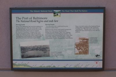
Moving Goods
Since 1729, Baltimore has owed its existence to its deepwater port. The city looks east to the Chesapeake Bay and ports around the world. It also looks west with access to markets in America’s heartland. It began with local farmers bringing in their crops. In the early 1800s, the National Road, which started here as the Baltimore and Frederick-Town Turnpike, gave the port more and more reach inland.
Moving People
“The long ocean trip is ended and the great unknown is before them.”
Baltimore has always welcomed immigrants. Many have been poor and desperate, fleeing war and famine. They were seeking comfortable lives and religious freedom. At first, most were Germans and Irish. Later, they were Poles, Italians, Scandinavians, Czechs, Lithuanians, Greeks, Russians and freed Blacks. Many traveled west on the National Road, adding their ingredient to the American “melting pot.” Second only to New York, Baltimore was a doorway to a new life for millions.
[Captions:]
Steam and sail once competed for business in a crowded Baltimore Harbor. Trucks still carry cargo to and from modern marine terminals on centuries old roads.
As immigrants landed in Baltimore and took to American roads and railroads, they created a rich tapestry of cultures throughout the nation.
Erected by America's
this page online
Topics and series. This historical marker is listed in these topic lists: Roads & Vehicles • Settlements & Settlers. In addition, it is included in the The Historic National Road series list. A significant historical year for this entry is 1729.
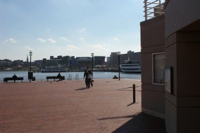
Location. Marker has been permanently removed. It was located near 39° 17.131′ N, 76° 36.656′ W. Marker was in Baltimore, Maryland. It was in the Inner Harbor. It could be reached from the intersection of East Pratt Street and South Street, on the right when traveling east. The marker is on the exterior wall of the USS Constellation visitor center. Touch for map. Marker was at or near this postal address: 301 E Pratt St, Baltimore MD 21230, United States of America.
We have been informed that this marker is no longer there and will not be replaced. This page is an archival view of what was.
Regionally, this marker was in Central Maryland. It was also in the American Mid-Atlantic, in the Chesapeake Bay Region, and on the Eastern Seaboard. Globally, it was in the North Atlantic Region, North America, the Western Hemisphere, the Western World, and the Anglosphere. Historically,

Photographed by Christopher Busta-Peck, March 12, 2008
2. Marker, on the wall of the USS Constellation visitor center
Other nearby markers. At least 8 other markers are within walking distance of this location: USS Constellation (a few steps from this marker); Hammock Rails (a few steps from this marker); The Ship's Helm (within shouting distance of this marker); Spar Deck Guns (within shouting distance of this marker); The Ship's Head (within shouting distance of this marker); Living Classrooms (within shouting distance of this marker); a different marker also named The Port of Baltimore (within shouting distance of this marker); An Active Port for 300 Years (about 300 feet away, measured in a direct line). Touch for a list and map of all markers in Baltimore.
Photographed by Christopher Busta-Peck, March 12, 2008
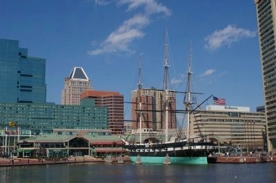
3. USS Constellation with Baltimore skyline in the background
The visitor center is, in this photograph, behind the ship.
Credits. This page was last revised on September 16, 2025. It was originally submitted on March 12, 2008, by Christopher Busta-Peck of Shaker Heights, Ohio. This page has been viewed 1,793 times since then and 19 times this year. Last updated on August 18, 2025, by Evan Dwyer of Richmond, Virginia. Photos: 1, 2, 3. submitted on March 12, 2008, by Christopher Busta-Peck of Shaker Heights, Ohio. • Devry Becker Jones was the editor who published this page.
