
Near Breckenridge in Summit County, Colorado — The American Mountains (Southwest)
The Continental Divide

Photographed by Cosmos Mariner, July 26, 2025
1. The Continental Divide Marker
Hoosier Pass lies on the Continental Divide, the lofty meandering spine of mountains that separates the Atlantic and Pacific watersheds. Nineteenth-century pioneers dreaded the barrier, particularly its high, difficult Colorado stretches; for that reason many westbound emigrants and early railroad builders avoided the region altogether, seeking lower and easier crossings in Wyoming or New Mexico. Railroads and highways eventually eased the passage, but the Divide retained a definite mystique, even when water started flowing under and through it. During the twentieth century almost forty pipeline, tunnel, and ditch projects breached the Divide, transferring hundreds of billions of gallons a year from the Western Slope to the more heavily populated Front Range. Impermeable no longer, the Divide evolved from a physical boundary into a political one — the front line in the West's water wars.
Father John Dyer
The Reverend John Dyer must have crossed Hoosier Pass a thousand times — almost always on foot, and often in the dead of winter. His sprawling Methodist ministry, launched in 1861, took him from Breckenridge to Fairplay,
this page online
[photo captions]
• Hoosier Pass summit, 1920s
• John Dyer and his children in the late 1840s. A Methodist minister from Wisconsin, Dyer first came to Colorado in 1861, intending to retire in the Midwest. When he learned that the region lacked religious instruction, he decided to stay, and remained in Colorado until his death in 1901. A memorial to Dyer is located near the summit of Mosquito Pass.
• Unidentified mail carrier, 1860s. Like this mailman, Father Dyer made his rounds on what were then known as snowshoes. These primitive boards were heavy and unwieldy, measuring ten feet
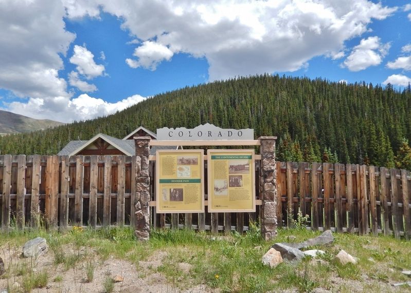
Photographed by Cosmos Mariner, July 26, 2025
2. The Continental Divide Marker
Looking east from the pull-out on Colorado Highway 9. This marker is the rightmost of two panels in this Colorado Historical Society interpretive kiosk.
Erected 2002 by Colorado Historical Society, Colorado Department of Transportation, and Federal Highway Administration.
Topics and series. This historical marker is listed in these topic lists: Charity & Public Work • Religion & Religious Structures • Roads & Vehicles • Settlements & Settlers. In addition, it is included in the History Colorado series list. A significant historical year for this entry is 1861.
Location. 39° 22.338′ N, 106° 3.404′ W. Marker is near Breckenridge, Colorado, in Summit County. It is on State Highway 9 0.3 miles south of County Road 670, on the left when traveling south. The marker is in a pull-out 1.3 miles north of the Hoosier Pass summit. Touch for map. Marker is in this post office area: Breckenridge CO 80424, United States of America. Touch for directions.

Regionally, this marker is in the Colorado High Rockies and on the Continental Divide. It is also in the American Mountain West. Globally, it is in North America, the Rocky Mountains, the Western Hemisphere, the Western World, and the Anglosphere.
Other nearby markers. At least 8 other markers are within 7 miles of this marker, measured as the crow flies: Hoosier Pass (here, next to this marker); a different marker also named Hoosier Pass (approx. 0.8 miles away); Alma's Historic Ladies Aid Hall (approx. 6 miles away); Climax (approx. 7 miles away); Welcome to Climax! (approx. 7 miles away); Life on the High Line (approx. 7.1 miles away); Highway in the Sky (approx. 7.1 miles away); The Big Shot (approx. 7.1 miles away).
Related markers. Click here for a list of markers that are related to this marker. Hoosier Pass
Also see . . .
1. Hoosier Pass (Continental Divide) (Wikipedia).
Excerpt: Hoosier Pass is the location of the oldest known trans-basin diversion project in Colorado, a ditch diverting water from a tributary of the Blue River to the Middle Fork of the South Platte River. This water was used for placer mining above Alma. By 1929, the 1.8 mile East Hoosier Ditch and the 1.3 mile West Hoosier Ditch were in operation, able to divert an aggregate 77 cubic feet per second of water across the continental divide.(Submitted on August 18, 2025, by Cosmos Mariner of Cape Canaveral, Florida.)The City of Colorado Springs obtained the water rights to these ditches and constructed the Hoosier Pass Tunnel to replace them as part of the Continental-Hoosier Diversion System. The 10 foot diameter 1.5 mile water tunnel was completed in 1951 and delivers up to 500 cubic feet per second to Montgomery Reservoir about a mile southwest of the pass, from which the water is piped 70 miles to Colorado Springs.
2. John Lewis Dyer (Wikipedia).
Excerpt: In what are now Lake, Summit, and Park counties, he was appointed an itinerant preacher to the mining camps. Dyer hiked through blizzards and dealt with wild animals to reach remote mining towns, preaching in saloons, tents and on street corners. At times, miners put gold dust in the offering plate, as most were too poor to give actual cash. In many towns he set up churches, including one in Breckenridge that still holds services today. Dyer's life as a minister was far from easy, and he made little money on his circuit. To make more he started carrying mail between Alma and Leadville when traveling over Mosquito Pass. Wearing 10-foot "snowshoes" (really Norwegian skis), he would cross Mosquito Pass, which is 13,188 feet high, leaving in the evening, so the snow was frozen and easier to cross. Dyer became quite well-known and was affectionately nicknamed "Father Dyer" despite the fact that Methodist ministers were not called "Father".(Submitted on August 18, 2025, by Cosmos Mariner of Cape Canaveral, Florida.)
Credits. This page was last revised on August 18, 2025. It was originally submitted on August 18, 2025, by Cosmos Mariner of Cape Canaveral, Florida. This page has been viewed 143 times since then and 49 times this year. Photos: 1, 2. submitted on August 18, 2025, by Cosmos Mariner of Cape Canaveral, Florida.
