Charlestown in Boston in Suffolk County, Massachusetts — The American Northeast (New England)
Bunker Hill Burying Ground
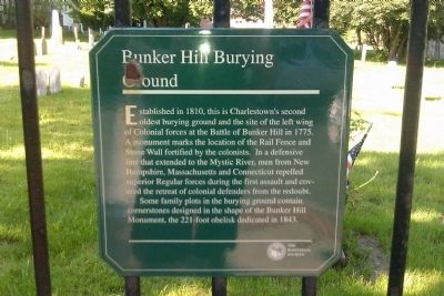
Photographed by Matthew R Gilbertson, May 20, 2012
1. Bunker Hill Burying Ground Marker
Erected by The Bostonian Society.
Topics. This historical marker is listed in these topic lists: Cemeteries & Burial Sites • War, US Revolutionary. A significant historical year for this entry is 1810.
Location. 42° 22.734′ N, 71° 3.725′ W. Marker is in Boston, Massachusetts, in Suffolk County. It is in Charlestown. It is on Bunker Hill Street just west of Polk St, on the right when traveling west. Marker is on the right of the entrance gate at Bunker Hill Burying Ground. Touch for map. Marker
this page online

Regionally, this marker is in Massachusetts’ Historic Boston. It is also in the American Northeast, in New England, and on the Eastern Seaboard. Globally, it is in the North Atlantic Region, North America, the Western Hemisphere, the Western World, and the Anglosphere. Historically, it finds itself in what was once one of the original Thirteen Colonies.
Other nearby markers. At least 8 other markers are within walking distance of this marker: The Line of Rail Fence and Grass Protection (here, next to this marker); The Rail Fence and Grass Line (about 800 feet away, measured in a direct line); New Hampshire Gate (approx. 0.2 miles away); United States Gate (approx. 0.2 miles away); The Breastwork (approx. 0.2 miles away); North-East Corner of the Redoubt (approx. 0.2 miles away); Colonel Richard Gridley (approx. 0.2 miles away); Breed’s Hill (approx. 0.2 miles away). Touch for a list and map of all markers in Boston.
Related marker. Click here for another marker that is related to this marker.

Photographed by R.J. O’Hara, June 17, 2025
2. Bunker Hill Burying Ground Marker
The burying ground is specially decorated for the 250th anniversary of the Battle of Bunker Hill on 17 June 1775.

Photographed by R.J. O’Hara, June 17, 2025
3. Bunker Hill Burying Ground Marker
The burying ground is specially decorated for the 250th anniversary of the Battle of Bunker Hill on 17 June 1775.
Credits. This page was last revised on September 18, 2025. It was originally submitted on May 20, 2012, by Matt Gilbertson of Medford, Massachusetts. This page has been viewed 1,610 times since then and 84 times this year. Last updated on August 18, 2025, by G.W.Bartlett of Hingham, Massachusetts. Photos: 1. submitted on May 20, 2012, by Matt Gilbertson of Medford, Massachusetts. 2, 3. submitted on June 27, 2025, by R.J. O’Hara of Fitchburg, Massachusetts. • Michael Herrick was the editor who published this page.
