Queenston in Niagara-on-the-Lake in Niagara Region, Ontario — Central Canada (North America)
Brock's Monument
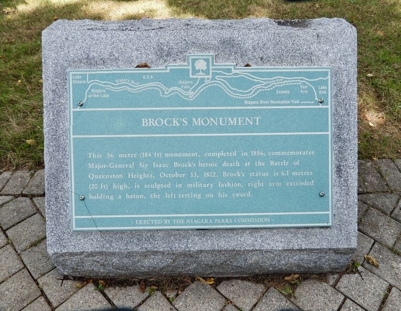
Photographed by Kevin Westell, August 18, 2025
1. Brock's Monument - Marker
Erected by Niagara Parks Commission.
Topics. This historical marker and monument is listed in these topic lists: Patriots & Patriotism • War of 1812. A significant historical date for this entry is October 13, 1812.
Location. 43° 9.485′ N, 79° 3.018′ W. Marker is in Niagara-on-the-Lake, Ontario, in Niagara Region. It is in Queenston. It is at the intersection of Niagara River Parkway and Portage Road on Niagara River Parkway. The marker is adjacent to the Niagara River Recreation Trail, 30 metres south-east of the circular intersection of Niagara River Pkwy and Portage Road. Touch for map. Marker is at or near this postal address: 14162 Niagara River Parkway, Niagara-on-the-Lake ON L0S 1J0, Canada. Touch for directions.

Regionally, this marker and monument is on the Golden Horseshoe and in Niagara Canada. It is also
this page online
Other nearby markers. At least 8 other markers are within walking distance of this marker: Southern Terminus of The Bruce Trail (within shouting distance of this marker); Roy Terrace (approx. 0.2 kilometers away); Attack / L'attaque (approx. 0.2 kilometers away); Laura Ingersoll Secord (approx. 0.3 kilometers away); The Battle of Queenston Heights (approx. 0.3 kilometers away); Black Militia Units In Upper Canada, 1812-1850 (approx. 0.3 kilometers away); The Decisive Battle / La bataille décisive (approx. 0.3 kilometers away); Brock's Monument - Queenston Heights Battlefield (approx. 0.3 kilometers away). Touch for a list and map of all markers in Niagara-on-the-Lake.
Regarding Brock's Monument. From here, the monument is 250 metres away. The audience for this marker is the pedestrians and cyclists using the trail: this
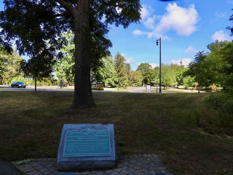
Photographed by Kevin Westell, August 18, 2025
2. Brock's Monument - Marker in context
Photo faces north-west. Brock's monument (distant upper right) peeks over the foliage. The nearby turning circle (centre, partially obstructed by tree) has a planter on the centre island. The white sign (centre right) marks a driveway to Queenston Heights Park parking.

Detroit Publishing Company (courtesy New York Public Library), August 19, 2025
3. Brock's Monument, Queenston Heights
Credits. This page was last revised on September 3, 2025. It was originally submitted on August 19, 2025, by Kevin Westell of St. Catharines, Ontario. This page has been viewed 131 times since then and 19 times this year. Last updated on August 19, 2025, by Kevin Westell of St. Catharines, Ontario. Photos: 1, 2. submitted on August 19, 2025, by Kevin Westell of St. Catharines, Ontario. 3. submitted on August 19, 2025. • Devry Becker Jones was the editor who published this page.
